 |
| Whale bones on the beach in Utqiagvik |
Seward
Unlike many of the places I am covering that I have visited only once or twice, I have been to Seward more times than I can count.
 |
| Our latest visit in 2023 |
 |
| Map: Google Maps |
That's because it is easily reached via the Seward Highway from Anchorage and because it is the launching point for boat tours in Kenai Fjords National Park and home to the Exit Glacier.
The town is located on Resurrection Bay, a fjord of the Gulf of Alaska on the eastern side of the Kenai Peninsula 120 miles south of Anchorage. With a population of 2,717, Seward is only the fourth-largest city on the Kenai Peninsula, behind Kenai, Homer and Soldotna.
The city is named for former U.S. Secretary of State William H. Seward, who orchestrated the purchase of Alaska from the Russian Empire in 1867.
 |
| Water and mountains: beautiful |
The Alutiiq/Sugpiaq people inhabited the area for more 7,500 years before the arrival of White people, who first used the area to establish a Russian fur trading post in 1793.
Seward was an important port for the military buildup in Alaska during World War II, but no longer has a military presence.
A large portion of Seward was damaged by shaking and a local tsunami during the 1964 Alaska earthquake.
 |
| Calm in the harbor this day |
Because it is the southern terminus of the Alaska Railroad and has well-developed road links to Anchorage and the rest of the Kenai Peninsula, Seward's economy is largely driven by seasonal tourism, including a high number of people visiting the National Park.
 |
| The Exit Glacier in Kenai Fjords National Park |
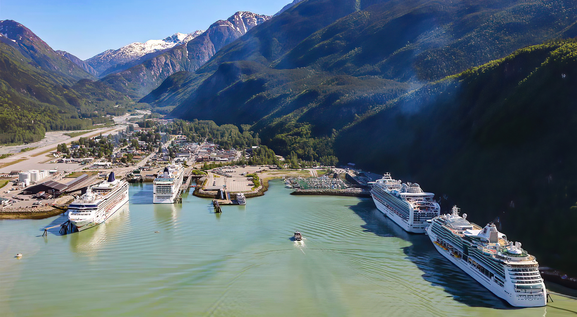
Seward is a northern end-port for major cruise ship lines including Norwegian, Royal Caribbean, Holland America and Celebrity Cruises. Ship passengers often disembark and take the train or bus farther north to Anchorage, Denali or other Alaskan attractions.
 |
| A Kenai Fjords boat in the foreground and a Celebrity cruise ship in the back |
Many accommodations, restaurants and shops cater mainly to tourists and are only open from mid-May through mid-September.
The town has several huge campgrounds with RVs packed pretty closely together along the edge of Resurrection Bay. I like to camp, but don't get the appeal of RV sites that look more like a parking space than a campsite.
Seward is no longer served by the Alaska Marine Highway; the nearest terminals are in Whittier, 90 miles north, or Homer, on the other side of the Kenai peninsula 150 miles away.
 |
| Scott's Halibut and Rockfish |
Another economic driver is sport (there a multiple outfitters in town) and commercial fishing, primarily for Halibut and Salmon. Seward is among the most lucrative commercial fisheries ports in the U.S.
Seward was the historic starting point of the original Iditarod Trail to Interior Alaska, with Mile 0 of the trail marked on the shoreline at the southern end of town. The race now starts in Anchorage.
A bike-friendly community, Seward has a paved bike path from the downtown business district along the waterfront, through the harbor and along the highway to mile 4.5. Bikes are available for rent and there are guided bike tours of the area.
 |
| Sea Life Mural |
A fun thing to do in Seward is visit the Alaska SeaLife Center, Alaska's premier public aquarium and only permanent marine mammal rehabilitation facility.
The Center is one of the only non-profit organizations in the world that has both a public aquarium and a fully supported research facility in the same building.
The SeaLife Center is affiliated with the University of Alaska Fairbanks and collaborates with many state, federal and international agencies and universities to study Alaska marine ecosystems and species.
This includes marine mammals, sea birds, fish and invertebrates. The Alaska SeaLife Center has dedicated programs for pinnipeds (Seals and Sea Lions), Eiders, Sea Otters and Salmon. The SeaLife Center also rescues, treats and releases stranded and sick animals.
 |
| Alaska SeaLife Center |
A lovely place to visit near Seward is Tonsina Point in Caines Head State Park.
 |
| Breathtaking |
A well-maintained forested trail travels from Lowell Point to Tonsina, crossing a couple of bridges and ending up at a lovely beach.
 |
| A nice hike |
It is a popular spot for Salmon viewing when they are running.
 |
| A good view through clear water |
If you hike it, don't proceed further down the beach past the point unless you have timed the tides. Rising tides have trapped people on the wrong side of areas where cliffs meet the ocean.
Sitka
Sitka is a beautiful community spread over Baranof Island, part of Chichagof Island and several other islands in the Inside Passage.
 |
| Sitka |
It beautifully balances the state's often contentious Russian and Tlingit histories with the juxtaposition ...
 |
| St. Michael's Russian Orthodox Cathedral's onion dome and ... |
 |
| Sitka National Historical Park's totem pole collection and native artist workshop |
Originally settled by the Tlingit people more than 10,000 years ago, Sitka was then settled by Russians in 1799 under the name Redoubt Saint Michael. In 1802, Tlingit warriors destroyed the original Russian settlement. Two years later, Russia re-took possession of Sitka and named it New Archangel. Then, the Tlingit re-established a fort on the Chatham Strait side of Peril Strait to enforce a trade embargo with the Russian establishment.
For the first half of the 19th century, Sitka was the most important port on the West Coast. It was the site of the signing of the Alaska purchase and subsequent transfer of power.
 |
| Sitka Harbor |
Even though most Russians left after the U.S. acquisition and there are few actual Russians left in the town, a local dance group called the New Archangel Dancers performs Russian songs and dances for tourists.
 |
| Most of the dancers aren't Russian, but they embrace the heritage |
Even St. Michael's Russian Orthodox Cathedral isn't truly authentic.
 |
| White clock face |
The original church burned down in 1966, losing its handmade bells, a large icon of the Last Supper, the bell tower clock and a large library of books in the Russian, Tlingit and Aleut languages. The church was restored to its (almost) original appearance in 1966, but the clock face is black in photos taken before 1966 and white after.
Sitka was the capital of Alaska from 1867 to 1906, until the government moved to Juneau. The move was precipitated by the declining economic importance of Sitka relative to Juneau, which gained population in the Klondike Gold Rush.
Sitka displaced Juneau as the largest incorporated city by area in the United States upon the 2000 incorporation with 2,874 square miles of incorporated area. It has about 8,900 residents.
 |
| The Sitka Lighthouse is now a vacation rental |
Mount Edgecumbe, a 3,200-foot "historically active" stratovolcano is located on southern Kruzof Island and can be seen from the city on a clear day.
 |
| An impressive volcano; Photo: Alaska.org |
As with most of the Inside Passage, you can reach Sitka only by air and sea. It is a stop on the Alaska Marine Highway and some cruise ships go there.
 |
| Sitka Ferry terminal |
There are only 14 miles of road from one end of the island to another and almost everything is within walking distance from the downtown area (but, the ferry terminal is seven miles from town, so I think a car is important). Sitka has won awards for being both bicycle- and walking-friendly.
 |
| We came by ferry with our car |
The climate is relatively mild when compared to other parts of the state. Only five days per year see highs at or above 70°F and there are only 10 days with the high not above freezing.
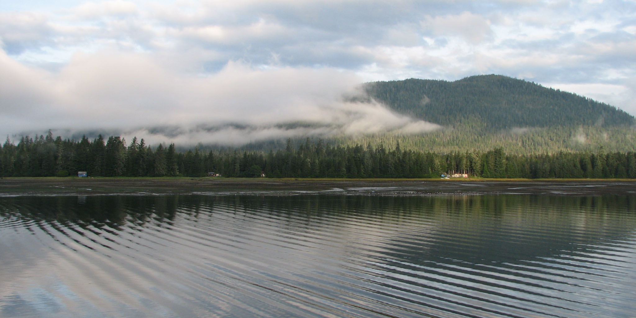
It is a lovely place to camp, with woods similar to those in Haines. We stayed at Starrigavan Recreation Site in Tongass National Forest, which has a magical quality about it that is hard to describe.
 |
| The temperate rainforest is certainly worth experiencing; Photo: Scott Stevens |
Sitka's annual Alaska Day Festival in October commemorate the Alaska purchase with a reenactment ceremony, interpretive programs at museums and parks, exhibits, aircraft displays, film showings, receptions, historic site and building tours, food, writing contests, Native dancing and entertainment.
 |
| Alaska Day; Photo: KTOO |
If you visit, don't go to the Fortress of the Bear; it is very depressing to see captive/trained Brown Bears.
Skagway
The word actually means "pretty woman." How did it get from waves to a woman?
Officials in Canada began requiring that each prospector entering Canada on the north side of White Pass bring one ton of supplies, to ensure that they would not starve during the winter.
Today, Skagway has a historical district of about 100 buildings from the gold rush era.
 |
| Skagway: Photo: Wikipedia |
Skagway, famous as the gateway to the Klondike Gold Rush, is one of the most touristy places I have visited in Alaska (and, it's almost in Canada!).
That may have been because there were many cruise ships in town or maybe it just is.
Skagway is located in a narrow glaciated valley at the head of the Taiya Inlet, the north end of the Lynn Canal, which is the most northern fjord on the Inside Passage. It is 90 miles northwest of Juneau.
 |
| Skagway; Photo: Travel Alaska |
The name Skagway (historically also spelled Skaguay) is derived from Sha-ka-ԍéi, a Tlingit idiom that referred to rough seas in the Taiya Inlet caused by strong north winds.
 |
| Sha-ka-ԍéi; Photo: Peakbagger.com |
Sha-ka-ԍéi was the nickname of Kanagoo, a mythical woman who transformed herself into stone at Skagway bay and now causes the strong, channeled winds which blow toward Haines.
The Kanagoo stone formation is known as Face Mountain, which can be seen from Skagway bay. Make sense? Well, maybe.
Skagway's population of 1,240 at least doubles in the summer to deal with more than a million annual visitors who come, primarily, to experience the Klondike Gold Rush.
 |
| Cruise ships bring most visitors; Photo: WPYR |
When gold was found in the Klondike region of Canada's Yukon Territory in 1896, it was extremely difficult to reach over land in Canada.
An "easier" route was to take a steamer to Skagway and then travel 500 miles to the gold fields. Tens of thousands of prospectors did just that (or, more accurately, attempted to do just that).
 |
| Yikes! Photo: Alaska Trekker |
Skagway's population quickly reached 30,000, composed largely of American prospectors. Some (wisely) realized how difficult the trek ahead would be and chose instead to stay in Skagway to supply goods and services to miners. Within weeks, stores, saloons and offices lined the muddy streets.
As one might expect, it was a rough and exceptionally corrupt town, described as "little better than a hell on earth."
 |
| Prospectors climbing Chilkoot Pass; Photo: Wikipedia |
To get to the gold fields, prospectors climbed the mountains over the White Pass above Skagway and onward across the Canada/U.S. border to Bennett Lake or one of its neighboring lakes, where they built barges and floated down the Yukon River to the gold fields around Dawson City.
Others disembarked at northwest of Skagway and crossed northward on the Chilkoot Pass, an existing Tlingit trade route, to reach the lakes.
 |
| Heavily laden; Photo: Wikipedia |
This placed a huge burden on the prospectors and pack animals climbing the steep pass. They often had to make multiple trips to get everything to the top.
In 1898, steam-operated aerial tramways were constructed at both passes, easing the burden of prospectors who could afford the fees to use them.
Then, trying to take advantage of the gold rush, construction began on a narrow-gauge rail route between Skagway and the Yukon that had been planned before the rush began.
 |
| The rails are still in use today (with updates); Photo: Explore Skagway |
By 1899, the stream of gold-seekers had diminished and Skagway's economy began to collapse. By 1900, when the railroad was completed, the gold rush was nearly over.
In 1900, Skagway was incorporated as the first city in the Alaska Territory.
 |
| The route: WPYR |
The White Pass and Yukon Route operates its narrow-gauge train around Skagway during the summer months, primarily for tourists. You can take a train to the pass and back.
When we went, it was marred by a very lengthy passport check at the top, which is in Canada. By the time we cleared immigration, we turned around and re-entered the U.S. The website now says,"no passport necessary," so it looks like they fixed the problem.
The WPYR also operates hiker transport services and services to Whitehorse.
 |
| The train at the pass; Photo: Milepost |
Skagway is one of three Southeast Alaskan communities that are connected to the road system; Skagway's connection is via the Klondike Highway, completed in 1978. This allows access to the lower 48, Whitehorse, Yukon, northern British Columbia and the Alaska Highway. This makes Skagway an important port-of-call for the Alaska Marine Highway.
 |
| Connecting to the Inside Passage |
Skagway was part of the setting for Jack London's book The Call of the Wild. The 1960 John Wayne film, North to Alaska, was filmed nearby.
Talkeetna
About halfway between Anchorage (113 miles) and Denali National Park (152 miles), Talkeetna is small, very cute town located at the confluence of three rivers, the Susitna, the Chulitna and the Talkeetna.
 |
| Floatplane landing |
Because it is on the route to Denali, we usually just blow past, but we have stayed overnight and explored a bit.
The Dena'ina people lived and hunted in the area for thousands of years, calling it K'dalkitnu, which means "food is stored river." Their peaceful existence was disrupted in 1905, when gold was discovered in Cache Creek to the west in the Dutch Hills.
In 1915, things got crazier when Talkeetna was selected as a district headquarters for the Alaska Engineering Commission (AEC) as they built the Alaska Railroad from Anchorage to Fairbanks.
 |
| Loading supplies: Alaska Railroad Photographs |
The population of Talkeetna rapidly swelled to an estimated 1,000 people.
 |
| 1915-era engine: Alaska Railroad Photographs |
World War I, the 1918 influenza pandemic and the completion of the railroad took its toll on Talkeetna and the population dropped to about 60. Those remaining either continued to mine for gold or provided services to the railroad and railroad passengers.
Then, in the late 1930s, Talkeetna built an airstrip and then an airport. The airport was used throughout World War II and eventually aviation became vital to the town. Then, mountaineers discovered that ski planes could land on the Kahiltna Glacier at 7,200 feet, making it easier to scale the West Buttress to Denali's 20,320-foot-summit. Before that, most efforts in mountaineering used the north side of the mountain.
 |
| Air services are critical to the economy |
Today, around 1,200 climbers come to Talkeetna to air taxi to the Kahiltna base camp, which has access to the West Buttress, West Rib, South Buttress and Cassin Ridge on Denali as well as Mt. Foraker, Mt. Hunter, Mt. Frances, Mt. Crosson and Kahiltna Dome. The original air taxi services, Talkeetna Air Taxi and Hudson Air Service (now Sheldon Air Service), are still in operation.
 |
| That's base camp in the lower right corner |
If being the jumping off point (maybe not the right term) for scaling Denali wasn't enough to make the town famous, it really got attention when it was named the best place in the nation to view the 1963 total eclipse of the sun. That same year, the road to Anchorage met the newly developed gravel Talkeetna Spur Road.
In the 1970s, Alaska tourism took off and Talkeetna got busy, building lodges, hotels, restaurants and other traveler services.
 |
| The famous Talkeetna Roadhouse |
The population of Talkeetna went from 250 in 1980 to 775 in 2000. Today, the population triples in summer and drops back down when the season winds down in September.
Summer/fall tourist activities include flightseeing, rafting, mountain biking, homestead tours, hiking, camping, fishing and hunting.
 |
| Nagley's Store; Photo: Los Angeles Times |
In winter, tourism is concentrated on winter sports, including nordic skiing and fat tire bike racing.
Winterfest, which takes place during the entire month of December, features a motorized Parade of Lights, a lighted tree in the Village Park, a Taste of Talkeetna and numerous special events hosted by local businesses and the Talkeetna Public Library.
 |
| The Roadhouse is known for pastries |
The core downtown area, the Talkeetna Historic District, is on the register of National Historic Places, with buildings dating from the early 1900s including Nagley's General Store, the Fairview Inn and the Talkeetna Roadhouse.
Talkeetna is also a stop on the Alaska Railroad's Denali Star, Aurora Winter Train and Hurricane Turn routes.
Always quirky, Talkeetna elected a cat as honorary mayor in 1997. "Mayor" Stubbs served until his death in 2017 when he was succeeded by another cat, named Denali. The town tried to run a dog against Denali, but the dog did not live to election day and Denali won.
 |
| Mayor Stubbs even survived assassination attempt by a dog; Photo: Wikipedia |
Utqiaġvik
There is nothing more iconically Alaskan than to stand beneath the whalebone arch in Utqiaġvik for a portrait.
 |
| Scott and me at he famous Utqiaġvik whalebone arch |
Utqiaġvik, which was known from the 1800s to 2016 as Barrow, is one of the northernmost towns in the world.
 |
| A town with latitude |
Granted, it's not quite as far north as Longyearbyen in Svalbard, but, at 330 miles above the Arctic Circle, it is the northernmost town in the U.S.
Nearby Point Barrow is the country's northernmost land. Only 2.6 percent of the Earth's surface lies farther from the equator than Utqiaġvik.
For its latitude, Utqiaġvik has a surprisingly large population with 4,927 people, of whom 60 percent are Native Alaskan.
Utqiaġvik's North Slope location has been home to the Iñupiat, an indigenous Inuit ethnic group, for more than 1,500 years.
The city's name refers to a place for gathering wild roots. Remains of 16 sod dwelling mounds can be seen on the shore (Utqiaġvik sits at the junction of the Beaufort and Chukchi Seas) on a slight rise above the high-water mark.
 |
| With rising sea levels, the mounds are at risk of being lost to erosion |
The former name Barrow was derived from Point Barrow and was originally a general designation, because non-native Alaskan residents found it easier to pronounce than Utqiaġvik. Point Barrow was named after a British Royal Navy officer involved in exploring and mapping the Arctic coastline in the early 1800s.
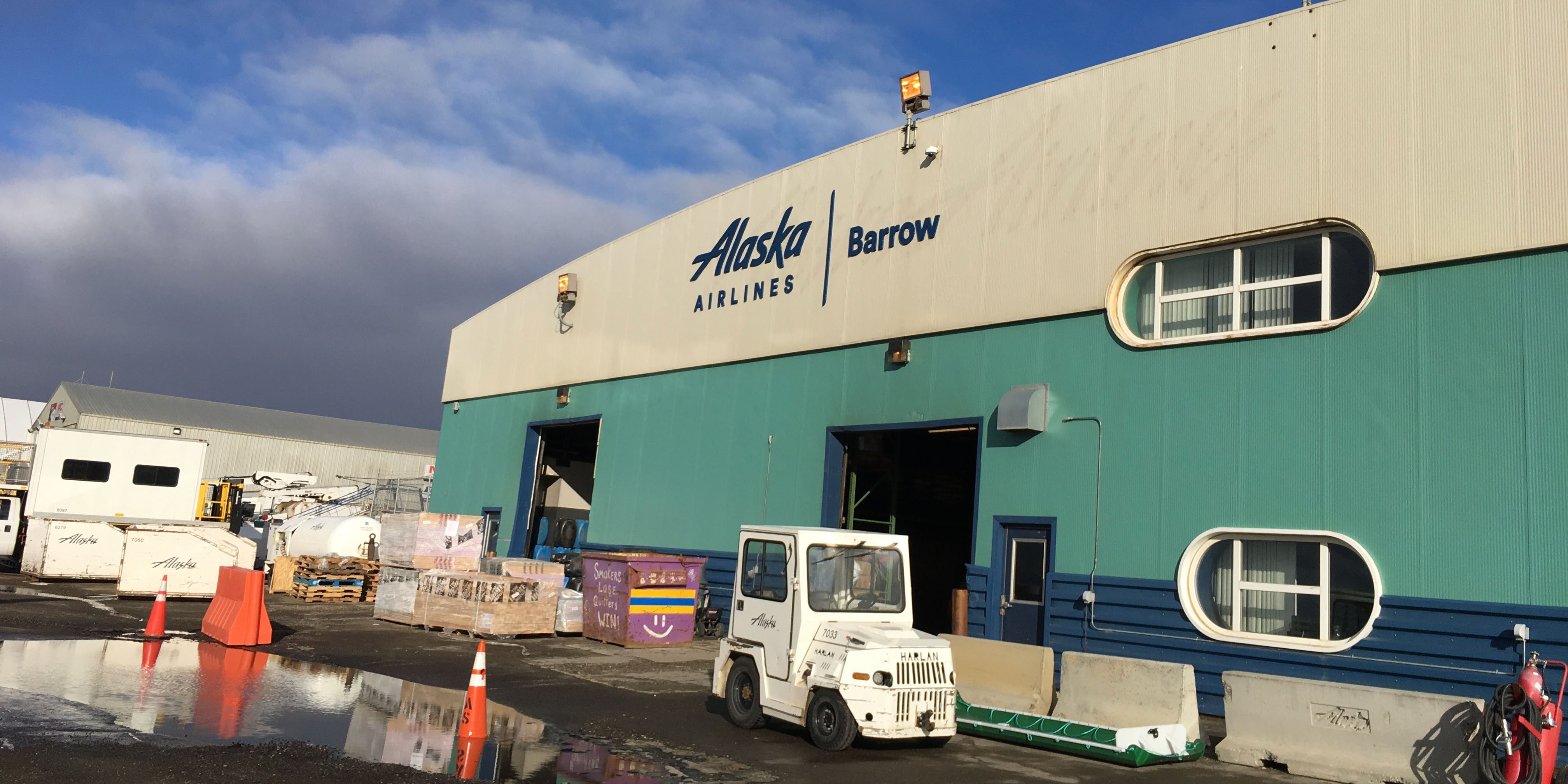 |
| Alaska Airlines hasn't caught up with the re-re-naming |
After the U.S. acquired Alaska in 1867, Utqiaġvik grew with construction of a meteorological and magnetic research station, a Presbyterian church, a whaling supply and rescue station and a Post Office.
The town became internationally famous in 1935 when humorist Will Rogers and pilot Wiley Post died in a plane crash 15 miles south of Utqiaġvik. The airport was renamed as the Wiley Post-Will Rogers Memorial Airport in their honor.
 |
| True-ish |
A book and a movie (starring Drew Barrymore and John Krasinski) were based on the rescue.
As one would expect, Utqiaġvik's climate is cold and dry, with extremely dangerous cold and wind in the winter. But, the topography moderates what could be a bit, making the temperatures less severe than one might expect. That's because, with the Arctic Ocean on three sides and flat tundra stretching 200 miles south, there are no wind barriers or protected valleys where dense cold air can settle and lower the temperature.
Still, Utqiaġvik has the lowest average temperatures of cities in Alaska, remaining below freezing from early October to late May and below 0°F from December to March. Extreme wind chill and "white out" conditions from blowing snow are common and can occur any time of year.
 |
| We had nasty wind and rain when we visited |
It's a desert climate, with less than six inches of "rainfall equivalent" a year. Since one inch of rain equals about 12 inches of snow, average snow is about 37-46 inches. But, still, Utqiaġvik is one of the cloudiest places on Earth; it is completely overcast slightly more than half of the year. Peak cloudiness is in August and September when the ocean is ice-free. Dense fog occurs an average of 65 days per year, mostly in the summer. Ice fog is common in the winter. Keep that in mind when planning travel.
The sun sets on November 18 and stays below the horizon until January 23, resulting in a polar night that lasts for about 66 days. When the polar night starts, there are about six hours of "civil twilight" (a glow beneath the horizon), decreasing each day until the winter solstice when civil twilight lasts three hours. Then it begins increasing again.
 |
| Last sunset in 2021; Photo: Bay News 9 |
Starting on May 10 or 11, the sun stays above the horizon for the entire day (AKA "the Midnight Sun") for 83 days until either August 1 or 2. On June 6, the daily mean temperature rises above freezing and the normal daily mean temperature remains above freezing until September 21. July is the warmest month of the year, with a normal mean temperature of 42°F. Brrrrrr.
With these temperatures, Utqiaġvik has a permafrost layer that is as much as 1,300 feet deep. Because of the permafrost, which heaves in the spring, the town has gravel roads. No roads connect the city to the rest of Alaska. Access is by air year-round and, for supplies, by marine barge in the summer.
 |
| Flying in |
The Arctic is warming three times the global average, forcing major adjustments to life on the North Slope. Thinner sea ice endangers Polar Bears and makes landing Bowhead Whale strikes on offshore ice more difficult for springtime whalers (see my explanation of whale strike in the section on Kaktovik). Caribou habitat and hunting is also affected.
 |
| The museum celebrates whaling |
Thawing soil threatens homes, municipal and commercial structures and infrastructure, particularly water, sanitation, power and roads. The shoreline is rapidly eroding and has been encroaching on buildings for decades. With an anticipated rise in sea level, Utqiaġvik's longterm survival at its current location is doomed.
Utqiaġvik is home to a NOAA Climate Monitoring Lab and a Department of Energy climate observation site.
Utqiaġvik's economy is based on support services to oil field operations, state and federal government operations and tourism.
 |
| The town has lots of new construction |
Because transporting food to the city is very expensive, many residents continue to rely upon subsistence food sources, including Whale, Seal, Polar Bear, Walrus, Caribou, waterfowl and fish.
 |
| The frame of a Whaling boat with some bones; Photo: Scott Stevens |
Local activities, which also attract tourists Piuraagiaqta (the Spring Festival celebrating breaking a path in the ice for boats to hunt Whales), Nalukataq Whaling Festival and the Eskimo Games (winners compete at the World Eskimo Indian Olympics).
When we visited, we took a Northern Alaska Tour Company trip that included flights, a day of touring and an overnight at the Top of the World Hotel. They also offer a one-day fly-up-and-back trip. We ate our meals at the hotel restaurant, Niġġivikput. I am not sure there are any additional restaurants in town; the famous Mexican place burned down.
One goes to Utqiaġvik for novelty, culture, birds ...
 |
| Snowy Owls in abundance! |
... and an occasional Polar Bear, but not for beauty.
There is virtually no vegetation except marsh grasses. The roads and many of the yards are bare sand and gravel. WWII and Cold War military buildings mix with new modular construction. And, like all hard-to-reach Arctic locations, old, rusting equipment is everywhere.
 |
| The gravel gets in everything! |
All buildings in town are built on pylons – some hidden and some obvious. If the buildings sat on the ground, the heat they generate would melt the permafrost and the buildings would sink. With global warming, many are sinking anyway and food caches, long used to store hunting bounty, are collapsing.
 |
| Caches, left, are vital for food storage; Left photo: Scott Stevens |
The Iñupiat Heritage Center houses exhibits, artifact collections, a library, a gift shop and a traditional room where local artisans demonstrate and teach traditional crafts. The displays include depictions of whaling and Whales, plus carved artifacts reflecting life in the Arctic.
 |
| We attended a native dance demonstration; Photos except shoes: Scott Stevens |
Outside of town (if you can get there; the road frequently is washed away by the ocean), is a gravel beach littered with Whale and Walrus bones.
 |
| Scott even brought bones home (it's legal) |
 |
| Scott at Point Barrow |
Point Barrow is, once again, a novelty.
It's a pole that officially marks the United State's northernmost spot. There's not much to it. Just a pole in the gravel. But, isn't that true of most monuments to location? I mean, Four Corners??? Meh.
Still, it is cool to have been there.
The beach has a dramatic, windswept, mildly dangerous allure.
And, the town, so remote and so harsh, is interesting.
 |
| Rough, but beautiful |
Valdez
I have been to Valdez just once and hardly spent any time there, so I probably shouldn't write about it. But, as a convenient starting point for visiting eastern Alaska, it is worth mentioning.
 |
| Pulling into Valdez |
Located near the head of a deep fjord in Prince William Sound, Valdez is surrounded by the heavily glaciated Chugach Mountains. Its importance stems from being the northernmost year-round ice-free port in North America.
 |
| Ice-free in winter; Photo: Matador Network |
The name immediately raises questions. It sure doesn't sound Alaskan. That's because it was named after the Spanish Navy Minister Antonio Valdés y Fernández Bazán (it's a good thing they just picked one of his names!), who explored the area in 1790 and declared Spanish sovereignty over the territory. Later, Spain granted Great Britain access rights to the Pacific Northwest and then finally relinquished claims.
The town, in very Alaskan style, got its start because of a scam. Steamship companies untruthfully promoted the Valdez Glacier Trail as a better route to Klondike gold fields than the White Pass/Chilkoot Passes in Skagway. The Glacier Trail was actually twice as long and steep as advertised. Many died attempting the crossing, mainly from scurvy during winter because they didn't have adequate supplies.
 |
| Map: Google Maps |
When the Richardson Highway connecting Valdez to Fairbanks opened in 1899, Valdez became the first overland supply route into the interior of Alaska. This is still the only road link to Valdez and, until 1950, it was closed during the winter.
Valdez had more big plans to capitalize on its ice-free port, but they were dashed in 1907 when (again in typical Alaskan style) a shootout between two rival railroad companies ended plans for a railroad link to the Kennicott Copper Mine.
Valdez isn't even where it used to be. After catastrophic damage and 34 deaths from the 1964 Alaska earthquake and subsequent 30-foot-high tsunami, the townsite was abandoned and a new town was built four miles away.
 |
| Valdez after the earthquake; Photo: The Atlantic |
The Army Corps of Engineers transported 54 houses and buildings by truck to the new site.
In the late 70s, the Trans-Alaska Pipeline was built to carry oil from Prudhoe Bay to a terminal in Valdez. There, it is loaded onto tanker ships for transport from Alaska. The construction and operation of the pipeline and terminal boosted the economy of Valdez.
 |
| The Pipeline Terminal |
But, there was more disaster in store for Valdez. In 1989, the oil-laden tanker Exxon Valdez hit Bligh Reef 25 miles from the port, creating an oil spill that devastated marine life in the surrounding area.
 |
| Oil-saturated ocean; Photo: Essex Investment |
Ironically, the massive clean-up effort actually boosted the economy for the short term.
 |
| Oil didn't reach Valdez, but soaked Prince William Sound; Photo: Hakai Magazine |
 |
| Fishing is a big draw; Photo: Travel Alaska |
Today, Valdez's economy is based on oil, freight and commercial fishing.
Plus, sightseeing of the marine life and glaciers, together with both deep-sea fishing and heli-skiing support a strong tourist industry in Valdez. Its year-round population is about 4,000.
We weren't particularly impressed with the rough-and-tumble town, but our Prince William Sound ferry trip in and Richardson Highway drive out were stunning.
 |
| On the way to Valdez |
I wouldn't plan on a long time in Valdez unless you really want to tour the Alaska pipeline.
As I mentioned, the Richardson Highway just out of town is gorgeous. It makes Valdez worth a visit.
 |
| A pretty drive |
Whittier
Whittier is an ugly little berg in a stunning location on Prince William Sound.
 |
| Whittier harbor on a nice day |
The locals say, "It's shittier in Whittier" and that's pretty accurate with its multiple railroad tracks and old army buildings, although I think the comment is really a reference to weather.
 |
| Shittier Whittier on a not-so-nice day |
Only 58 miles from Anchorage, Whittier used to be worlds away because it could not be reached by car. The only way in was rail, boat or plane.
There is still no road in, per se, but now a 2.5-mile-long railroad tunnel acts as a one-way toll road with 15-minute passages for traffic in on the half-hour and traffic out on the hour. It's open only from 5:00 a.m. to 11:15 p.m.; so you have to manage your time if you need to go to and/or leave Whittier.
 |
| The Anton Anderson Memorial Tunnel, also called the Whittier or Portage Tunnel |
Toll is $13.00 to go to Whittier; there is no charge to leave Whittier (also, I am sure, the basis for some jokes).
It the second-longest highway tunnel and the longest combined rail and highway tunnel in North America.
 |
| It goes through a mountain and under a glacier; Illustration: Girdwood, Alaska |
The region occupied by Whittier was once part of the portage route of the Chugach people and, later, the passage was used by Russian and American explorers, and then by prospecting miners during the Klondike Gold Rush. The town and the nearby Whittier Glacier are named for American poet John Greenleaf Whittier.
 |
| Whittier Glacier |
During World War II, the Army constructed the tunnel and Camp Sullivan, a military facility complete with port and railroad that operated until 1960. The port became the entrance for soldiers into Alaska. In 1962, the U.S. Army Corps of Engineers constructed a petroleum products terminal, a pumping station and a 62-mile-long pipeline to Anchorage.
The two buildings that dominate the town were built after World War II to provide housing and services for military families and civil servants supporting Camp Sullivan.
The 14-story Hodge Building (renamed Begich Towers) has 150 two-and-three-bedroom apartments plus bachelor efficiency units. The Whittier School was connected by a tunnel at the base of the west tower so students could safely access school on days with bad weather.
 |
| Almost everyone in Whittier lives here |
The Buckner Building, now abandoned and deteriorating, had offices and bomb-proof spaces
Begich Towers became a condominium and, along with the two-story private residence known as Whittier Manor, houses the majority of the Whittier's current 280+ residents.
Whittier suffered over $10 million of damage and 13 deaths in the 1964 earthquake and the resulting 43-foot-tall tsunami.
 |
| Fuel tank fire; Photo: The Atlantic |
With its deep-water port, Whittier is a port of call for the Alaska Marine Highway and serves as an embarkation/debarkation point for one-way cruises from Anchorage to Vancouver by Princess Tours.
Basically, Whittier isn't really a destination in itself. It's a place to ...
 |
| ... get out on the water |
 |
| ... take a cruise to Prince William Sound |
 |
| ... get on the Alaska Marine Highway |
 |
| ... go fishing (they certainly have enough boats) |
 |
| ... and, to get the best fish and chips ever at Varly's Swiftwater Seafood Cafe |
Wrangell
The last town on my list is Wrangell, not to be confused with Wrangell-St. Elias National Park, which is not nearby.
 |
| You reach the town by going through the treacherous Wrangell Narrows |
Both are named after Baron Ferdinand Petrovich Wrangel, head of Russian government interests in Russian America in the early 1800s.
 |
| Wrangell; Photo: Travel Alaska |
Wrangell, which is located in the Inside Passage between Metlakatla and Sitka and has almost 2,400 residents, may be one of the least recognized names of the towns I have covered because it prefers it that way.
Wrangell turned its back on a certain level of prosperity by refusing to sell its harbor frontage to the big cruise lines so that they could install their own stores and businesses. Instead, there are normal businesses, including an Ace Hardware store. Consequently, the big ships don't stop there anymore.
 |
| We loved the "realness" of Wrangell; Photo: Shermans Travel |
Numerous petroglyphs found at Petroglyph Beach just north of Wrangell, as well as many scattered on other islands in the vicinity, indicate that the Tlingit people and their ancestors have inhabited Wrangell Island for thousands of years.
 |
| Photo: Petroglyph Beach State Historic Site |
Russians moved into the area in 1811 to trade fur with the Tlingit in 1811. They built a fort that was then leased to the British Hudson's Bay Company (HBC), which started using Tlingit trade routes to the interior. White people were able to rather easily take control of the area because smallpox epidemics in 1836 and 1840 reduced the Tlingit population by half, seriously weakening the community
But, over-hunting rapidly depleted Sea Otter and Beaver populations and the HBC was gone by 1849. Fort Stikine, as the area was then called, remained under British rule until Alaska's purchase by the United States in 1867.
 |
| It took many years for the Sea Otters to recover |
The U.S. built and operated a military post called Fort Wrangell from 1868-77 and the area continued to grow through commerce with gold prospectors in the rushes of 1861, 1874-77 and 1897.
 |
| It also flies the Alaska state flag |
In the late 1890s, Wrangell focused on fishing and canning, which fueled the economy until the rise of logging in the 1950s.
A severe fire in the early 1950s burned much of the downtown area, destroying almost all historic buildings.
Logging is still a mainstay of the economy, but the former vast Alaska Pulp Corporation logging operations at Wrangell closed in the mid-1990s when they couldn't meet water quality standards. One of the last two major sawmills in southeast Alaska is just south of the city.
 |
| Dense temperate rain forest has been logged for years |
Fishing is also important, but threatened by over-harvesting. A commercial fishing fleet is harbored in Wrangell.
Tourism continues to gain popularity with sport fishing, kayaking, wilderness adventures to remote locations on the great Stikine River, glacier-viewing in LeConte Bay, Whale watching and a Tlingit Cultural Center and Museum. The Alaska Marine Highway serves Wrangell on its Inside Passage route and an inter-island shuttle. Wrangell also has a small airport. There is only about 24 miles of paved road plus lots of logging roads.
There isn't a lot to do there, but the local Wrangell Cultural Association puts on a dance/native culture performance that is charming and interesting.
 |
| Local entertainment |
Plus, I had some great Halibut and chips at a local restaurant.
Note: This section covered cities starting with S to W. But, if you are looking for Wiseman, it is combined with Coldfoot in a previous post; Soldotna is combined with Kenai.
No comments:
Post a Comment