 |
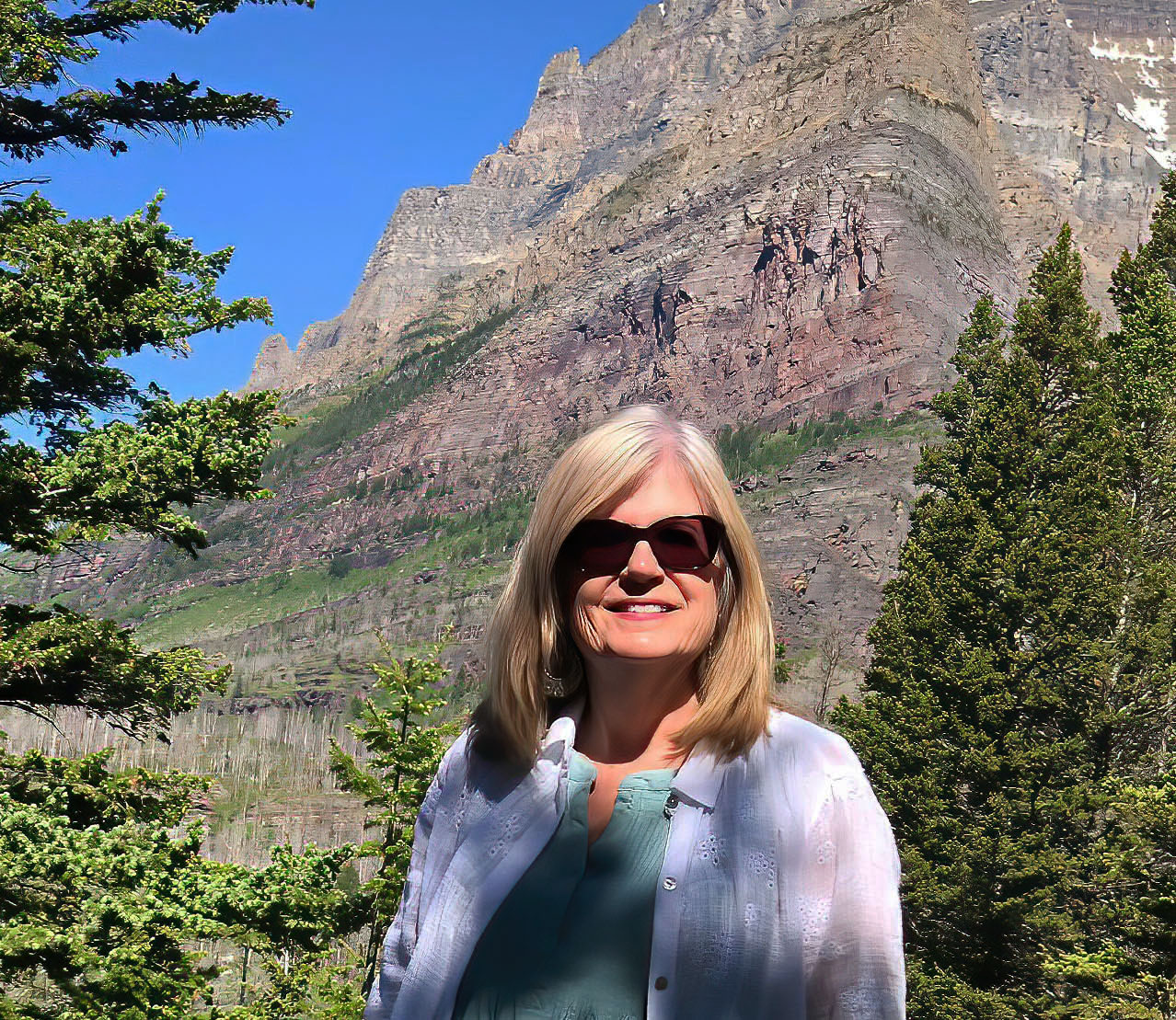
| Beautiful Glacier National Park |
It is not unusual for us the change plans mid-trip. That’s why I book hotels with good cancelation clauses whenever possible. I also but annual travel insurance, as well.
Kootenai Falls
On our way to Glacier, we stopped briefly at Kootenai Falls.
 |
| Kootenai is a gorgeous turquoise cascade over rock terraces |
During that visit, we spent much more time, crossing the swinging bridge and playing on the falls’ terraces. This time, I just hiked down and took some photos before returning to Scott at the car. It was about 100 °F degrees, so I didn’t get too ambitious.
Kootenai Falls is on the Kootenay River in northern Montana just east of the Idaho border. It think there are even a few more spellings than that floating around Idaho and Washington. The Kootenai are an indigenous people native to the area.
 |
| A lower cascade |
 |
| Rushing waters |
 |
| Photo: LibbyMT.com |
The original footbridge was destroyed by a flood in 1948. Shortly thereafter, a new footbridge was built atop a pair of concrete piers in order to overtake the historic flood stage of the river.
Although the bridge was maintained throughout the following decades, it was rebuilt in 2019 due to its popularity as a tourist destination.
The falls have made appearances in movies such as The River Wild in 1994 and The Revenant in 2015.
Glacier National Park
 |
| St. Mary Lake, Glacier National Park |
The Inn is advertised as being just minutes from the Park, which is technically accurate since the boundary is right across the highway. But, it was about 20 minutes from an entrance.
 |
| We prefer to stay in the Park, but it wasn't possible |
What we didn’t know was that the railroad tracks that were on the opposite side of the road further down the highway had crossed over and passed right behind our room. RIGHT BEHIND OUR ROOM!
 |
| I found this illustration of the issue on TripAdvisor; I guess other guests also noticed |
It didn’t bother me the first night (I must have been very tired), but it woke me up and disoriented me the second night.
Because this was a spur of the moment trip, we had to be mindful of times and distances.
 |
| Graphic: NPS |
 |
| Map: NPS |
 |
| Flathead River |
 |
| The Moon hasn't set yet |
 |
| On the way to Alaska, 2013; by the way, you cannot drive a trailer over Going to the Sun Road |
About the Park
 |
| Reflection at Many Glacier |
 |
| There are two different sub-ranges of the rockies in the Park |
At ten miles long and 464 feet deep, Lake McDonald is the largest, longest and deepest lake in the Park. The lakes remain cold year-round, with temperatures rarely above 50 °F at their surface. Cold water supports little plankton growth, keeping the water remarkably clear.
 |
| St. Mary Lake's super clear water |
However, the lack of plankton lowers the rate of pollution filtration, so pollutants tend to linger longer.
 |
| Falls along Going to the Sun Road |
While we were there many were running very aggressively because warm weather was melting the snowpack. However, during drier times of the year, many of these are reduced to a trickle.
The area was first inhabited by Native Americans. Upon the arrival of European explorers, it was dominated by the Blackfeet in the east and the Flathead in the western regions. The Blackfeet considered the mountains the "Backbone of the World."
 |
| Sacred to the Blackfoot Peoples |
 |
| The Park is preserved for all of us |
In 1891, the Great Northern Railway crossed the Continental Divide at Marias Pass near the southern boundary of the Park. Under pressure, the Blackfeet sold the mountainous parts of their treaty lands to the U.S. government for $1.5 million in 1895, with the understanding that they would maintain usage rights to the land for hunting and that the ceded area would be public land.
Shortly after the Park was established in 1910, the Great Northern Railway constructed several hotels and chalets, which are now listed as National Historic Landmarks, and began advertising the area as "America's Switzerland."
 |
| It does look like the Matterhorn |
By 1932, work was completed on the 53-mile-long Going-to-the-Sun Road, later designated a National Historic Civil Engineering Landmark, which provided greater accessibility for automobiles into the heart of the Park.
 |
| The waterfall flows under Going to the Sun Road |
 |
| Logan Pass |
Glacier National Park borders Waterton Lakes National Park in Canada; the two parks are known as the Waterton-Glacier International Peace Park and were designated as the world's first International Peace Park in 1932.
 |
| On this trip, we only visited in daylight |
In 2017, the joint Park received a provisional Gold Tier designation as Waterton-Glacier International Dark Sky Park through the International Dark Sky Association, the first transboundary dark sky park.
GNP’s mountains began forming 170 million years ago when ancient rocks were forced eastward up and over much younger rock strata.
 |
| Lots of exposed rock |
 |
| A quintessential glacial valley |
There are six mountains in the Park over 10,000 feet in elevation; Mount Cleveland is tallest at 10,466 feet.
 |
| Steep and jagged peaks are the norm |
Of the estimated 150 glaciers that existed in the Park in the mid-19th century during the late Little Ice Age, only 25 active glaciers remained by 2010. Scientists studying the glaciers in the park have estimated that all the active glaciers may disappear by 2030 if current climate patterns persist.
 |
| A glacier tucked in the mountains; Photo: Scott Stevens |
 |
| There is still snow in late June |
Reduced seasonal melting of glacial ice may also affect stream flow during the dry summer and fall seasons, reducing water table levels and increasing the risk of forest fires, which are common in the Park. There has been a fire every year of the park's existence except 1964. The loss of glaciers will also reduce the aesthetic visual appeal that glaciers provide to visitors.
 |
| You can see a burn scar on the other side of the lake in the background |
 |
| Flowers are everywhere |
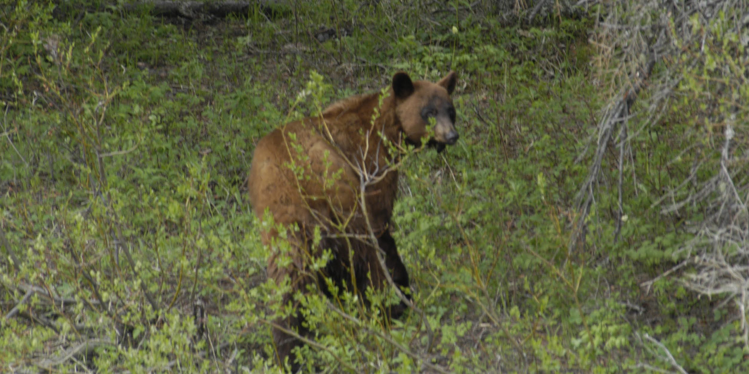
Large mammals such as Grizzly Bears, Bighorn Sheep, Moose and Mountain Goats, as well as rare or endangered species like Wolverines and Canadian Lynxes, inhabit the Park. We saw very few animals.
But, we did spend a lot of time photographing a Bighorn Ram that had settled himself in perhaps the most photogenic location possible.
 |
| Posing in beautiful morning light |
I have no idea what I will do with all the pictures I took.
 |
| This is a male Rocky Mountain Bighorn Sheep |
But, I can tell you it was more spectacular than the photos indicate.
 |
| This view takes your breath away |
During our visit, we saw quite a few Bighorn Sheep, many of them blocking traffic as they licked salt and minerals off the road near the highest elevations.
 |
| Sheep disrupting traffic near Logan Pass; the red bus is a Park tour vehicle |
Of course, these sheep were not nearly as interesting as the one that was posing in from of the Reynolds Creek Falls.
 |
| Incredible! |
We also spent some quality time with a Hoary Marmot that had held some French tourists captive by hunkering down under their rental car and refusing to budge. We helped coax it out.
 |
| A pesky Marmot |
And, it obliged by posing.
 |
| Scott getting a shot |
Hoary Marmots are related to, but have different coloration than the Yellow-bellied Marmots we have in Colorado. Hoary Marmots live further north; we have seen quite a few in Alaska.
 |
| The "Hoary" in the name comes from its "frosted" fur |
Up near the top of Going to the Sun road, we saw some Columbian Ground Squirrels and Least Chipmunks.
 |
| Upper elevation rodents |
We also briefly saw a Red Fox leaping through tall grass near the Trail of the Cedars area.
 |
| It took a huge pounce after this; I missed it |
We stopped by the Goat Lick area, but saw nothing. In 2004, we did see Mountain Goats there.
 |
| A line of Mountain Goats, 2004 |
 |
| This guy was huge; at first we thought it was a Grizzly, 2004 |
In the past, we have also seen Moose in the Park, but not this time.
 |
| Young bull, 2004 |
 |
| Eventually, he left his beautiful perch |
Hundreds of species of birds, more than a dozen fish species and a few reptiles and amphibian species have been documented. The Park has numerous ecosystems ranging from prairie to tundra. The easternmost forests of western redcedar and hemlock grow in the southwest portion of the Park.
 |
| There is ample fuel in the Park |
And, about those birds. I had an experience similar to the Quinault rainforest in Olympic National Park. While walking the Trail of the Cedars Nature Loop, the cacophony of birds was practically deafening – especially since somewhere in the trees was a very loud Varied Thrush, which are known for volume. But, NOTHING made an appearance. Click below to listen.
I mentioned that we spent some time photographing the Flathead River.
 |
| A great way to start the visit |
 |
| Sacred Dancing Cascades |
As you travel through the Park, it is obvious that there is a lot of water moving from the high places to the river ...
 |
| There are even walls of water |
Our Visit: Trail of the Cedars
 |
| Me back in 2004 |
As I mentioned, we walked the Trail of the Cedars Loop, an easy walk through beautiful cedar and hemlock forest on a raised boardwalk.
This "hike" (more like a stroll) was one of my favorite memories of our 2004 trip to Glacier. On that day, it was rainy and drippy. This time it was early morning, so it was cool and a little damp. But, there was no rain this time -- and it was significantly warmer.
Much like Olympic and North Cascades, the trail was bordered by ferns, mosses, downed trees...
 |
| New vegetation grows from decaying plants |
... and a wide variety of very green plants.
 |
| Even in the shade, the colors are vibrant |
A highlight of the walk is the box canyon formed by Avalanche Creek.
 |
| Avalanche Creek |
It was fun to watch and listen to the rushing waters.
There is a hike that branches off there to Avalanche Basin. On the day we were there, it appeared that everyone else in the Park was doing that hike.
 |
| We just stuck with the leisurely loop |
Our Visit: Going to the Sun Road
Then, of course, we drove Going to the Sun Road. Stopping frequently to photograph views …
 |
| Early morning view |
 |
| The river from above |
Distant waterfalls …
 |
| Falls across the valley |
Close waterfalls …
 |
| Right off the side of the road |
… and their attendant wildflowers …
 |
| Flowers by the falls |
 |
| Moisture seeping through the rocks is a good environment for mosses |
As I mentioned, wildlife …
 |
| I love this guy! |
 |
| Mid-summer flowers |
We even indulged in a (possibly illegal) free carwash courtesy of the Weeping Wall Waterfall …
Fun …
 |
| Washing the dust off the windshield |
Our Visit: St. Mary Lake
Once over the top, we spent some time on the East side at St. Mary Lake, the second-largest lake in the Park.
 |
| That little island is Goose Island |
 |
| The Park's second-largest lake |
It is a stunningly beautiful area that is popular for selfies and family photos. I remember scrambling down a hill in 2004 to get this shot …
 |
| Scott, Caty and me in 1993 (I guess Becca took the picture) |
 |
| St. Mary Lake walk |
The opening scene in the 1980 Stanley Kubrick film The Shining was shot at Saint Mary Lake. It's interesting that Kubrick seemed to shoot everywhere BUT Colorado, where the book is set.
I took a quick little hike down to the shore of the lake, just to stretch my legs and have a little "at peace with nature" moment.
St. Mary Lake is probably one of the prettiest -- and most photographed -- areas of Glacier National Park.
Our Visit: Many Glacier
We also drove up to Many Glacier (realizing we would have to drive around the Park because we would not be granted re-entry), but road construction hampered the ability to do much sightseeing.
 |
| Even with the disruption, the flowers were blooming |
It was a horrendous mess of gravel and dust. I was able to stop and take a few photos.
 |
| You can see why it's called Many Glacier; but for how long? |
That's All, Folks
After Many Glacier, Scott was tired, so we drove back without making any stops (I wanted to see Two Medicine again, but he wasn’t interested).
 |
| Running Eagle Falls, Two Medicine, 2013 |
We did cruise by Goat Lick, but there was really nothing to see.
It was a quick stop-over, but, with the long daylight hours and great weather, we really got a good overview of the main part of the Park.
 |
| The Flathead River |
And, no doubt, it is one of the prettiest places on Earth.
 |
| Wow! |
Trip date: June17-July 2, 2021