Thursday, March 12, 2020

On the Way Home from Death Valley

Red Rock Canyon National Conservation Area
On the way to Las Vegas from death Valley National Park, we made several stops at beautiful locations along the way.

Ash Meadows National Wildlife Refuge

Crystal Reservoir
First, we stopped at Ash Meadows National Wildlife Refuge, which is right outside Death Valley, but in Nevada rather than California. 

I was hoping for lots of birds -- or maybe something unusual. I saw a few birds, but not much else.

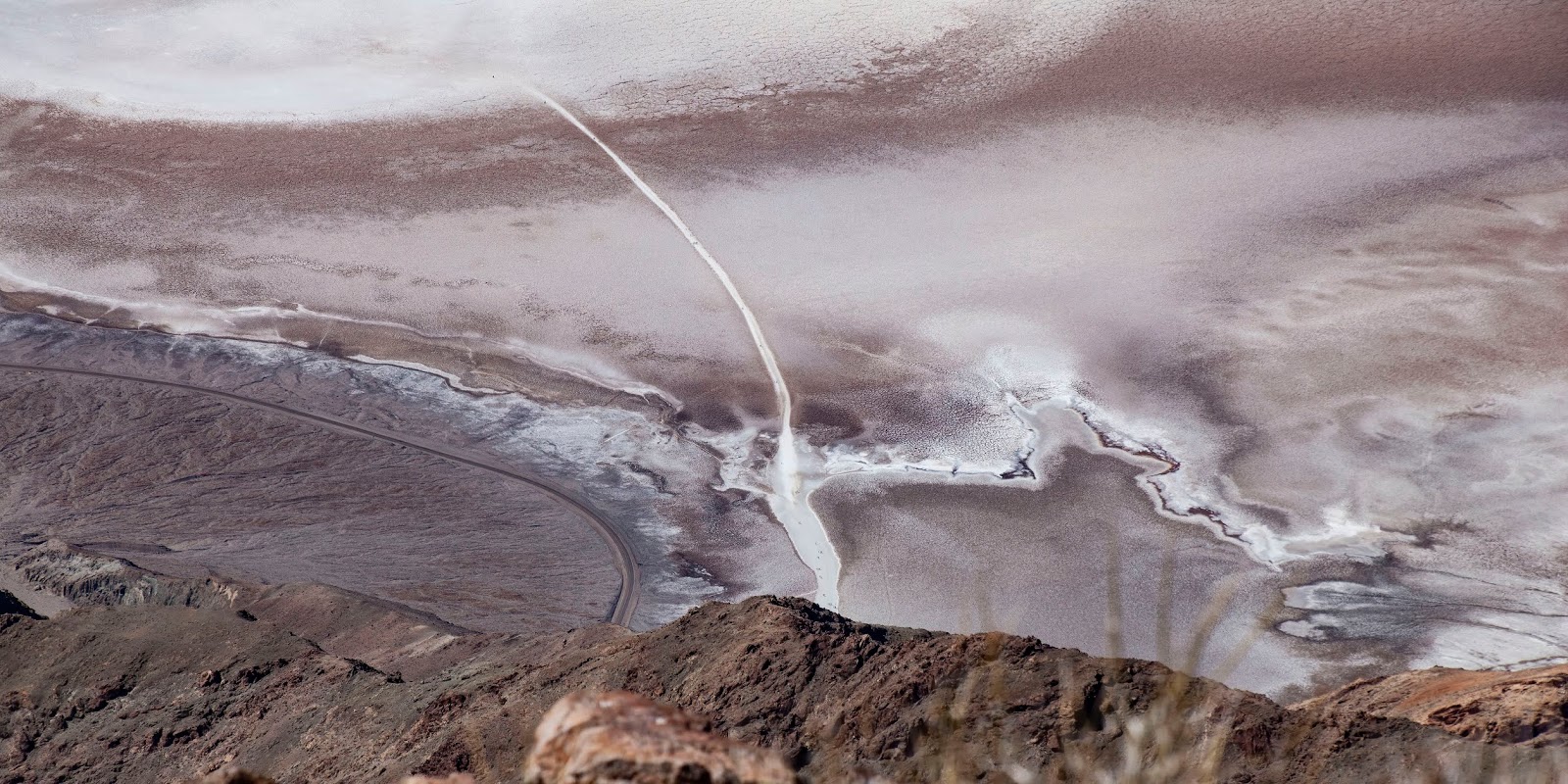
Located in the Amargosa Valley, the refuge was created in 1984 to protect an extremely rare desert oasis, which is the largest remaining oasis in the Mojave Desert. 

The refuge is a major discharge point for a vast underground aquifer water system, reaching more than 100 miles to the northeast. Water-bearing strata come to the surface in more than thirty seeps and springs, providing a rich, complex variety of habitats.

Reeds in the chalky water
Virtually all of the water at Ash Meadows is fossil water (water that comes from melted ice from the last ice age), believed to have entered the ground water system tens of thousands of years ago. The ranger told Scott that the water has a number of minerals in it, including arsenic. Early settlers apparently drank it, adjusting after several months of intestinal distress. But, who knows how many years it took off their lives?

Clear fossil water that could be deadly!
When you arrive, Ash Meadows looks like scrubby, alkaline wasteland. 

This is an oasis?
Then, you round a corner and see the lovely Crystal Reservoir, with its chalky blue water – and a contingent of American Coots. 

Crystal Reservoir reflecting nearby hills
Although we didn’t see any mammals except Black-Tailed Jackrabbits ...

Posing Black-tailed Jackrabbit, one of the West's reliable inhabitants
... I saw footprints of both Bighorn Sheep and Coyotes, which come down to the reservoir to drink and (in the case of predators) hunt.

Obviously, the water is infused with minerals, giving it a silty appearance.

Coots on the Lake's surface
After spending some time at the reservoir, we went to the Visitor Center and walked out on  the expansive boardwalk ...

Boardwalk
The boardwalk took us to a number of crystal clear springs surrounding by marsh grasses. What a surprise. You just don’t expect to see this in the desert.

Oasis
While exploring the springs, I was treated to a few birds, including the American Coots on the reservoir ...

This one is trying to walk on water
A Common Raven, rapidly flying over …

On a mission
A number of Phainopeplas, sitting in the trees all around the springs ...

Male Phainopepla, left, and female, right
Although I saw both males and females, most were the pretty black males; females are a dark slate-gray.

An absolutely arresting bird
These gorgeous birds are jet black with striking red eyes. The look like a cardinal designed by the Devil.

My first Phainopepla-in-flight photo; I did not know they had white on their underwings
While I was at one spring, I heard a bird calling out from inside the reeds. I knew I couldn’t wait forever and it was a long-shot that I would see what it was. But patience paid off and a tiny Marsh Wren made a brief, but personality-filled appearance. 

Marsh Wren
Not a lifer, but a bird I haven’t seen all that often.

Ash Meadows National Wildlife Refuge was established to provide and protect habitat for at least 26 endemic plants and animals, including four species of fish and one plant that are listed as endangered species. I looked and looked, but didn’t see many fish.

A riot of marsh plants
Ash Meadows National Wildlife Refuge was named after the galleries of ash trees described in expedition notes from 1893. The concentration of locally exclusive flora and fauna distinguishes Ash Meadows is the greatest concentration of endemic biota in any local area within the United States. It has the second greatest local endemism concentration in all of North America.

Alkali Grasshopper, not endemic, but waiting on the walkway for me to to photograph it
We did not explore the entire Refuge because we needed to press on.

Red Rock Canyon National Conservation Area
The red is really THAT red
Next stop? Red Rock Canyon National Conservation Area, which is only 15 miles west of Las Vegas, and is easily seen from the Las Vegas Strip. What a surprise!

My photos belie the reality. It was quite crowded, a big change from the relatively empty Death Valley National Park.

RRCNRA showcases a set of brightly colored sandstone peaks and walls called the Keystone Thrust. The walls are up to 3,000 feet high, making them a popular hiking and rock climbing destination. The highest point is La Madre Mountain, at 8,154 feet.

Looking back on the Calico formation from the High Point Overlook, which sits at 4,771 feet
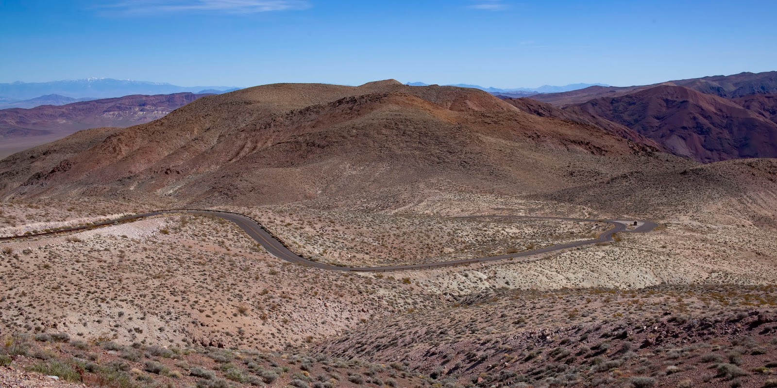
A one-way loop road, 13 miles long, provides vehicle access to many of the features in the area. Several side roads and parking areas allow access to trails.

The rock itself is a mish-mash of multiple colors
As many as six different Native American cultures may have been present at Red Rock Canyon over the millennia, including Paleo-Indians (11,000-8,000 BC), San Dieguito (7,000-5,500 BC), Pinto/Gypsum (3,500 BC-1 AD), Anasazi (1-1150 AD), Patayan Culture (900-1800s) and Southern Paiute (900-present).

Pictographs in Red Rock Canyon; Photo: Las Vegas Entertainment Guide
In the early 20th century, around the time the first European Americans settled in nearby Las Vegas, the Excelsior Company operated a small sandstone quarry near the northern area of the scenic loop. It proved to be uneconomical and was shut down. Evidence of the quarry's existence includes some of the huge sandstone blocks that have been left behind.

In 1967, the Bureau of Land Management designated 10,000 acres as the Red Rock Recreation Lands. In 1990, special legislation changed the status of the Red Rock Recreation Lands to a National Conservation Area, a status that also provides funds to maintain and protect it.

Interesting formations
RRCNRA is one of the easternmost parts of the Mojave Desert; the lowest elevation of the area, from 3,600 to 4,500 feet, is in the Lower Sonoran Zone, while the area from 4,500 feet up is in the Upper Sonoran Zone. A number of year-round springs are found in the recesses of the side canyons.

Some 600 species of plants are known in the area. Common types in the valley floor include the Joshua tree, Mojave yucca, banana yucca, creosote and blackbrush. Higher up, Utah juniper and Sonoran scrub oak dominate. Agave is easy to spot in red rock niches, with its thick low leaves and flowering stem that reaches twice the height of a man. Ponderosa pines may be found at the top of the valley, where it connects to the Spring Mountains.

The mountains to the west
Animals that live in RRCNRA include Wild Burros, Black-Tailed Jackrabbits, Desert Bighorn Sheep, Red-Spotted Toads and they protected Desert Tortoise. In our brief time there, we didn’t see anything but a couple of Woodhouse’s Scrub Jays. 

Woodhouse's Scrub-Jay

Color!
The RRCNRA area has a complex geological history, which over millions of years helped create the region's dramatic landscape. 

The area was under an ocean basin 600 million years ago. Up to 9,000 feet of limey sediments were deposited and eventually "lithified" to limestone. Lithification is the process in which sediments compact under pressure, expel fluids and gradually become solid rock.

When the earth's crust started to rise due to tectonic shifts 250 million years ago, marine shales and sandstones were deposited. 

As the basin became isolated, evaporite formations of salt and gypsum were deposited. Oxidation of iron in the sediments resulted in the red colors of some of the rocks. Deposition by streams and in swamp environments resulted in the formation of petrified wood.

By 180 million years ago, the climate continued to change and the area became a desert with vast expanses of huge shifting sand dunes. These dunes accumulated over a broad area, up to a half-mile thick, and were lithified, cemented with calcium carbonate and iron oxides. They developed as the colorful Aztec Sandstone.

Can you believe this is 15 miles from las Vegas?
During a mountain-building period around 66 million years ago (around the time of dinosaurs), the Keystone Thrust Fault developed and movement of the fault forced the older gray sedimentary rock over the younger red rocks, forming a varicolored landscape.

The swirls and loops are fascinating
Spring Mountain Ranch State Park
People were taking advantage of the great weather and lovely view on the Ranch lawn
Our finally stop was Spring Mountain Ranch State Park, which sits right next to RRCNRA and the historic Sand Stone Ranch, which was entered into the National Register of Historic Places as a historic district in 1976.

When we drove in, we were treated to a Greater Roadrunner crossing the road and disappearing in the scrub. 

Greater Roadrunner on the run
In the mid-1830s, a campsite was established along the wash that runs through the Ranch. The spring-fed creek and grassy meadows formed an oasis for travelers using the alternate route of the Spanish Trail through Cottonwood Valley. The use of the site by pack and wagon trains continued until their replacement by the railroad in 1905. This remote trail was also used extensively by outlaws involved in Indian slave trading, horse stealing and raids upon passing caravans. 

Historical reenactment at Spring Mountain Ranch; Photo: Spring Mountain Free Trappers
In 1840, a group of American mountain men and Ute Indians conducted a famous raid on the Mexican Ranchos in California. Mountain Man Bill Williams, a member of the raiding party, brought his band of horses through Red Rock Canyon where he rested the horses from the hard trip across the desert. Later, he revisited the area several times and, although he never lived on the property, the site became known as the "Old Williams Ranch" or "Bill Williams Ranch.”

In 1876 James Wilson and his partner George Anderson bought the land and created the "Sand Stone Ranch." Anderson left the ranch after a few years, leaving behind his Paiute wife, Kayer, and their two sons, Jim and Tweed. Jim Wilson later adopted the boys and deeded the ranch to them in 1902. 

Left to right: Jim, Tweed and Jim Jr. Wilson; Photo: Spring Mountain Ranch Docents
For many years, it operated as a cattle ranch serving to local area, although the owners also continued to prospect, hoping to strike it rich.

Then, it became a luxury retreat for a string of colorful owners, including furrier Willard George, Chester Lauck (of radio’s popular “Lum & Abner” show), German actress Vera Krupp and millionaire Howard Hughes. 

George (and a Chinchilla), Lauck,  Krupp and Hughes; Photos: Spring Mountain Ranch Docents
While Hughes owned the Ranch, he may have never visited, although his leather bar is in the historic ranch house. 

Left, Howard Hughes' bar; Right, Scott
Lauck called the property the Bar Nothing Ranch and Krupp changed the name to the Spring Mountain Ranch.

Vera Krupp's dressing gowns
Krupp lived at the Ranch for 11 years and is responsible for building and/or updating most of the buildings currently on the property, including adding a swimming pool and a "secret room" that could be reached via a closet door in her boudoir. 

Krupp had a glamorous wardrobe and serious jewelry, including a 33.6-carat blue diamond that eventually became Elizabeth Taylor's famous engagement ring from Richard Burton. But, she also enthusiastically worked the ranch and made jewelry from local minerals found in the Spring Mountains. She went through several husbands while running the Ranch.

After Krupp died, her estate attempted to sell it to the State of Nevada, which declined the offer. However, when the next owners announced plans to turn it into a gated golf/equestrian housing development, there was significant public outcry. Nevada then purchased the property and turned it into a State Park.


Vera Krupp with spring calves; Photo: Nevada State Parks
Historical sites at the park include the main ranch house, cabin and bunkhouse, blacksmith's shop, barn and corral, two-hole outhouse, Chinchilla shed (yep, Willard George ran the Ranch as a Chinchilla farm for awhile) and Wilson family cemetery. It also has trails, a picnic area and a summer theater program presented through a local non-profit theater organization.

Ranch house
Under the trees on the expansive grounds, I saw an American Robin, reminding us that Spring is on the way.

American Robin
What a lovely setting! If I ever were to live on a ranch, I think this would be the perfect spot.

Can you imagine that view every day?
But, we were running out of time and had to get to las Vegas for dinner.

Dinner
Photo: Firefly
On the last evening, we had dinner at Fireflyfabulous tapas restaurant. So good that we forgot to take pictures. I love tapas and can heartily recommend this place, especially the green apple and manchago salad, Spanish piquillo peppers stuffed with mozzarella and garlic cream cheese and the bacon-wrapped bleu-cheese-stuffed dates, all recommendations from Nancy and Russell. 

Photos: Firefly
A nice wrap-up for a lovely birthday trip.


Trip date: March 6-10, 2020

Wednesday, March 11, 2020

Death Valley National Park

Zabriskie Point
Happy birthday to me!
I turned 67 this month. Damn. I have been discovering, with all the coverage of the Covid-19 pandemic, that 67 is considered “elderly.” It’s not the way I feel, but I suppose it does drive me to say “yes” to travel more often than “no.” So, even though I went to the U.S. Virgin Islands in December, Minnesota in January and Florida in February, Scott and I decided to go to Death Valley National Park for a few days to celebrate.

Death Valley National Park is in California
Why Death Valley? A couple of reasons: We had planned to go there last October when visiting Scott’s sister in Las Vegas, but we had to cut that trip short in order to beat a snow storm home; although I had been to Death valley briefly in 2007, I hadn’t seen the whole Park; and it was affordable on short notice.

We broke from our usual preference of flying American Airlines because we could get to Las Vegas (the nearest airport) faster and cheaper on Frontier. I mean, who wants to go to Dallas on the way to Las Vegas? I put together a trip where we would stay two days in the Park at the Ranch at Death Valley and one day on either end at a cheaper hotel. Death Valley is only two hours from Las Vegas, so it was a pretty easy plan.

Our home base at DVNP
The Ranch at Death valley is one of two hotels at the Oasis complex in Furnace Creek. From what we saw, this is definitely the nicer property for lodging in the Park. The Ranch is the less expensive of the two Oasis options, although it is not cheap. 

Our room
A former working ranch, the Ranch at Death Valley has 224 rooms, two restaurants (The Last Kind Words Saloon and the 1849 Buffet), a coffee bar, a general store with souvenirs and a small supply of groceries (including delicious locally grown Medjool dates) and a nice pool. 

The room was comfy but not luxurious and, because it is smack in the middle of DVNP, the location was excellent for sightseeing. The Visitor Center is right next door, as is a gas station.

Scott waiting for dinner
We did have a nice  albeit pricy – dinner at The Last Kind Words. Because it's a National Park restaurant, you really have to make reservations (we did). I know this surprises people, but I saw diners turned away while we were waiting. There aren't a lot of eating establishments in National Parks, so any nice restaurant requires reservations. 

The Last Kind Words is basically a steakhouse. We started with smoked trout and then I had steak and Scott had ribs. It was my birthday dinner, so I also had flan that was inexplicably served with ice cream on the side. It was a good meal.

Scott ate breakfast at the 1849 Buffet the next morning and wasn't impressed. We also went, briefly, to the pool. It was nice, but quite crowded.


Our Trip
We didn’t do anything extraordinary, just visited most of the parts of the National Park you can reach on paved roads and a few gravel ones. The scenery, while decidedly arid, was amazing with a wide variety of colors and textures in the mountains, river basins, valleys and dunes. 

The landscape is vast; this is me at Salt Creek; Photo: Scott Stevens
The wildlife, however, was resoundingly disappointing. We saw two Coyotes before we reached the Park and a few dead Jackrabbits and a dead Kit Fox on the highway in the Park. The only live mammals we saw in the Park were Pallid Bats that came out at dusk and were impossible to photograph. We didn't see any of the Wild Burros or Bighorn Sheep that are much touted as Park inhabitants.

Of course, we saw Ravens. You always see Ravens. But, beyond that, we just saw a couple of Red-tailed Hawks ... 

Red-tailed Hawk
... and some frisky Say’s Phoebes ... 

Say's Phoebe
The few other birds I glimpsed were flying so fast that I could never tell what they were. In Salt Creek, we saw the highly endangered Salt Creek Pupfish. I will talk about those later.

Salt Creek Pupfish are endemic to the Park and endangered
We saw lots of Desert Side-Blotched Lizards. 

A battle (or romantic encounter) between two Desert Side-Blotched Lizards
And, that was that. 

Death Valley National Park
So, let’s talk about Death Valley.

Sitting on the California/Nevada border, Death Valley National Park (DVNP) is the largest National Park in the lower 48 and the hottest, driest and lowest of all the National Parks in the U.S. In fact, the lowest point in the U.S. and the second-lowest in the Western Hemisphere is in Badwater Basin.

Feelin' low; Photo: Scott Stevens
DVNP encompasses several valleys (Death Valley, Saline Valley, the northern section of Panamint Valley and the southern section of Eureka Valley) in an area between the arid Great Basin and Mojave deserts. It comprises a diverse environment of salt flats, sand dunes, badlands, valleys, canyons and mountains. 

Corkscrew Mountain
Because almost 91 percent of the park is a designated wilderness area, much is not reachable by car. We didn’t have a 4X4 vehicle and, quite frankly, I may be too “elderly” to enjoy hiking in a generally treeless desert environment.

Artists Drive
The natural environment of DVNP has been shaped largely by its geology. The valley is what is called a “graben:” a depressed block of the earth’s crust bordered by parallel faults.

Rainbow Canyon
The oldest rocks in DVNP are extensively metamorphosed and at least 1.7 billion years old. Ancient warm shallow seas deposited marine sediments until rifting opened the Pacific Ocean. Additional sedimentation occurred until a subduction zone formed off the coast. 

DVNP is characterized by lots of exposed and colorful rock
The subduction uplifted the region out of the sea and created a line of volcanoes. Later the crust started to pull apart and valleys filled with sediment and a few lakes. Since its formation, the area that comprises the Park has experienced at least four major periods of extensive volcanism, three or four periods of major sedimentation and several intervals of major tectonic deformation where the crust has been reshaped. 

Lava sits on top of sedimentary rock at Zabriskie Point
Two periods of glaciation have also had effects on the area, although no glaciers ever existed in the ranges now in the park. Both Death Valley and Panamint Valley were formed within the last few million years and both are bounded by north/south mountain ranges.

Water flows beneath Badwater Basin
At 282 feet below sea level, Badwater Basin on Death Valley's floor was for many years believed to be the lowest depression in the Western Hemisphere. Then, it was discovered that Laguna del Carbón in Argentina was lower, moving Badwater to second place. 

Ironically, the highest point in the continental U.S., 14,505-foot-tall Mount Whitney, is only 85 miles to the west. 

DVNP is the terminus of the Great Basin's southwestern drainage, which means that all water that falls in the Park is absorbed into the ground and does not flow to the Atlantic or Pacific Ocean. This absorption makes the mineral-rich salt pans in Death Valley among the largest in the world.

Although ancient lakes and rivers were above ground, today in many parts of DVNP, the main water flows underground near the surface, occasionally coming above ground when it encounters rock barriers. This, combined with dramatically varying water levels and ground absorption, results in lots of interesting salt formations.

Salt deposits in Badwater Basin
The hottest and driest place in North America, DVNP is so frequently the hottest spot in the U.S. that many tabulations of the highest daily temperatures in the country omit Death Valley. The record high was 134°F in July 1913, one of the highest ambient air temperatures ever recorded at the surface of the Earth. Daily summer temperatures of 120°F or greater are common, as well as below freezing nightly temperatures in the winter.

Although sundogs are usually associated with cold, we saw one
We had lovely weather, ranging from the low 50s to the 80s, reaching 87°F one day. 

Precipitation varies, with higher amounts at higher elevations (indeed, many peaks were snow-covered). But, make no mistake, DVNP is a desert. Badwater Basin receives about 1.5 inches of rain annually and some years fails to register any measurable rainfall at all. 

But, when it does rain, it is often in intense storms that cause flash floods that remodel the landscape and sometimes create very shallow temporary lakes. There have been several bad floods in recent years, which closed many Park roads and still prevent visitors from going to Scotty’s Castle in the north part of the Park. Scotty's Castle is supposed to reopen soon.

2015 storm damage near Scotty's Castle; Photo: NPS
Not much grows in DVNP
Several of the larger springs derive their water from a regional aquifer, which extends as far east as southern Nevada and Utah. Much of the water in this aquifer has been there since the Pleistocene ice ages, when the climate was cooler and wetter. But, today's much drier climate does not provide enough precipitation to recharge the aquifer at the rate at which water is being withdrawn.

The hot, dry climate makes it difficult for soil to form. Mass wasting, the down-slope movement of loose rock, is therefore the dominant erosive force in mountainous area, resulting in "skeletonized" ranges (mountains with very little soil on them). 

There are multiple sand dunes in the park, with the Mesquite Flat dune field (which I will talk about later) most easily accessible because it is reached via the main paved thoroughfare. The Mesquite Flats dunes are primarily made of quartz sand. Another dune field 10 miles to the north is mostly travertine sand.

Mesquite Flat Sand Dunes
Four Native American cultures are known to have lived in the area during the last 10,000 years. The first known group, the Nevares Spring People, were hunters and gatherers who arrived in the area around 7000 BC when the climate was much milder and there were still small lakes and plentiful large game animals. By 3000 BC, the Mesquite Flat People displaced the Nevares and, around 2,000 years ago, the Saratoga Spring People moved into the area, which by then was a hot, dry desert.

Petroglyphs from early peoples; Photo: NPS
The nomadic Timbisha (formerly called Shoshone and also known as Panamint or Koso) moved into the area around 1,000 years ago and hunted game and gathered mesquite beans and pinyon pine nuts. Because of the wide altitude differences between the valley bottom and the mountain ridges, the Timbisha had winter camps near water sources in the valley bottoms, moving higher up as the weather warmed.

Shoshone; Photo: Crystallinks.com
The California Gold Rush brought the first people of European descent known to visit the immediate area. In December 1849, two large wagon trains headed for California Gold Country stumbled into Death Valley after getting lost on what they thought was a shortcut off the Old Spanish Trail. Unable to find a pass out of the valley for weeks, they found fresh water at various springs in the area, but were forced to eat several of their oxen to survive and use their wagons for fuel to cook the meat and make jerky. 

Eventually, they hiked out and, as they were leaving, one of the women in the group turned and said, "Goodbye, Death Valley," giving the valley its colorful name.

Much of California's growth is associated with gold (and greed). 

Although Death Valley was not a primary Gold Rush location (more on that below), mining was a prime factor in Death Valley's development and mystique. 

The ores that are most famously associated with the area were also the easiest to collect and the most profitable: evaporite deposits such as salts, borate and talc. Borax was found near The Ranch at Death Valley (then called Greenland) in 1881. Later that same year, the Eagle Borax Works became Death Valley's first commercial borax operation. The Harmony Borax Works plant, which operated from late 1883 or early 1884 until 1888, produced borax for soap and industrial uses. The end product was shipped out of the valley 165 miles to the Mojave railhead in 10-ton-capacity wagons pulled by "twenty-mule teams" that were actually teams of 18 mules and two horses each. 

Historic Mule Team; Photos: 20-Mule Team Borax
The teams averaged two mph and required about 30 days to complete a round trip. In 1914, the Death Valley Railroad was built to serve mining operations on the east side of the valley. By the late 1920s, the area was the world's number one source of borax.

Although there are deposits of copper, gold, lead and silver in DVNP, mining ventures were hampered by the remote location and harsh desert environment. In 1903, two men prospecting for silver discovered an immense ledge of free-milling gold, starting a minor and short-lived gold rush into the area. The Keane Wonder Mine, along with mines at Rhyolite, Skidoo and Harrisburg, were the only ones to extract enough metal ore to make them worthwhile.

Site of the Keane Wonder Mine
The first documented tourist facilities in Death Valley were a set of tent houses built in the 1920s where Stovepipe Wells is now located. People flocked to resorts built around natural springs thought to have curative and restorative properties.

The lower entry into the Oasis Hotel
In 1927, Pacific Coast Borax turned the crew quarters of its Furnace Creek Ranch into a resort, creating the Furnace Creek Inn and Resort. That property, which is surrounded by date trees, is now the Oasis at Death Valley, which is where we stayed.

The spring at Furnace Creek was harnessed to develop the resort, and as the water was diverted, the surrounding marshes and wetlands started to shrink.

Soon the valley was a popular winter destination. Other facilities started off as private getaways but were later opened to the public. 

Most notable among these was Death Valley Ranch, better known as Scotty's Castle. The Spanish Revival home became a hotel in the late 1930s, popularized by “Death Valley Scotty,” a gold miner who pretended to be owner of "his castle," which he claimed to have built with profits from his gold mine. Neither claim was true, but the real owner, Chicago millionaire Albert Mussey Johnson, encouraged the myth.

Left, Scotty's castle; Photo: NPS; Right, Scotty; Photo: mojavedesert.net
After Death Valley became a National Monument in 1933, the Civilian Conservation Corps (CCC) developed infrastructure including barracks, 500 miles of roads, water and telephone lines and 76 buildings. Trails in the Panamint Range were built to points of scenic interest and an adobe village, laundry and trading post were constructed for the Timbisha Shoshone Tribe. Five campgrounds, restrooms, an airplane landing field and picnic facilities were also built.

CCC workers; Photo: Security Pacific National Bank; DV CCC Camp; Photo: NPS
Creation of the National Monument temporarily closed the lands to prospecting and mining, but that was quickly overturned and mining continued until 1976, progressing from simple “mule and a few prospectors” to open strip mines. Public outcry resulted in the Mining in the Parks Act, which closed Death Valley National Monument to new mining claims, banned open-pit mining and required the National Park Service to examine the validity of tens of thousands of pre-1976 mining claims. Mining was allowed to resume on a limited basis in 1980 with stricter environmental standards.

Early Death Valley Park Ranger; Photo; NPS
Death Valley National Monument was designated a Biosphere Reserve in 1984 and, in 1994, the Monument was expanded by 1.3 million acres and re-designated as a National Park. That really surprised me. I thought Death Valley had been a National Park for much longer.

With one of the darkest night skies in the U.S., DVNP was designated as a Dark Sky Park by the International Dark-Sky Association in 2013.

Among the places we spent some time were Badwater Basin, Artists Drive, Zabriskie Point, Dante’s Peak, the Salt Creek Interpretive Trail, the Mesquite Flat Sand Dunes, Emigrant Canyon Road, the Panamint Area, Mustard Canyon and the Keane Wonder Mine.

Badwater Basin
Badwater Basin
Badwater Basin, the lowest point in the U.S., consists of a small spring-fed pool of "bad water" next to the road in a sink. As in all of DVNP, the water level fluctuates from dry salt pan to full-on lake. There was very little surface water the day we were there. 

Mountains reflecting in the small amount of water in the basin
Accumulated salts of the surrounding basin make it undrinkable, thus giving it the name. Repeated freeze-thaw and evaporation cycles gradually push the thin salt crust into hexagonal honeycomb shapes. 

Salt pan surface
There is a small deceit at the viewing area: the lowest point is actually several miles to the west and varies in position, depending on rainfall and evaporation patterns. 

Left, viewing platform; Right, Sea level marker way above the basin floor
Because the salt flats are hazardous (in many cases being only a thin white crust over mud), the sign marking the low point is at the pool instead.

Not entirely accurate
Salt crystals
Badwater Basin was first created by the drying-up of 30-foot-deep Recent Lake 2,000 to 3,000 years ago. 

Rainstorms frequently flood the basin, covering the salt pan with a thin sheet of standing water. 

Each newly formed lake doesn't last long though, because the average 1.5-1.9 inches of rainfall is overwhelmed by a 150-inch annual evaporation rate. 

This, the nation's greatest evaporation potential, means that even a lake 12 feet deep and 30 miles long lake can dry up in a single year. While flooded, some of the salt is dissolved, then is redeposited as clean, sparkling crystals when the water evaporates.

Artists Drive
A drive that would inspire any artist
Artists Drive (or, alternately, Artist Drive or Artist’s Drive – I wish NPS could decide about plurals and apostrophes) is a one-way road that winds through mountains marked by colorful mineral deposits, some bright red and some an incredible blue-green. 

The name, obviously, comes from the diverse color palette
These colors are caused by the oxidation of different metals ...

The variety of colors is amazing
... iron produces red, pink and yellow ...

Iron is prevalent in DVNP
... decomposition of tuff-derived mica produces green and manganese produces purple ......

But, the green and purple are the most amazing
The Artist Drive Formation was created by DVNP’s most violently explosive volcanic period, which left cemented gravel, playa deposits and volcanic debris up to 5,000 feet thick.

Volcanic debris
We visited first during the day; click here for a video of the drive. 

Blue sky with red mountains
It was so beautiful, but so hard to capture in photos.

Panorama
Then, we returned in the evening for a dramatic sunset – and lots of encounters with those impossible-to-photograph Pallid Bats.

Artists sunset; Right Photo: Scott Stevens
Zabriskie Point
Manly Beacon at Zabriskie Point
Noted for its dramatic erosional landscape,  Zabriskie Point is composed of sediments from Furnace Creek Lake, which formed 9 million years ago and dried up 5 million years ago, long before Death Valley came into existence.

Lots of colors and contours
Sediments collected at the bottom of the lake in the form of saline muds, gravels from nearby mountains and ashfalls from the then-active Black Mountain volcanic field. These sediments combined to form what we today call the Furnace Creek Formation. 

Furnace Creek Formation
The climate along Furnace Creek Lake was dry, but not nearly as dry as in the present. Camels, mastodons, horses, carnivores and birds left tracks in the lakeshore muds, along with fossilized grass and reeds.

Zabriskie provides the most arresting photos
Regional mountains building to the west influenced the climate to become more and more arid, causing the lake to dry up. Subsequent widening and sinking of Death Valley and the additional uplift of the Black Mountains tilted the area, providing the necessary relief that allowed erosion to produce badlands. 

Substantial tilt
Some of the ridges are capped with lava from eruptions that occurred 3-5 million years ago.

Sedimentary hills wearing a lava cap
The location was named after Christian Brevoort Zabriskie, vice-president and general manager of the Pacific Coast Borax Company in the early 20th century.

Zabriskie Point is popular for both sunrise and sunset photography. With few clouds, we didn’t get the right sunset light when we were there. Scott did go at night (I was too tired) and got some nice night sky shots.

Zabriskie at night; Photos: Scott Stevens
Dante’s View
That's Badwater Basin below
Rising 5,500 feet above sea level is Dante’s View, where you can look down and see Badwater Basin or look across the valley to see 11,331-foot-tall Telescope Peak. 

Snow-topped Telescope Peak
The winding road ends in a parking lot with a lovely panorama.

The road up
Dante's View is named from Dante Alighieri, who wrote the Divine Comedy, in which there are described the nine circles of Hell, the seven terraces of Purgatory and the nine spheres of Paradise. In 1926, businessmen of the Pacific Coast Borax Company trying to develop the area as a tourist attraction selected Dante's View as the best view in the area.

Badwater Basin
Dante's View is part of the Black Mountains, a part of the volcanic Amargosa Range. The mountains were created when the surface of the earth was stretched, causing the crust to rupture and release lava.

A heavenly – or hellish – view
Salt Creek Interpretive Trail
Walking the boardwalk; Photo: Scott Stevens
Listed as a great place to bird, the Salt Creek Interpretive Trail was a “must see” for me. Although it failed to deliver any identifiable birds (I saw one tiny bird rapidly flit into some bushes never to re-emerge), it did provide a lovely morning’s entertainment (especially because we were the only ones there until right before we left).

Actual water can be see at Salt Creek
Sitting at 161 feet below sea level, much of Salt Creek is usually dry at the surface and covered by a bright layer of salt that was created by flooding and subsequent evaporation. 

The boardwalk
The loop trail is built above and around brackish water that is present year-round, but only flows to the boardwalk November-May. Here lives the last survivor of prehistoric Lake Manly: the endemic endangered Salt Creek Pupfish, AKA the Death Valley Pupfish.

Salt Creek Pupfish, a type of Death Valley Pupfish
A small, silvery fish with 6-9 dark bands on its sides, the Salt Creek Pupfish is an average of 1.5 inches long with a recorded maximum of 3.1 inches. The males turn bright blue and yellow during mating season, April through October, but the ones we saw were fairly bland. Plentiful, but bland.

This time of year, their colors are dull; when they mate, the turn blue and yellow
The Salt Creek Pupfish can withstand harsh conditions that would kill other fish: water that is four times more saline than the ocean, hot water up to 116°F and cold water down to 32°F. Found only in only Salt Creek, River Springs and Soda Lake, this fish has a close cousin found in DVNP’s Cottonball Marsh, which is 260 feet below sea level.

This innocent-looking creek is actually a harsh environment
There are more plants around Salt Creek than most of the rest of DVNP and, tucked among the plants, are a occasional surprises, like this web that was concealing its occupant ...

There's a spider in that bubble of web
The boardwalk also is home to lizards, lots and lots of Desert Side-Blotched Lizards, pretty with their orange/yellow bellies and bright blue spots.

Desert Side-Blotched Lizards
Mesquite Flat Sand Dunes
Climbing the dunes – with two cameras; Photo: Scott Stevens
Surrounded by mountains, the Mesquite Flat Sand Dunes are composed of pulverized quartz and feldspar from the Cottonwood Mountains that lie to the north and northwest.

A fine-grained gray-tan sand
The largest dune, Star Dune, is relatively stable and stationary because it is at a point where the various winds that shape the dunes converge. The depth of the sand at its crest is 130-140 feet, which is small compared to other, more-difficult-to-reach dunes in the area that have depths of up to 700 feet.

Star Dune
There are no trails through the dunes, but also no restrictions for where you walk. I saw a number of people carrying sleds (and cardboard sheets) to ride down the taller dunes. Even with a somewhat warm air temperature, the sand was not particularly hot to walk on. I suspect it gets pretty toasty when the temperatures start to reach 120°F.

The golden sand contrasts against the purple mountains
In between many of the dunes are stands of creosote bush and some mesquite.

Oddly, the dunes hosted some of the larger plants; Photo: Scott Stevens
Mixed with the sand are still patches of dried mud, creating interesting cobblestone-like patterns. 

Walking on the cracked mud is much easier than walking across the sand
Mud used to cover this part of the valley before the dunes intruded. Then, mesquite was the dominant plant, but now creosote dominates because it does much better in the sand dune conditions. Interestingly, I keep thinking I was smelling something burning, like maybe our brakes. Nope. It was the creosote.

Left, a plant holds onto a dune; Right, remains of a tree that did not survive
As we drove away from the dune field, we saw a Red-tailed Hawk that crossed the road, then landed and observed us before taking off.

And, off we go ...
Emigrant Canyon Road
We took one long drive along Emigrant Canyon Road, a mostly paved scenic drive that leaves the main valley and heads through a canyon, across a plateau beyond and on into the mountains, past perfect desert scenery, with vistas of distant hills and valleys. It is named for the emigrants that wandered into the valley when they missed an Old Spanish Trail shortcut.

The main valley
The first eight miles wind along the canyon past steep grassy slopes and low rocky cliffs, climbing to a high point of 5,318 feet at Emigrant Pass. 

An interesting formation on the side of the road
It was in the canyon that we stopped to photograph a Red-tailed Hawk guarding its nest.

Posing for us by the road
Then, the landscape opened up with views over wide plains to far-off mountains both east and west. 

A great vista from the crest of the road
The road then descends down a narrow ravine (Wildrose Canyon) and becomes steep and unpaved. We saw a number of Say’s Phoebes at the Wildrose campground. We heard even more.

Let, me digress for a moment here to talk about campgrounds: they look pretty awful unless you have a self-contained RV. There is little vegetation, just scree-covered pads. Most look fairly close-packed. But, if your fellow RVs could keep their party lights and TVs off, I imagine the night skies might make it worth camping.

Say's Phoebe
The unpaved road continues to the Charcoal Kilns, ten conical structures built in the 19th century for the smoking of locally-felled pinyon and juniper wood to produce charcoal for silver ore smelting. We didn’t make it that far because Scott didn’t want to drive the rough washboard track.

Wildrose Charcoal Kilns; Photo: NPS
Click here to see a little bit of the road.

The Panamint Area
Looking east across Panamint Valley
After we drove the Emigrant Canyon Road, we continued on the main park road toward Panamint Springs, which sits in the 65-mile-long, 10-mile-wide Panamint Valley that stretches north-south on the western side of DVNP. The Valley is striking as you drive out of the mountains and down towards it. It’s a wide salt flat that formerly held a large lake (and can become a lake when it rains heavily) that rises up to mountains on the other side.

The road descends quickly from the mointains
As we were approaching, I saw what I thought was a Raven climbing straight up in the sky. But, it wasn’t. It was a fighter jet out of China Lake doing loops and rolls. 

USAF F-35 jet
That explains the circular vapor trails we had been seeing all day.

The sky bears the history of the military maneuvers
Once you traverse the flat, you begin to ascend again, this time traveling into colorful Rainbow Canyon, which cuts through basalt lava flows and lapilli beds of the Darwin Hills volcanoes, which last erupted 2-4 million years ago. Formations of granite and marble and other pyroclastic rock is also exposed, resulting in steep walls of reds, grey and pink.

Rainbow Canyon was the most aggressively volcanic place we visited
In addition to driving the Canyon, we also had some exceptionally yummy burgers at the Panamint Springs Resort.

Keane Wonder Mine
Keane Wonder Mine's aerial tramway remains
DVNP has more than 18,000 historical mining features, scattered all over the Park. We passed turn-offs to the Skidoo and Harrisburg Mines, as well as the Charcoal Kilns, on the Emigrant Canyon Road. And, we drove by the Harmony Borax Works without, unfortunately, taking any pictures.

Old water tank at the Keane Wonder Mine
Earlier, I mentioned the Keane Wonder Mine, which is located in the Funeral Mountains on the eastern side of DVNP. The Wonder Mine location was discovered in the early 1900s by Jack Keane and Domingo Etcharren, who were looking for silver.

A closed off mine entrance
Etcharren was leaving the area when he noticed an outcropping of quartz, which can often be found near gold deposits. When Keane investigated further, he discovered gold, which he named "Keane's Wonder." Keane and Etcharren sold an option on the claim to a New Yorker named Joseph DeLamar.

The was gold in them thar hills
The discovery caused a brief gold rush, which was soon eclipsed by a larger find further north. DeLamar was disappointed with the gold Keane and Etcharren found and forfeited his option. This happened with a second investor as well. It was not until 1906 when investors John Campbell and then Homer Wilson turned the find into a major – and profitable – mine. Etcharren used his share to purchase a store, but Keane didn't fare as well. He was involved in two shootings and was imprisoned in Ireland for murder.

Rusted debris is all that remains
Homer Wilson moved to the mine site with his family and tried to establish two towns, Keane Springs and Chloride City, nearby. Both failed within months of their founding. The mine, however, continued to be profitable throughout the Panic of 1907 and the subsequent depression. It was limited only by a lack of water and the extremely high heat in the valley, which the miners to work at night.

Old railroad relics?
The mine used a gravity-powered aerial tramway to transport ore, moving up to 70 tons of gold ore a day during peak production. A railroad was built  to deliver the ore to the Tonopah and Tidewater Railroad, but it was used only briefly. 

Old rusted equipment is strewn across a large area
By 1912, the value of the Keane Wonder Mine ebbed with a lack of raw material to continue mining profitably and, by 1942, the last attempt to continue operations came to a close.

Mining in the Valley did not stop completely until an increasing series of government interventions eventually resulted in Death Valley's 1994 designation as a National Park.

Danger!
The last active mine in Death Valley closed in 2005. 

At that point, the only value of the mines was tourism. 

However, unstable ground and toxic chemicals, such as lead, mercury and cyanide, led to the closing of the area to visitors in 2008 so that the Park could engage in structural stabilization, mine mitigation and soil sampling.

NPS reopened the site in 2017, but it remains pretty rough, with lots of rusted debris, some sketchy trails and no on-site supervision to present people from doing really stupid stuff, like climbing the tramway or entering mine shafts.

The chemicals can't be too bad, this Desert Side-Blotched Lizard has only one head!
Mustard Canyon
Mustard Canyon
Unstable-looking hills
We took a quick drive through Mustard Canyon. I bet you can’t guess how it got its name. 

It’s reached by driving a short gravel road through some low, exceptionally rough hills that look like mustard-yellow decaying concrete. Actually, the tint comes from salt, borates and oxidized iron in the soil. Kinda freaky.

After our day drive, we went back in the early morning to try to capture the Milky Way, but the sun just came up too soon. I did get some nice Big Dippers, though.

Left, early morning; Right, the Big Dipper
A Nice Visit
So, we drove almost all the roads, only skipping the northeastern route to the still-closed Scotty’s Castle, which is slated to open later this year. 

Some Death Valley views
Good-bye!
As usual, we saw only that which can be reached via road (paved or high-quality gravel). 

Scott doesn’t fancy hiking and, quite frankly, with scree, salt flats and virtually no trees, DVNP doesn’t really appeal to me for hiking, either.

I feel as though we got a nice overview of the Park, missing only a good slot canyon. 

We had allotted three full days, but actually left early on the third so that we could take in the sights on the way back to Las Vegas, where we were having dinner with Scott’s sister. 

I will cover those stops in my next post.


Trip date: March 6-10, 2020