Monday, September 23, 2019

California, Here We Go – Home via Utah


Sunset at Buffalo Point on Antelope Island
Our trip to California, Oregon and Washington was fun, but it was time to go home. We had no set agenda, so Scott decided to go through Salt Lake City so that he could show me Antelope Island. As it turns out, we made it to SLC so late, we barely had time at the island before the sun set and, then, we had a little time right after dawn before we hit the road.

With the heat of August and the landscape at Antelope Island, that was perfect! 

In the summer, late or early is best
Everything was bathed in glorious golden light ...

In early August, the grass is golden
... or, even better, the glow of a spectacular sunset ...

The sun setting on the Great Salt Lake
A short stop, but a nice one.

At the southeastern corner of the Great Salt Lake, Antelope Island covers 42 square miles and becomes a peninsula when the lake is extremely low. The largest of ten islands located within the Great Salt Lake, it is home to Pronghorn (after which the island is incorrectly named) ...

Pronghorn grazing before sunset
... Bighorn Sheep, Mule Deer, many small mammals and millions of waterfowl ...

Left to right: Eared Grebes, California Gulls and American Avocets
 It is also the site of one of the few free-roaming American Bison herds in the U.S. ... 

We never saw a herd, just a few individuals
Bison were introduced to the island in 1893 and have proven to be a valuable genetic pool for breeding and conservation purposes. The Bison do well because much of the island is covered by dry, native grassland.

Lots of golden grass and a few sunflowers
Another thing that seemed to do well was Orb-weaver Spiders. They were everywhere.

Western Spotted Orb-weavers
A rocky outcrop
Antelope Island consists mostly of alluvial plains with prairie grassland on the north, east and south of the island. The mountainous central area is ancient metamorphic and igneous rocks covered by newer sedimentary rocks, which are, in turn, covered by a thin layer of lake deposits. The highest peak is at 6,596 feet, which is about 2,500 feet above the lake. 

Antelope Island boasts some of the oldest rocks in the United States, older even than the rocks at the bottom of the Grand Canyon.

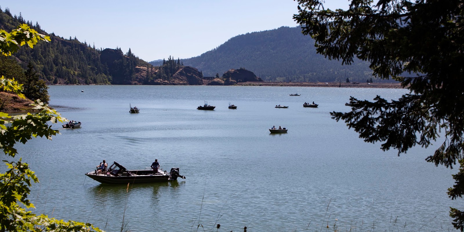
Antelope Island is surrounded by the Great Salt Lake, which salt levels reaching as much as 25 percent of the lake by volume. 

Great Salt Lake view
Therefore, the lake does not support fish, but does support large numbers of brine shrimp and brine flies, which provide food for visiting waterfowl. And, boy was there waterfowl! 

Most striking was a huge flock of American Avocets, feeding in the shallows along the seven-mile causeway that connects the island to the mainland ...

Thousands of American Avocets
We also encountered large concentrations of Franklin’s Gulls …

Franklin's Gulls on the wing
California Gulls …

The California Gull is the Utah state bird
Wilson’s Phalaropes …

Wilson's Phalaropes – the same bird we saw at Mono Lake
And, a lifer for me, Eared Grebes …

A new bird for me – and boy were there a lot of them!
Because of the high salinity, the island is mostly without readily available fresh water. Although not strictly a desert island, Antelope Island has no permanent human inhabitants and conditions are quite dry and can be very hot during the summer. That’s why late evening and early morning were perfect. There are a few natural springs, mostly in the mountainous spine of the island and towards the south end of the island.

The evening we visited, we stopped at Buffalo Point (also misnamed; Bison are not Buffalo), where water and restrooms are available. There is also a gift shop and small fast-food restaurant that is open during the main visitor season, but nothing was open when we were there. Public beaches, a marina and overnight camping areas are available on the northern part of the island.

Buffalo Point
On the east side of the island, 11 miles south of the causeway, is the Fielding Garr Ranch, which contains the oldest building in Utah built by European-Americans that is still on its original foundation.

The first known non-natives to visit the island were John C. Frémont and Kit Carson during exploration of the Great Salt Lake in 1845. They allegedly "rode on horseback over salt from the thickness of a wafer to twelve inches" and "were informed by the Indians that there was an abundance of fresh water on it and plenty of ‘Antelope.’" It is said they shot a Pronghorn on the island and in gratitude for the meat they named the site Antelope Island. Of course, they didn’t know then that Pronghorn are not related to Antelope.

The island's misidentified namesake
Originally, Antelope Island was used as a ranch for cattle and sheep, starting from the earliest days of the arrival of the Mormon pioneers into the Salt Lake Valley. The Church of Jesus Christ of Latter-day Saints (Mormons) controlled the ranch from 1848 until 1870, when the island was purchased by John Dooly, Sr. He established the Island Improvement Company, which managed the island and ranches from 1884 until 1981. 

This could have been a National Park
Early in the 20th Century, because of its wildlife and scenic beauty, some wanted Antelope Island to become a National Park, but the movement never came to fruition. 

When the Utah State Parks System was created, public support grew for making the area a State Park, despite the fact that the land was privately owned. 

The State of Utah purchased the northern part of the island in 1969. When the State acquired the remainder in 1981, Antelope Island State Park was established and the cattle and sheep were removed.

A bison wallow in the dust
Antelope Island State Park has approximately 300,000 visitors annually. 

Its big annual event is a Bison Roundup held each October. Similar to the Custer State Park (South Dakota) Bison roundup, this event is more than a tourist attraction. 

It is a primary tool to ensure the continued health of one of the nation's largest and oldest public bison herds.

Visitors can watch as hundreds of horseback riders round up nearly 700 bison from around the Island and move them north into the holding corrals. 

The Bison rest for five days to reduce their stress levels for sorting, vaccination and implantation of a computer chip that serves as a permanent ID and stores health information.

Then, some Bison are released back onto the island and some are sold in a public auction. With no natural predators on the island capable of taking down a bison, it is necessary to artificially reduce the herd size to balance out the food supply. The ideal herd size on Antelope Island is about 550 bison.

This one made it through last year's Roundup
After a lovely visit, we headed for home.

Taking the Little Guy home

Trip date: July 19-August 2, 2019

Sunday, September 22, 2019

Oregon and Washington, Here We Come

Left, Multnomah Falls; Right, Mount St. Helens
Where to go next? Our planned trip to California (plus Crater Lake) was over and we had not planned our trip home. Scott decided that he wanted to go fishing and he thought Bend, Oregon, would be a good destination. However, he didn’t find any fishing guides there, so we decided to go on up to the Columbia River Gorge, visit the waterfalls and get him a guide there. It worked out, kind of.

We passed Mt. Hood along the route
We stayed in Hood River, which is close to the waterfalls along the Gorge.

Columbia River Gorge
Up to 4,000 feet deep, the Columbia River Gorge stretches for more than 80 miles as the river winds westward through the Cascade Range, forming the boundary between the state of Washington to the north and Oregon to the south. 

Columbia River Gorge
Extending roughly from the confluence of the Columbia with the Deschutes River (and the towns of Roosevelt, Washington, and Arlington, Oregon) in the east down to the eastern reaches of the Portland metropolitan area, the water gap furnishes the only navigable route through the Cascades and the only water connection between the Columbia Plateau and the Pacific Ocean. It is also the route of Interstate 84, U.S. Route 30, Washington State Route 14 and railroad tracks on both sides.

The Gorge has beautiful signage
A popular recreational destination, the Gorge holds federally protected status as the Columbia Gorge National Scenic Area and is managed by the Columbia River Gorge Commission and the U.S. Forest Service.Transitioning from 100 inches of precipitation to only 10 inches in 80 miles, the Columbia River Gorge comprises a diverse collection of ecosystems, from the temperate rainforest on the western end to the eastern grasslands to a transitional dry woodland between Hood River and The Dalles.

The area is known for its high concentration of waterfalls, with over 90 on the Oregon side of the Gorge alone. Many are along the Historic Columbia River Highway, including the notable 620-foot-high Multnomah Falls, one of the falls we visited  ...

Multnomah Falls
We had visited the Gorge in 2003 with the Wilsons and loved it then ...

Scott from the Multnomah bridge in, left, 2003, and, right, 2019
We loved it this time, too. We stopped at Horsetail Falls …

Horsetail Falls
… Latourell Falls …

Latourell Falls
… Wahkeena Falls …

Wahkeena Falls
… and the Vista House at Crown Point …

Vista House
The Columbia River Gorge began forming roughly 17 to 12 million years ago and continued to take shape up to to 700,000 years ago. During this period, the Cascade Range was forming, slowly moving the Columbia River's delta about 100 miles north to its current location. Although the river slowly eroded the land over this period of time, the most drastic changes took place at the end of the last Ice Age when the Missoula Floods cut the steep, dramatic walls that exist today, flooding the river as high up as Crown Point. This quick erosion left many layers of volcanic rock exposed.

Map: Columbia River Gorge National Scenic Area
This player made it far!
An important area that is frequently referenced is The Dalles (Oregon Trail computer game, anyone?). 

The name comes from the French word dalle, meaning either "sluice," akin to English "dale" and German T[h]al; "valley;" "slab;" or "flagstone," referring to the columnar slabs of basalt rocks carved by the river. 

When a river flows over hard flat rocks, it becomes shallow and rapids are created.

The French-Canadian immigrants used the term to refer to the rapids of the Columbia River between the present-day city called The Dalles and Celilo Falls, which have been submerged since the building of the The Dalles dam in 1957. Also in the same area was the Petite Dalles (AKA Little Dalles or Short Narrows). 

The Gorge has supported human habitation for over 13,000 years. Evidence of the Folsom and Marmes people, who crossed the Bering land bridge from Asia, were found in archaeological digs. 

Excavations near Celilo Falls, a few miles east of The Dalles, show humans have occupied this salmon-fishing site for more than 10,000 years.

Water, water, everywhere
The Gorge has served as a transportation corridor for thousands of years. Native Americans traveled through to trade at Celilo Falls, both along the river and over Lolo Pass on the north side of Mount Hood. 

In 1805, the Lewis and Clark Expedition used the route to reach the Pacific. 

Early European and American settlers subsequently established steamboat lines and railroads through the gorge. 

In the early days of westward immigration, the only practical option for many immigrants to the Willamette Valley along the Oregon Trail was to convert their wagons into rafts at the Dalles. Many died or lost their possessions in the attempt to convey their wagons via rafts through the Cascades Rapids. And, in the Oregon Trail game, that was your last, unfortunate, chance to die!

Mural showing the crossing in the city of The Dalles
Today, the BNSF Railway runs freight trains along the Washington side of the river, while its rival, the Union Pacific Railroad, runs freight trains along the Oregon shore. The Columbia River Highway, built in the early 20th century, was the first major paved highway in the Pacific Northwest. Shipping was greatly simplified after Bonneville Dam and The Dalles Dam submerged the gorge's major rapids.

In 1986, Congress made the Gorge the second U.S. National Scenic Area and established the Columbia River Gorge Commission as part of an interstate compact. 

These waterfalls are now protected
The experimental designation came in lieu of being recognized as a National Park, which would have required that the existing industries in towns along the river relocate. The designation was initially opposed by residents fearing government encroachment, due to restrictions in the plan for items such as building colors. 

It was also opposed by conservationists who feared additional development in the region.

It's a beautiful drive, but during tourist season, it is incredibly crowded. Parking can be difficult and the crush of people makes it very difficult to photograph the falls, especially since many are using cell phones and we know how rude cell phone photographers can be. Still, we persevered enough to visit some of the falls. Early morning is likely better, but we arrived in the afternoon.

Columbia River Gorge from Vista House
Crown Point provides a spectacular view up and down the Columbia River. Known historically as Thor's Heights or Thor's Crown, Crown Point is a basalt promontory that provides a panoramic view of part of the Columbia River. It stands 733 feet above the river and is the remains of a lava flow that filled the ancestral channel of the Columbia River 14 to 17 million years ago. The Point was designated a National Natural Landmark in 1971.

Vista House; Photo: NPS
The Vista House observatory at Crown Point serves as a memorial to Oregon pioneers. The octagonal Art Nouveau stone building was completed in 1918 after nearly two years of construction. It underwent a major restoration from 2000-2005.

Vista House
Fishing
The next morning, Scott went fishing on Drano Lake, a lake right by the highway that was created by backwater from the impoundment of the Columbia River from the Bonneville Dam. 

Drano Lake
The Little White Salmon River drains into Drano Lake  and the lake drains into the Bonneville Reservoir. It wasn't exactly what Scott had in mind. He really wanted to go fly fishing and this was fishing from a boat within the view of the highway and lots of other fishing boats. The prominent fish is the steelhead, but Scott didn’t catch any. He did, however, catch a huge sturgeon (perhaps 100 lbs.) that put up a big fight. Unfortunately, the proximity of other boats caused them to have to cut the fishing line before they got a good look at it.

Lots of boats, little solitude
California Gull on the lake
No, the lake is not named after a drain cleaner or its draining into other bodies of water; it is named after William Drano, also known as French Billy. 

Drano organized the Drano Flume Company to build a flume across his homestead land. 

Underfinanced, the firm got into trouble and was bought out by Broughton Lumber Company, which operated the flume mill for 70 years.

While I was waiting for Scott to depart in the early morning, I saw an Osprey hunting on the lake. I wish there had been more light, but it was cool to watch.

Hunting Osprey
Conboy Lake National Wildlife Refuge
Conboy Lakes has extensive wetlands
While Scott was fishing, I went northeast to Conboy Lakes National Wildlife Refuge (CLNWR) to look for birds. CLNWR is located on the east slope of the Cascade Mountains at the base of 12,281-foot Mount Adams in southern Washington state.

Mount Adams
CLNWR encompasses 7,071 acres on the lakebeds of the historic Conboy and Camas Lakes, a shallow marshy wetland area drained by early settlers. Conifer forests, grasslands, shallow wetlands and deep water provide homes for many animals and 150 species of birds, as well as numerous amphibians, reptiles, and fish.

CLNWR protects multiple species
When I arrived, it was deserted – just me and the early morning silence. Later, there was a dad and a couple of kids tromping around off the trail in the marshes. 

While there, I took a short hike along the wetlands and through the woods.

A varied terrain
Along my hike, I saw a mama Ring-necked Duck and her Ducklings …

Ring-necked Ducks
… hundreds of Northern Rough-winged Swallows ... 

Northern Rough-winged Swallow taking a brief rest (the only way I could get a photo)
... (mixed in with some Cliff Swallows) …

Lots of mixed Swallows
… a Red-naped/Red-breasted Sapsucker Hybrid (and, no, I didn’t figure out it was a hybrid by myself; eBird informed me after I submitted as a Red-naped Sapsucker) …

My difficulty identifying this bird was explained when eBird told me it was a hybrid
… a Townsend's Solitaire that looked pretty rough as it molted into its winter plumage …

A bit scary looking
… a couple of female Black-headed Grosbeaks …

I saw only females (or perhaps juveniles)
… some female Western Tanagers (where were all the males?) …

Western Tanager (perhaps also a juvenile?)
… lots of House Wrens …

The House Wrens even had a house!
… some American Robins …

American Robins
… Some Cedar Waxwings …

Cedar Waxwing (but you can't see the red wingtips)
… and Eastern Kingbirds ...

Why are they called Eastern if they live in Washington?
Not 150 birds, but a good representation. I also heard, but never saw, some Sandhill Cranes way off in the distance.

Sad!
I was incredibly frustrated by one sighting. It started when I heard a tap-tap-tap in the trees and I tip-toed around looking for the source. It was a White-headed Woodpecker! This bird has a very limited range in the Pacific Northwest. It was a bird I really wanted to see and I was thrilled after I ferreted it out after just hearing it in the thick trees.

But, it was in the shade, in a very twiggy tree and I never got a good picture. I waited and waited and never found it again. So, a sighting without a shot!

I also had a very close encounter with a juvenile Northern Harrier as it flew right over my head 

This Northern Harrier startled me
... through the trees ...

Like a bullet
... and then back above my head ...

The buffy breast signifies a juvenile
... and away over the field ...

That telltale white stripe gives it away as a Northern Harrier
Later, I saw five Northern Harriers together, leading me to believe that there was a nest nearby – but in a restricted area, so I couldn’t get very close.

Northern Harrier nest
I couldn’t stay long because I needed to pick up Scott after his morning of fishing. So, after setting out with no GPS access, I finally found my way back, stopping to watch some of the ubiquitous windsurfers on the Columbia River just down the highway from Drano Lake on the way.

Colorful windsurfers on the Columbia
Mount St. Helens
We had discussed going to Mount St. Helens and I had considered going in the morning instead of going to Conboy. My GPS said it was less than two hours away, which was a bit too far for the morning, but would probably work for the afternoon.

Mount St. Helens
Scott also wanted more Dungeness crab, so he had made reservations for that evening at Salty’s on the Columbia in Portland. We had eaten there before and knew it had good (make that great) seafood. I had also eaten at Salty’s on the Alki in Seattle, as well. So, we decided to go to Mount St. Helens and then continue on to Portland for dinner.

Map: Google Maps
It wasn't until nearly the entire hour and 45 minutes of driving that we discovered that the GPS was taking us to the SOUTH entrance to Mount St. Helens National Volcanic Monument.

There is NO road through the Park to the actual mountain! 

Oooops.

So, we had to re-route, realizing that we could have taken the interstate and gotten there much faster. The drive we had taken was lovely, but with dinner reservations, time was ticking away.

The second GPS routing took us to a Visitor Center, but still not the right place. I knew it was wrong when we arrived, because I had vivid memories of the Visitor Center from when we were there in 2003. Nope, this was the Mount St. Helens Visitor Center at Seaquest State Park. We still had 50 miles to go! Ack! Why was this so hard?

We almost turned back, but decided that if we had gone that far, why not finish. We knew we would have time for only a quick drive-by, but what the heck.

Worth a drive-by
It was rushed, but I am glad we went. The landscape had changed so much in 16 years, it was almost unbelievable.

Flowers were blooming everywhere
A distant view
Mount St. Helens, an  active stratovolcano in southern Washington, violently erupted in 1980 in the deadliest and most economically destructive volcanic event in U.S. history. It killed 57 people and destroyed 250 homes, 47 bridges, 15 miles of railways and 185 miles of highway. 

A massive debris avalanche reduced the elevation of the mountain's summit from 9,677 feet to 8,363 feet, leaving a one-mile-wide horseshoe-shaped crater. 

The Mount St. Helens National Volcanic Monument was created to preserve the volcano and allow for the eruption's aftermath to be scientifically studied. 

When we visited in 2003 (and spent more time there), the destruction was evident everywhere.


The facing hills are still scarred
This time, it was gloriously green with new tree growth practically everywhere. 

A changed landscape
The volcanic crater is still very evident and the mountain itself clearly displays the damage. 

The actual volcano is still barren
The streambed (totally rearranged by the eruption and coincident earthquake and avalanche) still comprises a thick, thick layer of ash. 

Thick ash blankets the streambed
And, an opposing ridge is still littered with downed trees. 

Trees downed 39 years ago
But, this is all muted and mitigated by the hillsides of young green pines and the fields of wildflowers. As beautiful as it is, it dampens to effect of seeing the aftermath of a volcano.

Now, it looks serene
We were at the Johnston Ridge Observatory, site of the CORRECT Visitor Center, for about 15 minutes and then we had to go. Quick drive, but, actually, worth it.

The right place!
Salty’s on the Columbia
Next, it was on to Portland and dinner. 

A waterfront table
Delicious!
Instead of getting full dinners at Salty’s, we opted to get the Grand Seafood Platter featuring Dungeness crab, prawns, bay shrimp, oysters and lox and cream cheese. 

We also had some grilled artichokes and chowder, but that turned out to be unnecessary.

The 
Grand Seafood Platter was magnificent with ample (more than ample) quantities of all the seafood. A truly delicious meal to cap off our time on the Pacific coast. 

Happy Scott!
It’s too bad we left our to-go container of cream cheese and lox on the table – but that’s better than leaving it in the car!

It was a quick visit with a few misses (lake fishing, no White-headed Woodpecker photo, a too-long drive to Mount St. Helens) and lots of hits (dinner, green Mount St. Helens, dinner, beautiful scenery, dinner). 

But, it was time to head home.


Trip date: July 19-August 2, 2019