 |
| Our trip |
The plan was to fly to Seattle and then high-tail it over to Friday Harbor in the San Juan Islands to try to see some Orcas.
 |
| The ultimate quest |
 |
| Our Iceland "whale" boat |
She has been to the San Juans, which is generally known as a guaranteed Orca location and she and I even went to Iceland with Orcas high on the “must-see” list. In both cases, the Orcas were there right before and right after Caty, but not while she was there.
We also planned to visit North Cascades National Park, which would be a new Park for Caty and a chance to do more than a quick drive-through for me.
 |
| I went to North Cascades in 1992 on a business trip; this is about all I saw |
| We had to cancel two trips to Canada because of the pandemic |
So, we decided to go quickly to the Northwest and visit Mount Rainier and Olympic National Parks before meeting up with Caty.
 |
| Mount Rainier and Olympic National Parks |
 |
| Glacier National Park, Bison and Beartooth Highway |
Morley Nelson Snake River Birds of Prey NCA
We drove up to Caty’s to pick up luggage she wanted to send ahead and to give us a head start and then blasted our way to Boise, which was actually farther than we originally planned to get the first day AND was out most expensive hotel room, despite being an Airport Red Lion. I guess it’s because we booked that day after canceling our room near Grand Teton National Park where we had originally planned to stop.
It was still light and we saw some highway signs for Morley Nelson Snake River Birds of Prey National Conservation Area, which I had read about before.
 |
| This might be the Morley Nelson Birds of Prey NCA |
It boasts the largest number of nesting raptors in the U.S. and is supposed to be a fantastic spot for raptor viewing in the winter and spring. It was summer, so we didn’t know what to expect. But, we went anyway.
Located along the Snake River and managed by the Bureau of Land Management, it covers 484,873 acres, so we didn’t even know if the road would take us anywhere near where birds nest.
 |
| Morley Nelson Snake River Birds of Prey National Conservation Area |
And, typical of a BLM property, it started out with some road signs, but when we got down to the river via a fairly steep gravel road, there was no mention of the Conservation Area. Nor were there any raptors except a lone Red-tailed Hawk we passed on the way in.
There was a dam, a boat launch, a gravel road that headed off along the river ...
 |
| The dam on the Snake River |
... and two fawns.
 |
| The first fawn I saw |
Yep, all we saw were these two little deer that were scrabbling around in the bushes, making lots of noise. When I went to investigate (yeah, I do walk toward noises in the bushes!), one ran out so close to me, I thought it was going to knock me over.
 |
| It ran past me and sprinted across the parking lot |
 |
| We saw one Red-tailed Hawk |
His namesake NCA is home to more than 700 pairs of raptors, representing 15 different species, which nest on the high canyon walls.
Nine additional raptor species use the Snake River area as seasonal hunting grounds during migrations or as wintering areas.
Birds of Prey NCA is particularly important for Prairie Falcons, North America's only endemic Falcon. The area is home to a significant portion of the species' known population. But, as I said, we didn’t see any.
 |
| Raptors nest on the cliffs (but not while we were there!) |
Unusually high numbers of small burrowing mammals, which make their home on a vegetation-rich plateau, support a high density of raptors and one of the densest populations of badgers in the world (up to 11 badgers per square mile). We didn’t see any of those either.
 |
| There were some cottages at the river -- staff housing, perhaps? |
So, it was a 40–50-mile roundtrip bust. I am not even sure we were in the Conservation Area because the signs stopped. Oh, well.
National Historic Oregon Trail Interpretive Center
 |
| The view from a covered wagon |
The next morning, we headed to Washington, making a brief stop at The National Historic Oregon Trail Interpretive Center in Baker City, Oregon. We had stopped there once before and remembered it as a nice facility.
 |
| The Oregon Trail passed through here |
When open, it offers living history demonstrations, interpretive programs, exhibits, multi-media presentations and more than four miles of interpretive trails.
 |
| Some of the outdoor displays |
But, the museum was closed because of COVID. So, we spent a little time enjoying the vistas and walking some of the trails.
 |
| The ONLY wildlife and some prairie flowers |
Then, we moved on so that we could make it to Mount Rainier National Park. The most exciting thing that happened was a pretty dramatic windshield ding.
 |
| Yikes! |
Mount Rainier National Park
 |
| A nice Park entrance |
Our plan was to spend the afternoon at Rainier and return in the morning ONLY if we didn’t feel we got enough.
Mount Rainier is a relatively small Park and the weather was absolutely gorgeous when we arrived mid-day.
 |
| Seeing 'the mountain" is a big deal in the Pacific Northwest |
 |
| Mount Rainier is full of tall, tall trees |
 |
| A happy camper |
All my other memories of Mount Rainier and/or the nearby area involved cold, fog and dripping rain. This was not that.
From an environmental point of view, that’s bad.
From a photography point of view, pretty good (more on that later).
 |
| Box Canyon |
 |
| Melting snow had the streams rushing |
We didn’t have much time for exploring on foot (and, let’s face it, that is not Scott’s thing). But, we got a nice overview of the area.
 |
| Some lakes were still partially frozen |
 |
Like other Parks, Mount Rainier has Civilian Conservation Corps structures |
 |
| Unlike Colorado mountains, Rainier is always swathed in snow |
 |
| Mount Rainier and one of its glaciers |
 |
| Winter snow had given way to summer flowers |
 |
| Yum! |
The Mill Village Inn in Eatonville was an old-style motel and, because it had vacancies so late in the game, I had a bit of trepidation. It turned out to be nice, clean and convenient.
Even though we didn't make it back to the Park, I am so glad we got to see it on such a beautiful day.
 |
| Box Canyon |
The next morning, we left early for the three-hour drive to Olympic National park. We have been to Olympic before on several occasions (together and separately) and, this time, Scott wanted to revisit the rainforest that he had photographed with his friend Will years ago (oddly, it seems that his most vibrant vacation memories are trips with Will – whatever!).
 |
| Quinault Rainforest |
President Theodore Roosevelt originally designated the park as Mount Olympus National Monument in 1909 and it was re-designated a National Park by Congress and the other Roosevelt, Franklin, in 1938. In 1976, it was designated by UNESCO as an International Biosphere Reserve and, in 1981, as a World Heritage Site. In 1988, Congress designated 95 percent of the Park as the Olympic Wilderness.
 |
| The Park protects mountains and shore |
The Park preserves a primeval forest of Sitka spruce, western hemlock, Douglas fir and western red cedar; provides a winter range and permanent protection for the herds of native Roosevelt Elk (we didn't see any) and other indigenous wildlife (we didn't see any); and conserves mountains, glaciers, perpetual snow fields and a narrow strip along the Washington coast.
 |
| The Park protects mountains and shore |
 |
| It is a large portion, but not all, of the Olympic Peninsula |
The center of the park is occupied by the Olympic Mountains, which are topped with massive, ancient glaciers. Mount Olympus rises to 7,965 feet from sea level. We skirted the center, but didn’t venture to the higher elevations this time because we have been there several times before (and, as I will explain later, Scott wasn’t feeling it).
 |
| Hurricane Ridge in 2012 |
 |
| Ferns love the rain |
As opposed to tropical rainforests and most other temperate rainforest regions, the rainforests of the Pacific Northwest are dominated by coniferous trees, including Sitka Spruce, Western Hemlock, Coast Douglas-fir and Western red cedar. Mosses coat the bark of these trees and even drip down from their branches in green, moist tendrils.
 |
| Mosses and plants |
We started the morning in Quinault on the Rainforest Nature Trail. It was lovely – and frustrating.
First, the lovely part: cool green, full of interesting plants and flowers, including lots of ferns and even new trees growing out of old trees.
 |
| New growth feeding on the old |
 |
| Photo: Scott Stevens |
Who knew that you could find so many interesting nooks and crannies in such a small area?
Because Washington was in the midst of a drought, it wasn’t as wet as it usually is. It was also the beginning of the heat wave and we were there early in the day, so it was warmer than normal, but not yet too hot.
So, we were able to walk without getting dripped on and it wasn’t humid enough to be steamy.
 |
| Shooting the green |
Just a pleasant stroll with very interesting vegetation.
 |
| It is decidedly damp |
The Nature Trail, which skirts Willaby Creek as it flows through Willaby Gorge, is only a half mile long. But, we were there for quite a while.
 |
| A wide variety of plants |
So, what was frustrating? Birds! It wasn’t that there weren’t any. Oh, no. Their songs were almost deafening. It was that they were high in tall, tall trees and/or deep in the dense foliage. Twice, I saw tiny birds flit by so fast that I couldn’t ID them and once I saw woodpecker that flew right by me and then took up residence on the other side of a tree that I could not see no matter how hard I tried.
 |
| It is hard to see any creatures in the dense foliage |
I looked. I craned. I really, really tried. I saw no birds I could ID.
Then, we headed to the coastal part of Olympic National Park, a narrow 60-mile-long rugged, sandy beach with a strip of adjacent forest.
 |
| Me on Ruby Beach |
But, the first one we stopped at required scrabbling down a huge boulder while holding onto a rope.
Not for us. We just don’t do rock climbing.
 |
| The beaches have sea stacks and interesting rock formations |
When we were leaving, we passed a wedding party heading for the beach. I hope I never get invited to a wedding that requires me to lower myself to the venue while holding onto a rope.
Our next stop, Ruby Beach, was more easily accessible and was a place we remembered.
 |
| Ruby Beach |
This is a beautiful beach, with a stream flowing from the cliffs into the ocean, a wide expanse of rocky shore and some very interesting rock features. With rip tides, floating logs and icy Pacific water temperatures, it really isn't suited for swimming, although we saw a number of people (including little kids) braving to rough and chilly sea.
 |
| A serene landscape |
But, we also remembered beautiful tidepools and seals from our last visit. This time, neither were to be seen. Scott said he thought that the tide was not as far out during this tide cycle as it sometimes is and, therefore, we had little chance of seeing any tidepools.
 |
| Tidepools, 2012 |
Well, that was a disappointment, because we really wanted to see some sea critters.
 |
There were Blue Mussels and whatever that is on the left ... |
Still, we walked along the beach, took a few photos and moved on.
 |
| Wind-tortured trees on the cliff above the beach |
And, even though it was fairly dry, there was sea fog, as you would expect in the Pacific Northwest.
 |
| Scott disappears into the fog |
Our next destination was the Hoh Rainforest, which is about 30 miles inland. This is the rainforest Scott had photographed with Will and he had high hopes. He wanted to get moody black-and-white rainforest photos with fog and dripping water.
 |
| Hoh Rainforest, 2012 |
Plus, it was sunny and dry. Scott was not happy with the dappled sunlight – or the crowds.
 |
| He was happy in Quinault, but didn't like the sun in the Hoh Rainforest |
So, even though I would have liked to stop, he wasn’t having it and we left. Unfortunately, he sometimes gets a specific goal in mind for a location and does not adjust well when things aren’t what he expected.
We drove along the upper part of the Park for awhile before heading to our hotel.
 |
Gorgeous forests in the north |
I had wanted to stay at the Kalaloch Lodge, where we had stayed back in 2012, right on the coast.
 |
| Kalaloch Lodge, 2012 (I still drive that car!) |
But, it was booked (we even stopped when we passed by to see if there were any last-minute vacancies; there were not).
We stayed at the Little Creek Casino Resort in Kamilche, southeast of the Park. It was convenient and far less expensive than the National Park Lodging, plus it had fabulous Dungeness Crab. But, it would have been nice to be in the Park in the evening.
 |
| Ruby Beach, 2012 |
Columbia River Gorge
 |
| What we wanted; 2012 photo |
This was despite the fact that were had three nights booked on the Oregon coast after the San Juans.
The day turned out to be a lot more driving than seeing.
First, we drove across the mouth of the Columbia River and stopped at Fort Stevens State Park, Oregon. It looked a lot like every other coastal fort I have I have ever been to.
 |
| Fort Stevens State Park; Photo: Oregon State Parks |
 |
| The beach on the mouth of the Columbia River |
Really, the only thing we saw was this bored-looking California Ground Squirrel.
 |
| A little old man standing guard at the entrance station |
Then, we made it almost to the Oregon Coast and stopped for lunch. Scott was still wanting more Dungeness crab and was not finding it. Traffic was crazy and we were very near Seaside, Oregon, where we had stayed once before and swore we would never re-visit. Seaside is extremely popular, but it’s crowded and kitschy and not our cup of tea.
So, despite being almost to the area where there might be tidepools, Scott changed his mind and decided to head toward the Columbia River Gorge.
 |
| Artwork by Paul A. Lanquist |
We’ve been there lots of times – and fairly recently – but Scott likes it and wanted to go back. Plus, it really is a "must do" in the Pacific Northwest.
I would have preferred to spend more time in Olympic National Park, but the drive to the Gorge was pretty.
We stopped at a local farm and bought two types of Northwest cherries: Rainier and Strawberry (they were supposed to taste like strawberries; they didn't).
Then, we made it to the Gorge.
 |
| The canopy of trees keeps the Gorge cool |
Up to 4,000 feet deep at some points further inland, the Columbia River Gorge stretches for more than 80 miles as the river winds westward through the Cascade Range, forming the boundary between Washington and Oregon.
 |
| Vista House at Crown Point is just 733 feet above the Columbia River |
Because the river is the only navigable route through the Cascades and the only water connection between the Columbia Plateau and the Pacific Ocean, it is also the route of Interstate 84, U.S. Route 30, Washington State Route 14 and railroad tracks on both sides.
A popular recreational destination, it holds federally protected status as the Columbia Gorge National Scenic Area and is managed by the Columbia River Gorge Commission and the U.S. Forest Service.
 |
| Horsetail falls |
Atmospheric pressure differentials east and west of the Cascades create a wind tunnel effect in the deep cut of the Gorge, generating 35-mile-per-hour winds that make it a popular windsurfing and kiteboarding location.
 |
| Windsurfers on the Columbia; 2019 photo |
 |
| The bottom of Horsetail Falls |
The Columbia River Gorge began forming as far back as the Miocene (roughly 17 to 12 million years ago), and continued to take shape through the Pleistocene (2 million to 700,000 years ago). During this period the Cascade Range was forming, which slowly moved the Columbia River's delta about 100 miles north to its current location.
Although the river slowly eroded the land over this period of time, the most drastic changes took place at the end of the last Ice Age when the Missoula Floods cut the steep, dramatic walls that exist today, flooding the river as high up as Crown Point. This quick erosion left many layers of volcanic rock exposed.
 |
| Wahkeena Falls |
The Gorge is famous because it was a final challenge on the Oregon trail (and it is the last hurdle in the popular 80's computer game, Oregon Trail). The only practical option for many immigrants to the Willamette Valley was to convert their wagons into rafts at the Dalles. Many died or lost their possessions in the attempt to convey their wagons via rafts through the Cascades Rapids.
 |
| Graphic: The Let's Play Archive |
The Columbia River Highway, built in the early 20th century, was the first major paved highway in the Pacific Northwest.
 |
| Highways and railroad tracks run along both side; 2019 photo |
 |
| This designation was a new one |
In 2017, the Eagle Creek Fire burned in the Gorge for three months, consuming almost 50,000 acres. The burn scar is evident but mitigated by the abundance of plants that grow quickly in the damp environment.
 |
| The cycle of life and death is amped up by the climate |
Even though it was a warm day, the Gorge was lovely; to quote John Denver, "cool, green and shady."
 |
| The waterfalls come down the steep cliffs and tumble into shady creeks |
There was an abundance of tiny flowers (and, as my brother Mark, likes to say, "nano flowers"), mosses and lichens.
 |
| A great example of nature's landscaping |
It was summer and many falls were crowded, but it was a nice afternoon after a fruitless morning.
|
| Horsetail Falls |
More Olympic Peninsula
 |
| Before heading out, we wanted to see more |
The next day was the day Caty was coming in. We opted to stay that night in Everett, which is halfway between SeaTac Airport and the Anacortes Ferry, so we wouldn’t have a long drive before our 9:00 a.m. trip to the San Juans the next morning. So the day was about sightseeing and working our way back to the mainland.
We started the morning driving up the east side of the Olympic Peninsula. We stopped at Lake Cushman, a very pretty (and deserted) lake just north of our hotel.
 |
| Lake Cushman |
Then, we headed up the coast and stopped at Seal Rock, a park that had a beach littered with oyster shells and some live oysters.
 |
| Pacific Oyster shells |
Just as we were discussing whether one could eat the oysters on the beach, we saw people doing just that.
Apparently, you can take up to 18 per day. I don’t eat oysters and I am not sure I would eat any found out of the water on a warm day. But, there were some enthusiastic oyster harvesters there.
 |
| Free oysters! |
Further up the road, we drove up to the Mount Walker Overlook. It’s a winding gravel road that ends at two different short trails to overlooks at the top.
 |
| Trails at the Mount Walker Overlook |
The overlook offered a pretty view of a pretty place.
 |
| The view back to the mainland |
 |
| Our route before going to the mainland |
We had a nice picnic lunch while waiting and then zipped across Puget Sound to Edmonds.
We drove around a bit, stopping briefly in Anacortes, which had lots of beautiful lavender blooming ...
 |
| A Yellow-faced Bumblebee enjoying Anacortes' fragrant lavender |
 |
| Anacortes Light |
 |
| This photo is on their website! |
We ended up driving in horrendous traffic to Kent Washington to go to the Boiling Crawfish restaurant that advertised steamed crab.
They were out of crab!
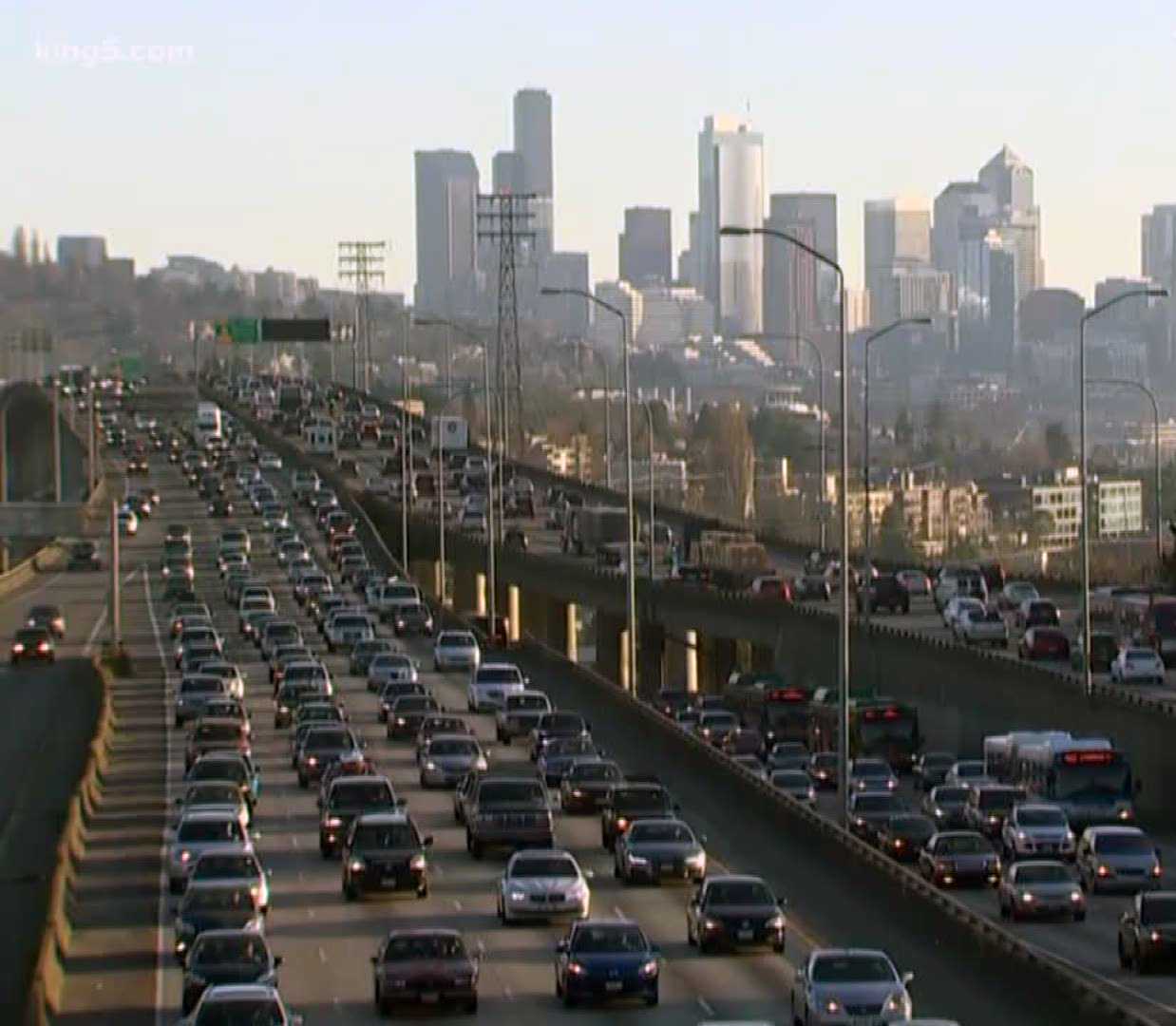 |
| Photo: King5 News |
Seattle traffic is terrible. But, we had to pick up Caty, so we had to brave it. Her flight was late, so the worst of rush hour was long gone by the time we collected her and headed back north to Everett.
Turns out that the drive wasn't too bad. We could have stayed in Anacortes!
The next morning, we began our Orca quest. But, I’ll save that for the next post.
 |
| Would we see them? Photo: Alaska, 2018 |
Trip date: June17-July 2, 2021
No comments:
Post a Comment