 |
| Scott, caty and me at the prettiest National Park entrance I have ever seen |
 |
| The steep mountain descends right into the lake |
I drove through it once in 1992 and remembered very little except a high wall of snow lining the road. I have always counted it as a Park I had visited, but I always felt I was cheating just a bit. So, when Caty wanted to include it in our Northwest adventure, I was in.
 |
| Map: NPS |
The complex also comprises Ross Lake National Recreation Area and Lake Chelan National Recreation Area.
That area is surrounded by additional National forests and Canadian Parks.
NCNP’s more than 500,000 acres protect the rugged mountain peaks of the North Cascades Range, the most expansive glacial system in the contiguous United States, the headwaters of several rivers and vast forests with the highest degree of plant biodiversity of any American National Park.
 |
| Liberty Bell Mountain |
 |
| A creek and falls on Cascade River Road |
A Hot Day
We didn’t have a lot of time to explore and, by the time we arrived at the Park, this year’s monstrous heat wave had also arrived. Temperatures reached 100 °F in an area where you might expect 70 °F at the most. So, in this case, our sightseeing-by-car system worked pretty well.
 |
| The cool spray of a roadside waterfall was a nice foil to the heat |
 |
| Look what I found! |
Marblemount is a tiny town with a couple of restaurants that had somewhat reduced service because of COVID, but it worked for us.
Most of my experience in the Pacific Northwest was when I worked for GTE. imagine my surprise to find an old GTE sign still in place!
Drive-Through
We spent our day at the Park driving the main road, State Route 20, to admire the lush forests …
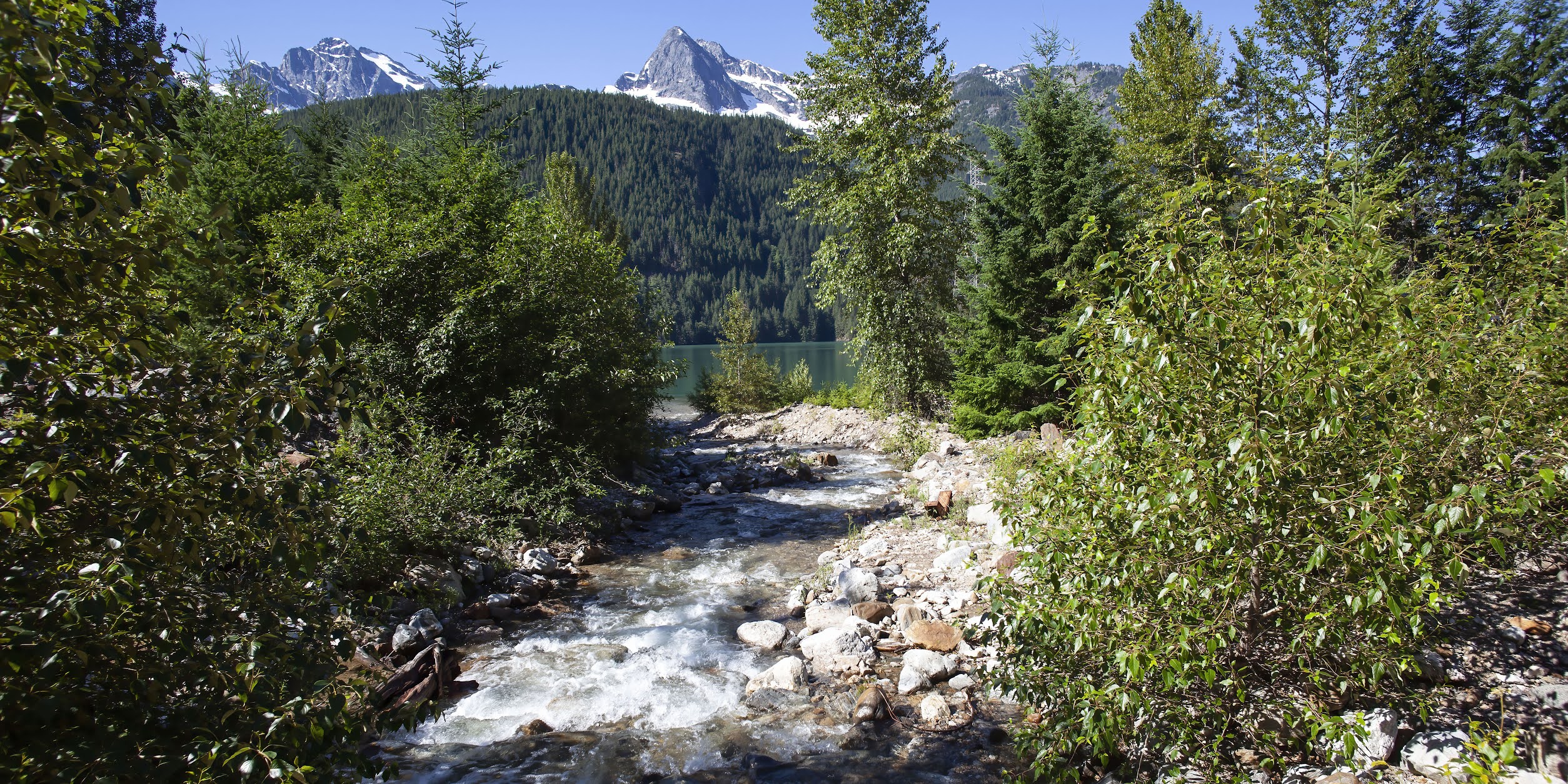 |
| A creek winding through the trees |
Waterfalls …
 |
| Lots of water flowing |
Crazy beautiful lakes …
 |
| Diablo Lake -- no, this is not color-corrected |
And rugged peaks …
 |
| View from the Washington Pass Overlook |
In the evening, we drove out the nearby Cascade River Road for a heavy dose of ferns ...
 |
| The primordial forest |
Flowers …
 |
| The deep green is punctuated by lots of color |
And flowing streams …
 |
| A rushing cascade on Cascade River Road |
| Skagit Artwork |
So, here’s some background on the Park.
The region was first settled by Paleo-Indian Native Americans. By the time European American explorers arrived, it was inhabited by Skagit tribes (the river that flows through the middle is the Skagit).
By the early 19th century, the region was visited by fur trappers and, after the Canada-United States border was set at the 49th parallel in 1846, explorers came to chart potential routes through the mountains for roads and railroads. Limited mining and logging occurred from the late 19th century to the early 20th century, but the terrain made most endeavors nearly impossible. Thus, much of the area is still pristine.
 |
| A wide variety of plants |
The first significant human impact in the region occurred in the 1920s when several hydroelectric dams were built on the Skagit River. Environmentalists then campaigned to preserve the remaining wilderness, culminating in 1968 with the National Park designation.
 |
| Ross Lake, one of several large lakes formed by dams |
 |
| Photo: North Cascades Glacier Climate Project |
Erosion from water and glacial ice have created some of the steepest mountain ranges in the contiguous U.S. There is nearly 9,000 feet of vertical relief; the highest point is 9,220-foot-high Goode Mountain and the western valleys are only 400 feet above sea level.
 |
| "Rugged" is always used to describe the North Cascades |
The Park is home to over 312 glaciers and 500 lakes and ponds. It contains the headwaters for streams that flow into the Skagit, Stehekin and Nooksack Rivers.
 |
| Mountain rivers and creeks |
 |
| The range is still uplifting |
Rock formations have been repeatedly eroded, reburied and subjected to fracturing and heat, creating one of the most complicated and least understood geological records in North America.
The region continues to see uplift and faulting.
Many streams are feed directly by glaciers and thus carry finely ground rock particles commonly referred to as glacial flour, which remains suspended in the water, giving streams and the lakes they feed a bright but milky turquoise hue.
 |
| The silt gives the lake, in this case Diablo Lake, a milky turquoise hue |
 |
| Ross Dam |
NCNP has the most glaciers of any Park outside Alaska and a third of all the glaciers in the lower 48 states – an expanse totaling 27,000 acres as of 2009. Glacial volume has been rapidly decreasing due to climate change; in the past 150 years, ice volume has reduced by 40 percent. The heat wave we experienced probably did some additional serious damage.
 |
| Photo: North Cascades Glacier Climate Project |
 |
| A ferny grotto |
NCNP is home to 75 mammal species, among which are Wolverines, the endangered Gray Wolf and, possibly, the Grizzly Bear. NCNP is a prime Grizzly habitat, but the species was extirpated from the region by 1860. NCNP has management plans in place to return Grizzlies to the Park but not Wolves because the latter are seen as likely to reestablish themselves naturally over time.
 |
| Well, we did see one bear! |
More than 200 species of birds pass through or use the park as a breeding ground, but we saw only Robins and Dark-eyed Juncos.
 |
| At least the only bird I photographed was a pretty one |
At least 28 species of fish, including all five species of Pacific salmon (pink, chinook/king, sockeye, Coho and chum); seven species of reptiles; 12 species of amphibians; 250 species of aquatic invertebrates; and more than 500 species of insects have been documented in the Park.
 |
| Flowers by a stream |
 |
| Photo: Outside Magazine |
A Really Quick Overview
Our visit was rather uneventful, as I said. We traversed State Road 20, once up to Washington Pass and once all the way through.
 |
| Washington Pass |
The evening we stayed in Marblemount, we also drove out the secluded gravel Cascade River Road that eventually reaches into the Park. It was cool and lovely, with lots of flora – but no fauna.
 |
| Foxgloves are a common and colorful plant |
Then, we left the next morning by driving east and then south around the bottom, heading back to Seattle.
 |
| Summer playground; Photo: TripSavvy.com |
It was full of boaters, swimmers and windsurfers.
One thing we would have liked to do, but didn’t have time for was to take a ferry up narrow Lake Chelan and stay at a rustic Lodge at Stehekin.
There are two different routes (it was unclear whether both were currently running): a leisurely four-hour narrated tour and a 90-minute express ferry.
Maybe next time!
| Photo: the Lodge at Stehekin |
Deception Falls
The way back to Seattle was very pretty with a number of waterfalls and scenic vistas.
We stopped at Deception Falls, an absolutely astounding waterfall.
 |
| Deception Falls at the bridge |
Not for its height or width, but for its raw power. I would not have expected such intensity in such a small waterfall. See it here.
Caty and I walked the half-mile interpretive trail and a little bit further on a connected hiking trail.
 |
| The trail crosses and follows the creek |
 |
| One of the lower falls |
Allegedly the falls can run dry in the late summer, which is hard to believe at the height of heat-wave-induced snow melt.
 |
| Flowing through the woods |
It was a nice soul-calming break on our drive back to the heat and bustle of Seattle.
 |
| A lot of Pacific Northwest plants |
End of the Core Trip
The next morning, Caty flew home with another National Park and a pod of Orcas checked off her to-do list.
 |
| Wildlife, scenery and culture; a good trip |
Trip date: June17-July 2, 2021
No comments:
Post a Comment