 |
| Kenai Fjords National Park (well, you can drive to parts of it) |
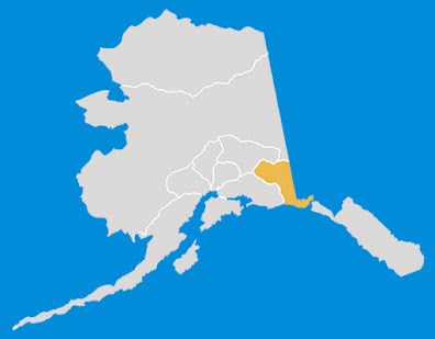
Alaska has eight National Parks and I have visited all of them – some many times and some ever-so-briefly. Over the this and the next two posts, I'll go through each and share what I know.  |
| Map: morethanjustparks.com |
The Alaska National Parks tend to be huge; in fact seven of the eight are among the nation's ten largest National Parks. This is how they rank by size: #1 Wrangell-St. Elias; #2 Gates of the Arctic; #3 Denali; #4 Katmai; #6 Glacier Bay; #7 Lake Clark; #9 Kobuk Valley; and #17 Kenai Fjords.
 |
| Map: morethanjustparks.com |
But, they all present challenges to access.
Some have limited roads; some have none. Some require boats or planes to get even close.
This post will cover the "easy" (and therefore, more popular) ones: Denali, Kenai Fjords and Wrangell-St. Elias.
Denali National Park & Preserve
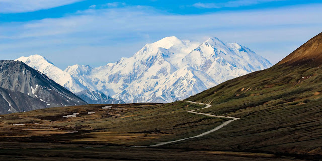
Denali National Park and Preserve is the most well-known and it is a MUST. It is the home of Denali, which, at 20,310 feet, is the tallest mountain in North America. The peak also has the highest vertical relief (distance from base to peak) of any mountain in the world – about 18,000 feet.
 |
| The Great One |
Denali is primarily made of granite, a hard rock that does not erode easily, which is why it has retained its height rather than getting smaller.
 |
| The whole thing was just politics |
The original name of the mountain that anchors the Park was Denali, meaning "the high one" in the native Athabaskan language.
But, did America respect that? Nope.
We "re-named" it Mount McKinley after newly elected U.S. President William McKinley in 1897, but this moniker wasn't official until the U.S. government formally adopted the name when Mount McKinley National Park was created in 1917 (Alaska was a territory then, not a state). President McKinley never visited Alaska and had very little to do with the Park or anything else in the state.
In 1980, Mount McKinley National Park was combined with Denali National Monument and named Denali National Park and Preserve. At that time, the Alaska State Board of Geographic Names changed the mountain's name back to Denali (great move!). However, the U.S. Board on Geographic Names continued to use Mount McKinley.
 |
| Denali in full glory |
This situation lasted until 2015, when President Barack Obama re-renamed the mountain to Denali, using his statutory authority to act on requests when the Board of Geographic Names does not do so in a "reasonable" time period. I have always called the mountain Denali, because, well, that was what the original peoples called it. I was happy when Obama made it official.
 |
| The right name |
With 9,446 square miles of land (7,408 in the Park; 2,038 in the Preserve), Denali's landscape is a mix of forest at the lowest elevations including evergreens and deciduous taiga ...
 |
| The forested lowlands |
... tundra at middle elevations ...
 |
| The domain of lots of fungi |
... and glaciers, snow and bare rock at the highest elevations ...
 |
| A glacier nestled in dramatic peaks |
Denali National Park and Preserve includes the central, highest portion of the Alaska Range, together with glaciers and glacial valleys running southwards out of the range. To the north, the Park and Preserve encompass the valleys of the McKinley (he still has a namesake), Toklat and Foraker Rivers, as well as the Kantishna and Wyoming Hills.
 |
| A broad ice river from the air |
Glaciers cover about 16 percent of the Park, mainly on the southeastern side of the range. The largest, the 32-mile-long Muldrow Glacier, is on the north side.
 |
| The Muldrow Glacier has a coat of dirt and vegetation |
The landscape is decidedly glacial, dotted with erratics (large rocks randomly deposited as glaciers moved past) ...
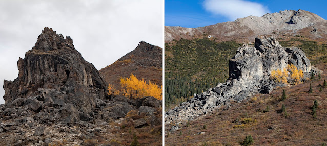 |
| A giant erratic near Savage River |
... moraines ...
 |
| Glacial landscape |
... braided meltwater streams ...
 |
| An ever-changing layout |
... and kettle lakes that formed when buried ice blocks thawed at the end of the Ice Age ...
 |
| Top: lakes near Polychrome; Bottom: Wonder Lake |
Because of its elevation and cold temperatures, much of Denali is permafrost. On top is a one-inch-to-10-foot-thick active layer that freezes and thaws seasonally. Below that is 30 to 100 feet of ground that stays perpetually frozen. The freeze/thaw cycle can cause heaves, humps or strangely positioned vegetation. As the climate warms, more and more permafrost melts, creating all kinds of problems, including eroding roadbeds.
Denali is a wonderland of animals. When visiting, you may see:
 |
| Brown Bears, sometimes close but often far away |
There are also Black Bears, but you don't see them often. I have seen only one there and got no decent photos. If you don't know the difference between Brown and Black Bears, click here.
 |
| Caribou: the resident herd has about 3,000 members |
 |
| Alaskan Moose; Right photo: Scott Stevens |
 |
| Dall Sheep (usually high on the mountains) |
 |
| Timber Wolves (if you are lucky and have good eyes) |
 |
| Canadian Lynx; Left and right photo: Scott Stevens |
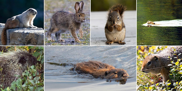 |
| CW: Hoary Marmot, Merriam Snowshoe Hare, Red Squirrel, Muskrat, Arctic Ground Squirrel, North American Beaver, North American Porcupine |
 |
| Red Fox |
There are also Coyotes, Shrews, Pikas, Martens and Wolverines, but they are rare to see.
Bird sightings depend on season, but there is a nice variety.
 |
| CW: Belted Kingfisher, White-crowned Sparrow, Tundra Swans, Boreal Chickadee, Canada Jay, Black-billed Magpie |
 |
| Northern Hawk Owl |
 |
| Willow Ptarmigans |
Because many of the rivers and lakes of Denali are fed by glaciers, glacial silt and cold temperatures slow the metabolism of any fish living in them, preventing them from reaching normal size, and many of the silty streams don't really have any fish. That's why animals aren't often seen feeding in the streams. Animals do, however, use the shallow gravel stream beds as roadways because travel is easier along these corridors.
 |
| Brown Bears following a stream |
This is a Park that is easy to get to from Anchorage to the south and Fairbanks to the north via the Parks Highway.
 |
| Map: RV Alaska |
Now, I always thought it was the Parks Highway because it runs along the eastern edge of the Park. Nope. It is named after George Parks (it is officially the George Parks Highway), Alaska's first resident governor.
Denali's entrance is 232 miles from Anchorage and 127 miles from Fairbanks. The nearest town is Healy, 11 miles to the north. But, there are lots of seasonal hotels and restaurants right outside the Park entrance. The Denali Visitor Center is located just inside the entrance.
Parts of the Park are somewhat easy to see (compared to other Alaska Parks) because there is a road that runs 92 miles from the entrance to Kantishna. The road is called the Park Road, not to be confused with the Parks Highway!
 |
| Map: NPS |
During the winter, the road is not accessible because of snow. Plowing begins no later than March and, by mid-April, the road is usually clear enough to accommodate private cars up to mile 30. Then, in May (usually around May 20), bus service into the Park begins. At that point, private cars are restricted to the first 15 miles.
 |
| Savage River is as far as you can in your own car go most of the time |
There are a number of reasons travel is restricted: First, the permafrost and the freeze-thaw cycle make the road rather delicate and maintenance would be expensive if there was heavy automobile traffic. Second, the gravel road is very narrow with some areas with no guardrails, sheer drop-offs, steep grades and sharp turns, which makes it dangerous and would create horrible traffic jams whenever an animal was spotted, which is often. And, third, it would be very hard to patrol stupid tourists who don’t understand the dangers presented by Denali’s wild animals.
 |
| The road can be especially treacherous if it snows |
There is one exception to the "no cars" policy: the annual Denali Road Lottery.
 |
| Registration is on recreation.gov |
Road Lottery winners may buy a permit to drive the entire road (if weather allows) on one of four days in mid-September. In years with early snow, the Park Road might open no farther than Savage River (mile 15); in milder years, lottery winners are able to go all the way to the end of the Park Road (mile 92).
A fifth day of the Road Lottery, called Military Appreciation Day, is open only to active-duty military service members and their families.
Once the Lottery weekend is over, all private vehicles may once again drive up to 30 miles into the Park until snow closes the road, usually in late September or October. Then, travel can be restricted to as short a distance as three miles! The Park is open then, you just can't travel anywhere in a vehicle.
 |
| The Park Road |
Simple, right? Oh, but wait! There is another wrinkle.
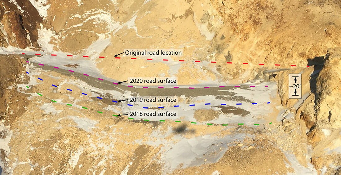
In 2021, the Park had to close the Park Road at Mile 43 (halfway in) because the roadbed was sliding dramatically, making the road too dangerous to travel.
 |
| A big slide zone; Photo and illustration: NPS |
 |
| Not so pretty rocks; Photo: NPS |
During the 1990s, the landslides, which occur below the roadbed, caused only small cracks in the road surface. However, by 2018, the slumping increased to almost half an inch per day, and then to three and a half inches per day by August 2020.
 |
| A long-term problem with a sudden emergency; Chart: NPS |
Early August rains in 2021 triggered the rate to increase significantly, with much of the landslide moving downhill at over 10 inches per day. The day before the closure, it was 17 inches in one day. So, they declared an emergency and closed the road, forcing evacuation of employees, hikers and campers on the other side.
A ranger told us that the cliff on which the road is built isn’t actually solid rock. Rather, it is rock bound in ice. Climate warming is weakening the entire mountain.
The National Park Service is currently finalizing plans to build a bridge to span the Pretty Rocks Landslide.
 |
| An expensive and difficult fix; Illustration: NPS |
It's a complex project that will continue into 2026 (and possibly beyond). So, be aware that travel within the Park is limited until then.
 |
| Work has begun; Photo: NPS |
Quite frankly, if you are planning your once-in-a-lifetime visit to Denali, I would suggest holding off until after the Pretty Rocks Bridge opens. You miss so much with just half the road. If you foresee being able to return, then go for it and do as much as you can.
 |
| You don't want to miss this opportunity |
So, how can you see the Park (both in this restricted environment and when the road is open)?
Take a bus!
 |
| The way to go! The only way to go! |
There are (typically) three types of bus service:
Non-narrated transit buses provide flexible travel to specific points in the Park. The name is a misnomer, because ALL the drivers provide some kind of running commentary. But, narration is not the focus of these buses.
Transit buses stop for wildlife, restrooms and scenery, just like tour buses, but you can disembark or board anywhere along the road, providing there is room on the bus you are trying to get on. This way, you can travel at your own pace. And, you can change buses if your bus is too full or you don't like the driver or your fellow bus travelers. It's a good option for hikers.
 |
| Not that comfy for the bumpy ride; Right photo: Scott Stevens |
There were four choices of non-narrated trips, of varying length (listed length is if you just ride without getting off for long periods or switching buses): The Toklat River bus to mile 53 that took at least 6.5 hours roundtrip; the Eielson Visitor Center bus to mile 66 that took at least 8 hours round-trip; the Wonder Lake bus to mile 85 that took at least 11 hours; and the Kantishna bus to mile 92 that took 13 hours roundtrip. Prices ranged from about $32.75 per person to $55. Obviously, these won't run until the road opens.
Now, with the Pretty Rocks situation, there is one new option: the East Forks bus to mile 43. Adult fare is $32.75.
 |
| The Pretty Rocks turnaround |
Transits are great for return visitors who want flexibility (like us).
 |
| Bus arriving at the depot near the Park entrance |
There were six different narrated bus tours, in which you stay with the specific driver and bus and receive a full targeted lecture.
 |
| Tour stop; Photo: Scott Stevens |
They stop for wildlife and scenery and provide a snack or full lunch (although, be warned, a "full lunch" is actually a fairly pathetic snack; bring your own food!). Until the road is fixed, there are only two tours available.
The Denali Natural History Tour, which focuses on the natural and cultural history of the Park, travels to mile 17. It includes several interpretive stops, with at least an hour of off-bus experience. It runs from early May to late September and takes about 5 to 5 1/2 hours. It costs $114.00 for adults and $49.50 for children (Alaska ain't cheap).
The Tundra Wilderness Tour provides in-depth information about the history of the Park, as well as looking for wildlife and photography opportunities. It goes to the "end" of the road at mile 43, but historically traveled as far as mile 62 (and presumably will resume that schedule once the bridge is built). It takes 4 1/2 to 5 hours and is $141.25 for adults and $62.25 for children.
The tours currently not being offered are: The 4-hour Teklanika Tundra Wilderness Tour to mile 30; the 7-8-hour Toklat Tundra Wilderness Tour to mile 53; the 8-9-hour Eielson Excursion to mile 66; and the 13-hour Kantishna Experience to the end of the 92-mile road.
 |
| The Eielson Visitor Center has a spot that features my motto |
These tours are good for first-time visitors or people with strong specific interests. We have done some in the past, but now prefer the flexibility of the transit buses. Regardless of how you travel, you should go on the longest tour being offered in order to see as much as you can.
 |
| The roads can be dusty |
If you are camping past the Savage River Bridge, you can drive your car in and out – but ONLY one time each way. To move around the Park while you are camping, you still have to use the buses.
 |
| We camped back in 2013 |
You have to pay a $10 Park fee for every bus reservation, but, onsite you can get a refund by producing your National Park Pass. No, you can't waive the fee while booking; you have to request a refund. It has something to do with the fact that the tours are operated by a concessionaire.
None of the buses are luxurious – they are old school buses. But, they do the trick. One of our drivers explained that school buses, rather than tour buses, are used because they are much lighter weight and, therefore, do less damage to the road.
 |
| Basic transportation |
Unless a meal is provided, you have to bring your own food and drinks. Nothing but water is available on the bus routes and that's pretty scarce (I don't even think there is any in the current 43-mile scenario). Take water!
You can open the windows to take pictures. They are difficult to open, but once you get them down without crushing your fingers, you can get some pretty decent photos – assuming the bus is aimed correctly.
 |
| The Wilderness Tour bus has bigger windows than transit buses; Right photo: Scott Stevens |
Getting the windows closed – and getting them to stay closed – is another issue. Personally, I like to leave them open, but some riders don't like the breeze.
 |
| Buses have screens to help passenger see wildlife |
The two biggest rules are to keep your hands, arms and head inside the bus at all times (people taking cell phones photos struggle with this) and to be quiet when near animals. This stops animals from associating buses with humans, which keeps animals safe and creates a better environment to see them up close.
The tour and shuttle drivers are trained to spot animals and guests are also asked to speak up when something comes into sight. Generally, the drivers give you a decent amount of time to take pictures, but we have had some who were grumpy and/or in a hurry – or quite punitive when riders break the rules (I get it, but perhaps a warning before driving away from a Bear because riders audibly gasped). Most of our drivers have been great, but sometimes you do get a difficult one. If you are on a transit bus, you can change to another driver. if you are on a tour, oh well!
 |
Most of the drivers are very good |
 |
| So majestic |
When you are not on a bus, there are some lovely spots in the first 15 miles that you can drive yourself, including ...
 |
| A very nice nature walk along the Savage River |
 |
| An area frequented by Alaskan Moose |
 |
| A beautiful Visitor Center (with a store and restaurant); Photos: NPS |
 |
| The Denali Sled Dog Kennel, which offers tours; Photo: Anchorage Daily News |
Many Denali visitors come to the Park on a tour, often an extension of a cruise. Arrival can be by bus or on the Alaska Railroad. I have never done it that way, so I can't impart any wisdom.
 |
| The train coming in to the Denali Depot |
There are six lodges and one campground in the town of Kantishna at the far end of the Park Road. The two most well-known are the Backcountry Lodge and the Kantishna Roadhouse.
 |
| The Backcountry Lodge |
We have stayed at the Backcountry Lodge several times.
 |
| One of our cabins |
Previously, the best way to get to these lodges was via bus (and, indeed, the bus trip in and out was a HUGE part of the adventure because it is a nicer version of the Park's Wilderness Tours).
 |
| The buses are still the school-bus type, but nicer and with better lunches |
Now, the only way in and out of the Lodges is via small plane.
Because of the transit time, I suggest staying at least two nights if you opt to stay at the far-end of the Park. The lodges have lots of activities and include nice rustic chic meals. The mosquitoes can be awful. A mosquito net and bug spray are essential.
 |
| Becca panning for gold and Scott hiking way back in 2001 |
Denali has six campgrounds:
 |
| Map: NPS |
Riley Creek is just a quarter of a mile in and is open year-round for both RVs and tents. It has a store and shower house.
Savage River is at mile 14, also within the area where you can drive your personal vehicle. It is open in the summer to RVs and tents.
Sanctuary River, at mile 22, if open in the summer for tents only and is accessible only by transit bus.
 |
| Photo: NPS |
Teklanika River (mile 20) is open in the summer for RVs and tents. You can drive your own vehicle in on your first day of camping and out when you leave, but all other travel must be by transit bus. If you drive in, you must stay at least three nights.
Igloo Creek (mile 35) and Wonder Lake (mile 85) are tent-only and accessible via transit bus. Both are closed until the road fully opens.
Outside the Park are lots of accommodations ranging from luxury hotels to rustic cabins ...
 |
| Nice digs at McKinley Creekside Cabins (good food at the cafe, too) |
... campgrounds and restaurants ...
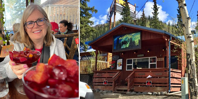 |
| We loved Moose-Aka's in Healy |
Plus, there are activities including whitewater rafting ...
 |
| Way back in 2001 |
... and flightseeing ...
 |
| For better photos, select a plane with wings above rather than below the windows |
Be aware that it is wise to get advance reservations for everything you plan to do in Denali. While it is possible to get a last-minute room or bus tour, it's difficult.
To climb Denali (which, no thank you, I will never do), you need a climbing permit and you must attend an orientation. This is a treacherous mountain that is prone to avalanches after early summer and can have violent weather any time of year. To date, more than 32,000 people have attempted to summit Denali, with a success rate of approximately 52 percent. More than 125 people have died on the mountain, some from falls and some from altitude- or weather-related issues.
 |
| Climbers at basecamp hoping to beat the odds |
The tallest mountain in North America, Denali is serious business.
 |
| I'd rather admire than climb |
Even though Denali is basically a "summer Park," it has definitive seasons ...
 |
| Flowers in the spring |
 |
| Hours and hours of sunlight in the summer |
 |
Glorious fall colors
|
 |
| Animals |
We often go late in the season, generally mid-September. That way, we can still see animals ...
 |
| Fall is when the bull Moose get big antlers |
 |
| You don't have to wait for winter for good aurora |
There is always risk that an early snow will close the Park (that has happened to us) ...
 |
| But, the trade-off can be dramatic |
Oh, and one last thing: you have probably heard that it is rare to see the mountain because it is shrouded in clouds most of the time. I think that used to be true, but climate change is revealing the peak more often.
I have seen it every time I have visited it recent years.
 |
| It never gets old |
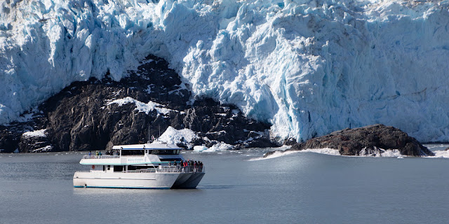
Kenai Fjords National Park
 |
| Another fabulous Alaskan National Park |
The 1,047-square-mile Park has two sections ...
 |
| Glacier-filled fjords, which are reached via boat, are the vast majority of the Park |
 |
| The small Exit Glacier section, which you can drive to, is north of Seward |
Both are reached from Seward at the end of the Kenai Peninsula. It's a relatively short drive from Anchorage.
 |
| How to get there and how it fits in |
Kenai Fjords National Park contains the Harding Icefield, one of the largest ice fields in the United States. In fact, more than half the Park is covered with ice and another large percent is water.
The Park's name comes from the numerous fjords carved by glaciers moving down the mountains from the ice field. The field is the source of at least 38 glaciers, the largest of which is Bear Glacier.
 |
| Map: NPS |
There are several companies that offer narrated boat tours out of Seward from May to October.
I haven't ever noticed a significant difference between the two main suppliers. Both have relatively small boats and offer a variety of outings of varying durations, ranging from four to eight and a half hours.
 |
| Map: Major Marine |
There are different types of tours at different times of year, including some short ones as early as March. The fjord tours are generally mid-May to mid-September, with some not starting until mid-June.
Shorter cruises usually serve a snack; longer cruises include a meal. The boats also have snack bars (hot chocolate is sure good when its chilly). Prices for adults range from around $80 to $270. The tour operators also sometimes offer specialty tours, especially in early season when the fjords are still iced over, and private charters.
When you book (and do book in advance!), ask for a AAA or AARP discount if you are eligible. They offer them, but sometimes it isn't obvious.
I have found the operators to be quite accommodating if you need to change times or days if there is space on the boat you want to be on.
The boats leave out of Resurrection Bay in Seward ...
 |
| Last look at civilization |
 |
| First look at Bear glacier |
... and then travel in the Gulf of Alaska down to the fjords, heading into the narrow channels to get close to the glaciers.
How many and which glaciers you see vary depending on tour length.
My personal preference is to always take the longest tour possible.
If you're gonna do it, do it all the way.
The longer tours also pass through the Chiswell Islands in the Alaska Maritime National Wildlife Refuge ...
 |
| A great area for wildlife |
... and beautiful multiple waterfalls at Cataract Cove ...
 |
| The boats usually come so close that the spray hits you |
The boats have heated interiors and decks (usually multiple levels) that facilitate wildlife and glacier viewing.
 |
| Lots of room to see |
Naturalists narrate, providing insight into history, geology, the composition and behavior of glaciers, wildlife and climate.
On the way to and from the glaciers it is common (but not guaranteed) to see lots of wildlife. I have seen ...
 |
| Orcas |
 |
| Even baby Orcas |
 |
| And breaching Orcas |
 |
| Humpback Whales (and, once, a Gray Whale!) |
 |
| A Humpback pod bubble-net feeding |
 |
| Fin Whales (rare, but I have seen them) |
 |
| Dall Porpoises (so very hard to photograph!) |
 |
| Puffins (top: Horned; Bottom: Tufted) |
 |
| Steller Sea Lions |
 |
| Lots of sea creatures, including Lion's Mane Jellies and Ochre Sea Stars |
 |
| Birds, including, CW: Thick-billed and Common Murres, Pigeon Guillemots and Parakeet Auklets |
 |
| Sea Otters |
 |
| Thousands of Black-legged Kittiwakes |
 |
| Harbor Seals |
 |
| Bald Eagles, often seen as you travel through Resurrection Bay |
 |
| Mountain Goats and even Bears up on the cliffs (less frequent, but possible) |
Of course, the real point of the cruise is to get up close to glaciers. And, you do.
 |
| A really good view of a glacier |
Access depends on how active the glaciers are. Most of the glaciers you see are tidewater glaciers, meaning that they terminate in the ocean.
 |
| Face of a glacier |
You can also see glaciers at the tops of the mountains, some that do not connect with the water, making them cirque or alpine glaciers.
 |
| Cirque glaciers |
If they are calving (the process where chunks of ice separate from the glacier and plummet into the ocean) ...
 |
| A calf makes a huge splash |
... the boats may have to thread through the detritus, which can include icebergs ...
 |
| Icebergs must be16 feet above sea level, 98-164 feet thick and 5,382 square feet |
... bergies ...
 |
| Bergies are about 1,079 to 3,229 square feet |
... growlers ...
 |
| About the size of a grand piano |
... and brash ...
 |
| A slushy mass of ice bits |
 |
| Ice and hats for a Christmas card |
Sometimes, the naturalists fish out glacial ice so that passengers can touch it. Sometimes they crush it and put it in drinks.
The water is hyper-pure. But, since glacial ice is often full of debris that got trapped when the glacier formed or scraped into the glacier as it traveled toward the sea, your drink could be silty.
If there is lots of activity, they may have to hang back to avoid getting hit by a wave caused by water displacement.
 |
| You can see a wave heading toward the boat |
Still, you get close enough to hear the groaning, cracking, popping and booming that happens as the huge ice wall creeps ever so slowly to the sea.
 |
| All that cracking makes noise |
And, if you're lucky (and you usually are), you can witness ...
 |
| Icefalls |
 |
| Small calves |
 |
| Huge calves |
It's like nothing you've ever seen before.
Getting to and from the glaciers, the scenery is spectacular.
 |
| It's gorgeous in sun ... |
 |
| ... and mist |
Weather around glaciers can be peculiar. It might be dense fog one place and clear blue sky right around the corner. Often the cold air coming off the glaciers makes it clearer than the weather farther away.
 |
| Cloudy above, clear below |
And, occasionally, the weather is NOT your friend ...
 |
| Fog and rain |
Regardless of weather, it can be cold. Often colder than you think it will be, especially on days when Seward is warm. Always be prepared for cold, fog and rain. I always wear layers, including a rain jacket, rain pants and a hat. And, do not forget your gloves. Because it can be wet, wear sturdy, non-slip shoes. But, also, be prepared for bright sun with sunglasses and sunblock. There is room on the boat to stash a backpack.
 |
| Typical mid-summer garb |
Most of all, take cameras. I usually take two ...
 |
| A camera with a wide-angle lens to capture the mind-blowing scenery |
 |
| And a camera with a long lens for the abundant wildlife |
 |
| A zoom lens is nice for when those distant Orcas decide to come close |
And, you'll probably want to take some video, as well, to catch both sight and sound. For that, I generally just use my cell phone.
Take batteries, chargers and extra cards. You'll take more photos than you thought you would.
 |
| So much to capture |
Plus, the cold can drain batteries more quickly.
When the naturalist asks you to be quiet and listen, please do. It's fascinating to hear, plus other people may be trying to record the sound.
I have been on these tours more times than I can recall (I try to go every time I go to Seward) and, most of the time, the sea has been quite calm with just a little chop when passing through open water between Resurrection Bay and the fjords. However, I have been when it was quite rough.
 |
| A little bit of sea action |
So, if you have issues with motion sickness, take precautions. I wear wristbands and sometimes take medication.
It's a long day. The combination of being on a boat, cold, excitement and the passage of time generally wipes you out.
 |
| Time to go! |
It is possible to do this as a day trip out of Anchorage (2.5-hour drive), but I suggest staying in Seward when you get back. Seward has some nice restaurants (ranging from pricey seafood to hot pizza) and lots of accommodations. Give yourself a break after the boat tour.
 |
| Can't beat a hot meal after a cold day |
Plus, you want enough time to go to the Exit Glacier portion of the Park. A spur road off the Seward Highway leads to the only road-accessible portion of Kenai Fjords National Park. A system of hiking trails leads to the terminus of the glacier and up to the Harding Icefield itself.
 |
| Exit Glacier |
Although Exit is one of the Harding Icefield's smaller glaciers, it is one of the most visited.
 |
| Hurry before it's gone |
 |
| The trail network covers ground that was recently icebound |
Exit Glacier is accessible year-round, but after the arrival of snow, usually in mid-November, the road closes to cars and access is via snow machine, dogsled, fat-tire bicycle or cross-country skis.
 |
| A Black Bear crosses the road in the summer |
The glacier received its name for serving as the exit for the first recorded crossing of the Harding Icefield in 1968.
 |
| Glacial melt creates a braided stream |
Kenai Fjords National Park has two Visitor Centers: one at the Resurrection Bay docks near where the boat tours depart and one at the Exit Glacier.
 |
| A good place to learn |
Exit Glacier has lots of trails, interpretive signs and Ranger programs.
It's a great place to learn about glaciers and the impact they have had – and are still having – on Alaska's landscape.
In my opinion, this Park is a "must-do" for anyone visiting Alaska. It doesn't hurt that the drive from Anchorage – which I will cover in another blog – is stunning.
 |
| A beautiful drive |
Wrangell-St. Elias National Park and Preserve
Wrangell-St. Elias is an expanse larger than nine U.S. states. More than 12,500 square miles are designated as the National Park and 7,500 more are designated as the Preserve.
 |
| Massive glacier-topped mountains |
The National Park alone is larger than the 47 smallest American National Parks combined and is more than twice the size of all but two other Parks.
 |
| Impressive peaks |
The Park includes a large portion of the St. Elias Mountains, which include nine of the 16 highest peaks in the U.S., yet are within 10 miles of tidewater, giving it one of the highest reliefs in the world. Wrangell-St. Elias borders on Canada's Kluane National Park and Reserve to the east and is close to Glacier Bay National Park to the south. Mount St. Elias, at 18,008 feet, is the nation's second highest peak and Mount Wrangell is one of several active volcanos in the range.
 |
| Mount Wrangell steaming; Photo: NPS |
The Park's glacial features include Malaspina Glacier, the largest piedmont glacier in North America; the Hubbard Glacier, the longest tidewater glacier in Alaska; and Nabesna Glacier, the world's longest valley glacier. The Bagley Icefield covers much of the park's interior, which includes 60 percent of the permanently ice-covered terrain in Alaska.
 |
| The Malaspina Glacier from the air |
Interestingly, Wrangell-St. Elias has only been a National Park since 1980 and was a National Monument for just two years before that.
 |
| A bit off the beaten path |
First, because it sits in the southeast corner of the mainland of Alaska, it is not on the most typical tour routes.
You can either drive the whole way (5+ hours from Anchorage) or take the ferry through Prince William Sound to Valdez and drive up (ferry is about 5.5 hours and the drive is 2.5 hours).
The ferry is a treat in itself. I have usually done this as a circle – ferry to and drive back from.
 |
| Worth the trip; prince William Sound |
And, both the Glenn Highway ...
 |
| The fall is incredible |
... and the Richardson Highway are spectacular ...
 |
| Budget more travel time for photos |
... and interesting ...
 |
| Fish wheels built by indigenous people to catch salmon |
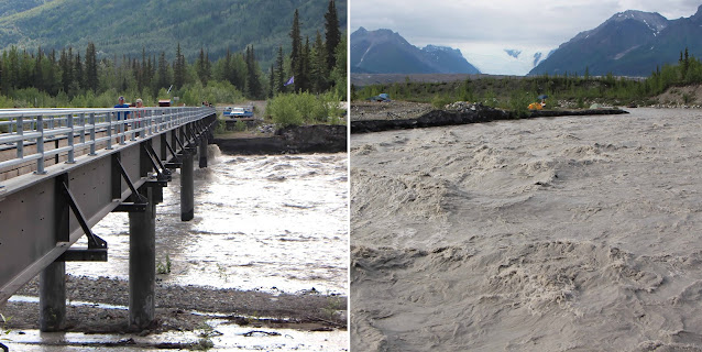
Caveat number two – and this is an important one – is that, yes, you can drive to Wrangell-St. Elias, but you can't reach very much of it by road. There are just two roads that enter the nation's largest National Park and they don't get very far in.
 |
| It 's more accurate to say you can drive around it – part of the way; Map: NPS |
Both the Nabesna Road and the McCarthy Road are gravel roads owned and maintained by the state of Alaska, not the National Park Service.
 |
| Not many roads; Map: Earth Trekkers |
If you have a traditional rental car in Alaska, you are not supposed to drive on any gravel roads. Although, I must admit, I have!
So, technically, both Nabesna and McCarthy are off limits unless you rent from one of the local companies that permit (and charge extra for) this type of travel.
The Nabesna Road is 42 miles long and travels along public, private and National Park land, ending in the Preserve, not the Park. It offers an opportunity to explore the northern edges of the Park, with views of the Wrangell, Mentasta and Nutzotin Mountains. It has campsites, scenic vistas, hiking routes and wildlife.
 |
| Nabesna Road; Photo: Earth Trekkers |
But, while both Nabesna and McCarthy are usually passable to all vehicles during the summer, driving beyond Mile 29 of the Nabesna Road often requires a high-clearance vehicle because of stream crossings which can quickly become impassable when it rains or when spring run-off is heavy.
The last four miles of the road are not maintained and can be so deeply rutted and wet that vehicle travel is not recommended.
 |
| Crossing streams; Photos: Earth Trekkers |
The National Park Service offers a Nabesna Road Guide with a downloadable audio tour. I have not driven the Nabesna Road, so can't speak to whether it is worth the risks.
I have driven the 60-mile McCarthy Road, which follows the old Copper River and Northwestern Railroad route.
 |
| There are still some railroad trestles by the road |
It can be rough and wash-boarded, but we didn't have problems with it. We didn't take our trailer because the NPS strongly recommends that oversized vehicles not travel the McCarthy Road.
 |
| The road was fine, but a Moose crossing it almost knocked down that hiker! |
This trip is so worth it because it's lovely ...
 |
| A nice blend of nature and history |
... and, at the end is the gateway to the fascinating Kennecott historic mine area.
There is a large parking lot and a bridge that crosses the Kennicott River (yep, the mine/town and the river/glacier are spelled differently).
 |
The river was raging when I walked across the bridge
|
The bridge affords a nice view of the nearby Kennicott Glacier (nope, not a lot of originality in naming places), which fronts a pretty significant glacial moraine.
 |
| The namesake glacier |
Flowing down 16,390-foot-tall Mount Blackburn (Alaska's fifth tallest peak), the Kennicott Glacier fills the four-mile-wide valley, dominating the view from all angles. It's a popular hiking and climbing spot. That's why the lot was full even when the town was virtually deserted.
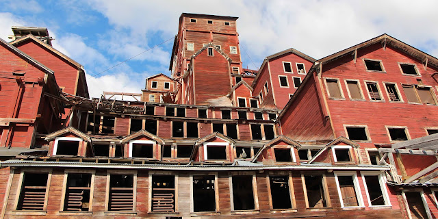
From the other side of the bridge, you can walk or take a shuttle (summer only) the five miles to the mine town of Kennecott, which was listed on the National Register of Historic Places in 1978 and designated as a National Historic Landmark in 1986.
 |
| It is considered the best remaining example of early 20th Century copper mining |
It has a number of buildings in various states of rehabilitation. Abandoned for decades, some buildings have been shored up, some need work (which is ongoing and will be for many years) and some have deteriorated beyond the point of saving.
 |
| Some areas are downright scary – hold on your children! |
The Kennecott Mines National Historic Landmark includes the land and mining claims that formed the foundation for the Kennecott Copper Corporation, later the Kennecott Minerals Company. The operation had two components: the mines where ore was extracted from the mountains and the mill town where the ore was processed.
 |
| The town boasts quite a bit of abandoned equipment |
From 1911 to 1938, nearly $200 million worth of copper was processed. At the peak of operation, approximately 300 people worked in the mill town and 200-300 in the mines. Kennecott was a self-contained company town that included a hospital, general store, school, skating rink, tennis court, recreation hall and dairy.
 |
| The town by the glacier |
 |
| Old smoke stacks |
By the late 1920s, the supply of high-grade ore was diminishing, and Kennecott Copper Corporation was diversifying into other North American and Chilean mines. Declining profits and increasing costs of railroad repairs led to the eventual closure of the Kennecott operation by 1938.
There are interpretive signs, exhibits, a film and Ranger programs. There is also a privately owned Lodge that looks like a cool place to stay.
 |
| The Kennicott Glacier Lodge |
 |
| A majestic presence |
A replica of a historic mining building, the 23-room Main Lodge was built in 1987. Each room has a cold-water sink, but share "individual use" baths with other guests. The South Wing building has 20 rooms, each with a private bathroom. The lodge has a dining room, as well.
My visit was short and I'd love to go back.
 |
| It's a photographer's dream |
 |
| So much to see |
If you drive either road, know that there is NO gasoline; there are gas stations within eight miles of McCarthy, but it's at least 34 miles to get to services from Nabesna.
As for the rest of the massive Park, I've read that the best way to see it is flight-seeing.
 |
| It's definitely a small-plane area |
There are nice views from the highways that skirt it, as well.
 |
| Day view |
 |
| Evening view |
When we visited, we camped at an absolutely gorgeous private campground: the Tolsona Wilderness Campground on the Glenn Highway before it connects to the Richardson. It had huge spaces, a nice showerhouse and a creek.
 |
| One of my favorite campsites |
So, is Wrangell-St. Elias an accessible Park or not? I am not really sure.
 |
| Does it really matter? At least you can see it from the road |


No comments:
Post a Comment