I just came from sitting outside in the glorious – and
incredibly warm – sunshine. No big deal, except that it’s 10 p.m. and there are
still hours more before the sun sets.
 |
| Time of day does not matter |
 |
| It was the only one, but a very pretty one (despite the flies) |
... and, of course, lovely birds ...
 |
| Steller's Jay |
 |
| Lifting fog |
 |
| The road is called the Klondike Highway here |
.. and some historic sights ...
 |
| A roadhouse along the former overland stage/mail route |
 |
| Map:1 Woman, 3 Great Rivers |
It was the principal means of transportation during the 1896-1903 Klondike Gold Rush.
Paddlewheel riverboats continued to operate on the Yukon until the 1950s, when the Klondike Highway was completed.
The name Yukon, or ųųg han, is a contraction of the words in the Gwich'in phrase chųų gąįį han that mean "white water river," referring not to rapids, but the silty color of the water.
 |
| The Yukon |
 |
| Before the highway, the river was it |
When it enters Alaska, the Yukon passes through Eagle, Circle, Fort Yukon, Stevens Village, Rampart, Tanana, Ruby, Galena, Nulato, Grayling, Holy Cross, Russian Mission, Marshall, Pilot Station, St. Marys and Mountain Village.
Then the River frays into many channels, sprawling across the Yukon-Kuskokwim Delta before emptying in the Bering Sea.
Despite its length, there are only four vehicle-carrying bridges across the river.
 |
| We crossed at Carmacks on the Klondike Highway |
We have also crossed at the bridge north of Fairbanks on the Dalton Highway.
 |
| Yukon River, November 2004 |
There are also two pedestrian-only bridges in Whitehorse, as well as a dam across the river and a hydroelectric generating station. The construction of the dam flooded the White Horse Rapids, which gave the city its name, and created Schwatka Lake.
 |
| A lone Bufflehead on a pond near the river |
 |
| Chinook Salmon |
Each year Chinook, Coho and Chum Salmon return to their terminal streams in Alaska, the Yukon Territory and British Columbia.
The Chinook have the longest journey, with an estimated 35-50 percent bound for Canada.
Because Salmon do not eat during their spawning migration, Yukon River salmon must have great reserves of fat and energy to fuel their thousands-mile-long journey. As a result, Yukon River Salmon are noted for their especially rich and oily meat.
The villages along the Yukon have historically relied on and continue to rely on Salmon for their cultural, subsistence, and commercial needs. Salmon are traditionally dried, smoked, and frozen for both human and sled dog consumption.
 |
| Yukon River |
We visited Five Fingers Rapids where four islands divide the river into five narrow channels of which only the eastern is passable.
 |
| The narrow passage at Five Fingers Rapids |
The Rapids are mentioned in Jack London's novel The Call of the Wild.
 |
| A rock outcrop in the river |
At Five Fingers, I did a short hike, and saw countless lakes and tree-filled vistas ...
 |
| The trail and an observation deck |
It was worth the stop.
 |
| Another nice location |
Dawson City
We are spending the night in Dawson City, which is the most
“touristy” place we’ve been so far.
 |
| Dawson City (not to be confused with Dawson Creek) |
But, it’s really charming: a combination of
old buildings sinking precariously into the ground, restorations and
reproductions that look like brothels, feed stores and saloons.
 |
| Even old riverboats |
 |
| Good food in unexpected places |
We had a
fantastic halibut dinner at Sourdough Joe’s. Front Street (AKA the Klondike
highway) is paved; the rest is dirt and the sidewalks are wood planks. The
Yukon River is bermed because it does have a tendency to flood.
Of course, Dawson City was the site of the initial gold strike that caused the Yukon Gold Rush. So much of the Yukon’s and Alaska’s history are tied up in this town.
Unfortunately, we won’t be here long enough to visit the dredges.
 |
| Dawson City |
We are a day ahead of schedule, which will give us an extra
day in – or near Fairbanks. Scott is exhausted from driving – I am hoping he’ll
slow it down a bit. We’re still pushing too hard.
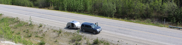 |
| Pressing on |
 |
| Smoke from the Picnic Rock fire |
We are concerned about friends
and acquaintances and hope that this fire gets under control soon. Our home is
far from the current fires, but we know we live in a high-risk area.
What with
the Oklahoma tornadoes right by Becca and this, I am more firmly convinced than
ever of the power of nature.
 |
| A beautiful Yukon stream and waterfall |
Trip date: June 3-July 20, 2013
I am so glad you are having such nice weather! Love you!
ReplyDelete