 |
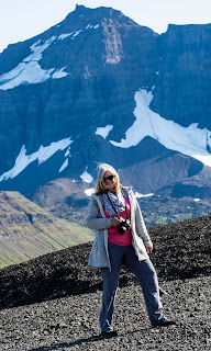
| Such beautiful scenery |
We bid farewell to Norðurlands.
The weather had cleared and the morning was glorious, so we were up for some pleasant sight-seeing. To get to Bustarfell, we had to turn south in Vopnafjörður, a pretty little village on a fjord of the same name.
 |
| A peaceful morning in Vopnafjörður |
Originally settled by Vikings in the late 9th century, the town's name ("Weapon Fjord") comes from the nickname of resident Eyvindur Vopni. Violent disputes between local chieftains are recounted in the Vopnfirðinga Saga.
The town became a trade port in the 17th century and continued in that role throughout the 19th century. Extreme poverty in the area made Vopnafjörður the largest port of Icelandic emigration to America in the late 19th and early 20th centuries. Thousands of North Americans have ancestors who lived in Vopnafjörður.
 |
| Vopnafjörður Harbor; Photo: Scott Stevens |
We didn’t stay long in town, but we did stop to take our pictures at a mural painted on the wall of a random building. The flowers had a blank spot in them designed for a person to pose in front of.
 |
| Such cool photos |
Bustarfell
Then, we headed south to Bustarfell, which is recognized as one of the finest historic turf houses in Iceland.
 |
| Typical (but well-preserved) Icelandic farm |
I had not planned to visit Bustarfell when setting up the trip (I never came across it in any literature), but we encountered a blog about it while trying to find some information on turf houses and it looked interesting.
 |
| Called a "turf house" because the roof is insulated by a sod-and-turf layer |
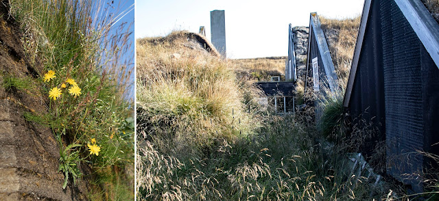
A quaint centuries-old Icelandic turf-and-stone house with red gables and a grass-grown roof, Bustarfell is one of the oldest and best preserved farms of its kind in Iceland.
 |
| Flowers grow on the grass-cover roof |
 |
| Multiple views of the house |
How old?
Árni Brandsson and his wife Úlfheiður bought the land in 1532 and began farming peat.
The house started as a turf shed and was added to and added to and added to until it had six connected units.
The family lived in the house up until 1966 and descendants now live next to the museum in a more modern home as they continue to operate the farm.
 |
| Scenes from the interior |
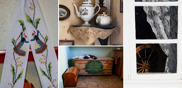
The museum – basically a walk through the house – is very well done. You can see how the home changed through the centuries and how a typical Icelandic farming family lived.
 |
| Pretty details |
Everything is on display from old photos to toys to saddles ...
 |
| The harsh climate dictates that everything happen indoors |
... to a kitchen from the mid-sixties ...
 |
| The kitchen is more modern than the rest of the house |
It was charming.
 |
| Quaint interiors |
Plus, the surrounding area had a very "Old Iceland" look to it.
 |
| A bridge on the road back to the highway |
Coastline
We rejoined the highway along the coast where the scenery grew increasingly dramatic.
 |
| We had to stop here to take a look |
We stopped at a beautiful waterfall that dropped down a cleft to a beach below.
 |
| Just a surprise along the road |
And, then, we saw a few tour vans stopped at another spot, so we went to investigate. We found Skjólfjörur and the Ljósastapi rock pillar just offshore.
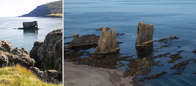 |
| Another unanticipated attraction |
 |
| Do you see it? |
Said to look like an elephant, it is often called "Fíllinn" (Icelandic for Elephant).
Whenever a rock is named for an elephant or camel or whatever, it always reminds me that the name cannot be that old. I mean, when did Icelanders ever see an elephant?
I have to admit, I didn’t see an elephant when I was there … but, after reading the name, I do now.
The coastline in that part of Iceland is also dotted with interesting buildings ...
 |
| The traditional cream paint and red roof |
 |
| European Shag |
... more birds ...
 |
| Long-tailed Duck |
... and spectacular views ...
 |
| Looking across the fjord |
Crazy Mountain Road
After Skjólfjörur, things got crazy. Our maps said that we would be at the next bay, Héraðsflói, in just a few miles. But, after some straight driving on a gravel road ...
 |
| The major route was gravel |
... there was a mountain in our path. As we got closer and closer, we started looking for a route around the cliff on the coast. We couldn’t see anything. Certainly, we couldn’t make it over that mountain in just a few miles.
 |
| How would we get over that? |
Yes, we could. See part of the drive here.
The road, which was gravel and obviously under construction went right up (I was going to say, “straight up,” but there was nothing straight about it), over and back down in a short, short distance.
 |
| Near the top of the road |
 |
| The road continues below us |
 |
| The route did have some squiggles |
No regrets, but had the weather been bad, it would have been harrowing.
OK, it was a teeny bit harrowing in perfect weather. But, I am glad we went that way.
 |
| An impressive road |
Once we reached the top of the mountain, the view below was amazing. We were looking at the Héraðssandur, a massive black sand delta formed by the outflowing of the Jökulsá á Brú and Lagarfljót rivers.
 |
| The view of Héraðssandur as we descended |
The ten-mile-wide beach is obviously impassable by car, so once we made it down the incredibly winding road, we had to drive south for about 15 miles along the Jökulsá á Brú, where we finally rejoined the Hringvegur.
 |
| A very wide delta |
We saw a car way out on the sand right by the ocean and the side of the river is dotted with farms.
There are a few gravel roads throughout the delta, but I have no idea how that car got to the far shore.
I assume there are a lot of 4WD vehicles.
Egilsstaðir
Once we got back on 1, we headed to our next destination, two nights in Egilsstaðir. The town sits on the banks of the Lagarfljót, which is not a river here, but rather a 16-mile-long lake. Only 1.6 miles wide, it is 367 feet deep at its deepest point.
 |
| Lagarfljót |
 |
| From a video by Hjörtur E. Kjerúlf |
Egilsstaðir is pretty big compared to other Icelandic towns – it has more than 2,000 residents.
 |
| Finally, a place to wash the car! |
It is new, even by Icelandic standards, having been established as a regional service center in 1947. The area was once a farm (also called Egilsstaðir). Not new by any standards, the farm was well established in the 15th century.
While Egilsstaðir generally looks like any regular town, it did have some charming aspects, including automobile-sized woven baskets filled with flowering plants along the sidewalks and a beautiful riverfront.
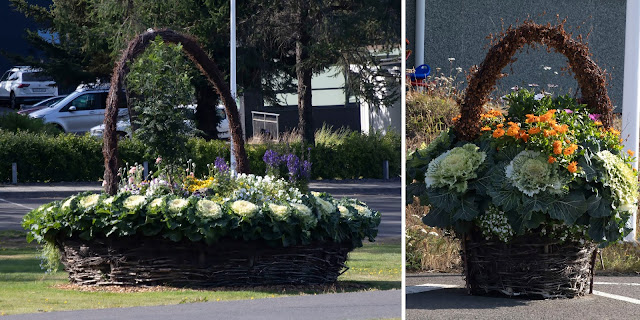 |
| These were really pretty |
We stayed at the Hótel Eyvindará, a nice place on a hill above town. It is known to have a good restaurant, but it was closed because they were not able to hire sufficient staff after being closed during Iceland’s pandemic shutdown. Booking.com listed it as having a washing machine, but that wasn’t accurate. It did, however, offer reasonably priced laundry service, which we took advantage of.
 |
| Hótel Eyvindará |
After we checked in, we went exploring. My Lonely Planet guidebook discussed several nearby places to visit, including the two towns of Seyðisfjörður and Bakkagerði, which were described using terms like “charming,” “enchanting,” “storybook” and “fairy village.” Of the two, Lonely Planet listed Seyðisfjörður as the “don’t miss” option.
We had been driving all day and, at first, Scott balked at driving more. So, we opted to go to Seyðisfjörður, which was closer.
Seyðisfjörður
The drive was beautiful, winding over the mountains down to the head of a very narrow fjord (also named – are you catching on here? – Seyðisfjörður).
 |
| Driving into town is dramatic |
The area surrounding the town was spectacular with blue, blue water and two 3,000+ foot mountains. The town, itself, was so-so.
 |
| The ferry was loading when we were there |
With a deep harbor, it deals with a lot of cargo, is the terminus of the Smyril Line Ferry that takes tourists to the Faroe Islands and Denmark (advertised as the “ferry to Europe”) and is a port for large cruise ships.
As such, it seemed fairly touristy instead of being enchanting.
 |
| Part of the "charming" area; we did split a yummy burger |
It has some pretty old houses and a lovely church, but I couldn’t say it did much for me.
 |
| Rainbow walks, which show support for LGBTQ residents, are popular in Iceland |
On the plus side, the grocery store there had ice! Finding ice had been an ongoing struggle since we bought picnic supplies, so that goes in the “pro” column.
 |
| Seyðisfjörður flowers |
While the area was settled by Norsemen as early as the 11th century, Seyðisfjörður itself was settled in 1848 by Norwegian fishermen. The world's first modern industrialized whaling station was established in 1864, but operated for only two years. The first telegraph cable connecting Iceland to Europe made landfall in Seyðisfjörður in 1906, making it a hub for international telecommunications well past the middle of last century.
In 1913, a dam built on the main river harnessed power for the country's first high-voltage AC power plant together with a distribution network for street lighting and home use, the first of its kind in Iceland.
Seyðisfjörður was used as a base for British/American forces during World War II.
There are some old stone ruins in a park further up the fjord ...
 |
| Ruins on the fjord |
... and some pretty waterfalls ...
 |
| Falls just before town |
It was a pleasant visit, but not quite the “fairy village” I expected. The drive there was the best part.
 |
| Not a bad view |
Other people think so, too. The scene where Ben Stiller skateboards down a mountain road in The Secret Life of Walter Mitty was filmed here.
 |
| I thought the scenery looked familiar |
Bakkagerði
While we had not intended to venture further, we decided we’d go on to investigate Bakkagerði, which required us to return to Egilsstaðir and take a different road north.
 |
| This drive was breathtaking |
 |
| A stop on the drive |
Then, it curved up by some very impressive mountain peaks and cut by sheer cliffs edging a fjord until it dropped into the town.
Bakkagerði, is a remote town of around 100 people that's cradled on all three sides by jagged, colorful mountains.
 |
| Surrounding mountains; Photos: Scott Stevens |
What we found amazing is that the road that took us to this remote hamlet was a beautiful paved track that obviously required extensive engineering and must have cost a fortune to build.
 |
| Dramatic landscape to traverse |
When people traveled by foot and horseback, the route to Bakkagerði was much closer to the water.
 |
| Good quality roads to nowhere |
 |
| An Icelandic Goat by the road (he wouldn't care if it was steep and treacherous) |
At an overlook, there is a simple wooden cross that “protects” travelers on the road. The current cross was erected in 1954, but crosses have allegedly been in that spot since 1306.
 |
| The protecting cross |
Bakkagerði’s two most notable buildings are church dating from 1901 ...
 |
| Bakkagerði church |
... and Lindabakki, a renovated turf house built in 1899, also known as the “witch house” ...
 |
| Lindarbakki is partly why the town is considered mystical; Photos: Scott Stevens |
Although turf houses are common in Iceland, most are ruins, museums or barns. Lindarbakki, however, is still inhabited. It's owned by Elísabet Sveinsdóttir, who goes by Stella, and has spent every summer at Lindarbakki since the late seventies.
 |
| A pretty place to spend summers |
By the time we got to Bakkagerði, it was getting later and some of the best views were either shadowed or backlit. So, we looked around and headed home.
A Nice Surprise
 |
| Alway looking for aurora |
I had selected the Hótel Eyvindará because Egilsstaðir was centrally located to a number of potential attractions and because the hotel allegedly had a washing machine. I knew this would be a time to stock up on supplies and refresh our wardrobe. I also knew this was one of the most non-rural places we would stay, so I wasn’t even thinking of aurora.
Well, the skies were clear. So, we drove up a hill out of town and, finally, had some aurora.
 |
| The power lines aren't the best foreground, but the aurora was great |
Now, I have seen better, but this was pretty in that we were able to get it curling above the city lights as of Egilsstaðir as they reflected on Lagarfljót.
 |
| A pretty view over the city |
It was also ironic because Scott is so obsessed with total darkness and here we were looking down at city lights. But, I think it makes for a very pretty photo.
 |
| Aurora over Egilsstaðir |
One of the coolest things, however, was that the hill had one of those Icelandic cairns on it. Scott took his photos using the cairn as the foreground.
 |
| An interesting vantage point; Photo: Scott Stevens |
How Icelandic is that?
 |
| The perfect combination of old, new and nature; Photo: Scott Stevens |
Exploring
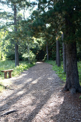 |
| Forest trail |
Now, a total of 85 tree species from over 600 places around the world can be found in the 268-square mile forest.
The drive took us along the lake and we stopped and walked along a quiet wooded trail. I was hoping for birds because it is venerated as a prime birding spot. But, no luck!
 |
| Forest floor |
Scott decided that it just wasn’t his cup of tea, so we turned around and headed back to Bakkagerði so that we could see it in better light.
That was a good call. We missed Hengifoss waterfall and time in Iceland's biggest forest. But, where we did go was so, so pretty.
Back to Bakkagerði
On the drive back, the sky brightened and we saw beautiful mountains and a glorious blue fjord.
 |
| Spectacular! |
And, we got to see the cute little town again.
 |
| Bakkagerði in good light; Photo: Scott Stevens |
When we stopped at one overlook, I was photographing some Common Eiders ...
 |
| Lots of Eiders in the water |
 |
| An active Harbor Seal |
It was obviously eating something as it dove and twisted and turned.
 |
| A Seal and his lunch |
I still haven’t positively ID’d the Seal's lunch, but I think it was a skate or a ray.
 |
| It's hard to identify the victim; perhaps a skate |
 |
| Rolling over |
In a country with few indigenous mammals, Harbor Seals are quite common. Of course, they are sea mammals. The Arctic Fox is the only indigenous land mammal.
We have seen Harbor Seals on every trip to Iceland and saw them in several places on this trip.
I have written about Harbor Seals in Iceland before.
You can read about them here.
 |
| Such a cutie (with big, dangerous teeth) |
That night in Egilsstaðir, we went out – in a different direction – looking for aurora again. We got a little bit before clouds moved in. But, it wasn’t as good as the night before.
 |
| Another chance for aurora |
Trip date: August 13-September 1, 2021
No comments:
Post a Comment