Sunday, March 22, 2015

Road Trip: Joshua Tree National Park

On the road again, California or bust. I left Flagstaff headed toward Joshua Tree National Park. It’s a 5+ hour drive that goes from high desert along the southern edge of the Grand Canyon (although not close enough to actually see the canyon) along the old Route 66. 

Arizona
I took a little detour off of I-40 along the real Route 66 that goes through Peach Springs, where I stopped for a picnic lunch. There is a road that goes to a beach along the Colorado River, but it requires a $30 tribal permit to drive, so I passed it by. The scenery was interesting and it was a good break from interstate driving.

Then, back to the Arizona/California border and the dry, hot Mojave Desert. 

Mojave Desert
I took the turn-off to Joshua Tree, only to find the road blocked by police cars … so back on to the interstate to the next exit, which was also blocked. Fortunately, the third was open. I never did find out why.

I arrived at Joshua Tree in the early afternoon, which gave me time to do an evening drive-through of the Park.

Joshua Tree!
The Park, at the juncture of the Mojave and Colorado deserts of California, is named after the very odd Joshua Tree, which looks like the child of a cactus and an oak tree, but is actually part of the orchid family. 

One big orchid!
The north part of the Park is in the Mojave and that's where you find the Joshua Trees. Fortunately, I had chosen to stay on the north side, primarily because there were hotels listed as close to a park entrance (there are three -- Yucca Valley, Twentynine Palms and Cottonwood Springs). 

Small ones look like cacti, big ones like trees
I was in Yucca Valley, which is closest to the "best" entrance. Twentynine Palms is also on the north side. Cottonwood Springs is on the south and has less interesting scenery and the town seems to be much smaller.

The Mormons named it Joshua tree because its shape reminded them of a Biblical story in which Joshua reaches his hands up to the sky in prayer.

Some of the trees, which are also called yucca palms, are huge. The really big ones look like trees; the short ones look like cacti.

They can be huge
The Joshua tree has a hairy bark made up of curly fibers ...

Up close, it looks more like a cactus
... with large flowers when it is blooming ...

A big, papery flower
The Park also features dramatic granite geological formations that look like something out of the Flintstones.

Interesting shapes
There are even scary rocks ...

Skull Rock
Anyway, after some evening photography, I went back, slept a few hours and then got up early to see sunrise.

Watching the sun rise
The trees and the rocks in the sun
Then, I ventured to the south side of the park, where the Joshua Trees fade out, and are replaced by forests of cacti ...

The cholla forest is amazing
... a huge area of chollas, often called "jumping chollas," because segments "jump" off and are carried by the wind to take root ...

At the right is a momma with her offspring
Although not as many, there were also ocotillos ... 

They have pretty red flowers
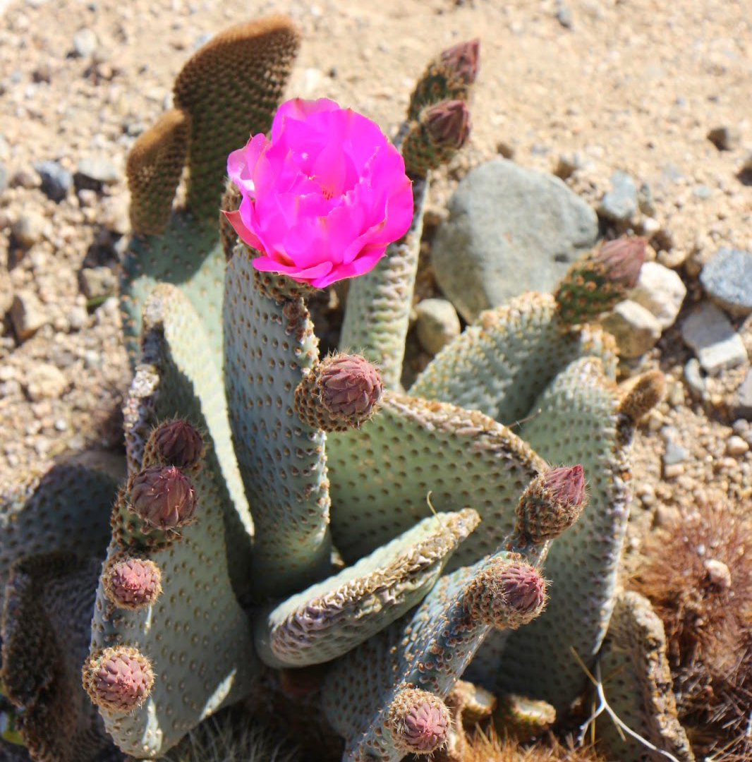
... and prickly pears as well ...

Brilliant blooms
I spent the next two days seeing the park in varying light ...

Morning
Mid-day
Afternoon
Evening
Night
... enjoying the interesting place names ...

Fun!
... seeing some Coyotes (I couldn't photograph because a Ranger scared them off) and a California Glossy Snake ...

Why did it cross the road?
... watching rock climbers ...

Up on the top
... and playing with my GoPro (watch here) ...

A beautiful Park
And, now, I have only eight more Parks to go.

A great visit

Trip date: March 7-14, 2015

Road Trip: Petrified Forest and Walnut Canyon

So, after I survived New Mexico Road #59 ...

It was a bit rough, but actually better than the way in to Chaco
... I headed to Flagstaff with a goal of stopping at Walnut Canyon National Monument along the way. But, the drive passed by the Painted Desert ...

The colors!
... and Petrified Forest National Park. 

And, more colors!
I had just been there last year, so there wasn’t really any reason to stop, except …

I recently decided that I would feature a photo of a different national park every day on Facebook until I had worked through all the parks for which I had digital photos (with an aim to scan photos in the future of the parks for which I had no digital files – or to go back to those parks). It was then that I discovered that I often visited parks and failed to get any pictures of myself at the park. And, I decided that I would always get a picture of myself in the future. Since Scott had given me a tripod for my birthday, this would become a little bit easier. Petrified Forest was one of those parks for which I had no pictures of myself. Since it is right off the Interstate, I decided to drop in a grab a few pictures ...

Magnificent
... including some of myself ...

Posing
Learning to do selfies
Of course, the “brief” stop prevented me from reaching Walnut Canyon before it closed and actually got me to Flagstaff well after dark. So, I decided to hit Walnut Canyon first thing in the morning, which, unfortunately, was 9 a.m. I mean, NPS people get up early, right? So, why do national monuments open so late? Anyway, I got up early and drove to the lovely high-mountain road that leads to the canyon. It was a snowy pine grove, so different from Chaco and Petrified Forest. I waited in a parking lot for a trail that was littered with the bones of a very large animal. 

 Probably an Elk
I wonder what was responsible. Coyote? Mountain Lion?

Walnut Canyon was one of the national monuments I thought I had visited years ago when I lived in Arizona. But, when I got there, I realized I had never been there. I have been so close so many times; I have no idea why I had never been there.

A snowy trail
Walnut Canyon is a very small national monument that features a large number of 800-year-old cliff dwellings on the sides of the canyon ...

Cliff dwelling
... and on an “island” of rock in the middle if the canyon ...

A few other people were on the trail now
There is a trail along the rim and one that goes down 240 steps and circles the “island” ... 

Nice trail
... with dwellings right along the path ...

You can get very close
It’s a good workout because the elevation at the rim is 6,690 ft. – just a smidge higher than my house.

The people who lived in Walnut Canyon were called the Sinagua, which is Spanish for “without water,” recognizing the high desert environment in which they lived. Before they built their homes there, there were seasonal inhabitants, but the Sinagua were the only people to live there fulltime. The cliff dwellings were built between 1125 and 1250 AD in shallow caves along the canyon walls. 

Overhang
It is not know why the Sinagua left after 100 years in the canyon, but it is believed they were assimilated into the Hopi culture.

Walnut Canyon is interesting not only because of the cliff dwellings, but also because of its diversity of plant life due to elevation and shade in the steep canyon. It combines desert and pine forest.

You can see dwellings all along the edge
I hiked the island trail alone because I was the first person to ascend. 

Selfie!
It was lovely and amazing. I still wonder why I had never been there before!


Trip date: March 7-14, 2015

Saturday, March 21, 2015

Road Trip: Chaco Culture National Historic Park

Another road trip? 

My kind of road
Why not? 

Scott had decided to go to Las Vegas and Death Valley with a friend to enjoy some warm weather and play a little golf. Why should I sit home when I could knock off another national park (and a few more national monuments)?

More places to check off
First, a word about that: Yes, I really do want to be able to say I have visited every national park. I am very close, so it really makes sense. I don’t think I’ll ever get to the every national monument/national seashore/national historic place/etc./etc. point because there are too many, they are constantly being added and – I just found out – some are not accessible. But, with only 59 national parks, the goal is within reach. At the beginning of the trip, I had nine to go.

Passports
So, I planned a road trip with my primary goal being Joshua Tree National Park in California. With all the cold and snow we’ve had in Colorado, I was also envisioning some downtime, lying by a pool in Arizona. But, I didn’t lay out a specific plan.

I headed out with my first stop planned: Chaco Culture National Historic Park in northwestern New Mexico. 

A remote Park
I have visited most of the NPS sites in New Mexico, by Chaco has always been just a bit too far. So, I made it a first goal.

Chaco is not easy to reach. I couldn’t leave until afternoon, so I drove from Colorado Springs to just north of Albuquerque for the night. As I drove, I left snow and gray and entered sunshine (still cold, but bright). I even worried that Chaco might be difficult to reach because the forecast was sub-freezing at night.

Luckily, the 135-mile drive was dry and sunny. Most is nice highway, but after the turnoff, there is eight miles of paved and 13 miles of dirt road. The last five miles was very rough, including crossing a wash that had a few inches of water running across it and a quarter-mile section that was so rutted, I had to carefully dive on the tops of the ruts. I should have taken a picture, but I was afraid that if I stopped, I would get stuck.

As a result, the park is relatively empty. And, when I arrived the weather was glorious – sunny, cool-turning-to-warm.

Chaco Culture National Historical Site is a partially excavated ruin of a major series of communities that were the center of the ancient Chaco culture about 1,000 years ago. 

Ancient ruins
The ten sites sit in the middle of Chaco Canyon ...  

A wide valley crossroad
... and, based on the more than 400 miles of carefully planned ancient roads leading into the canyon from all directions, this was the epicenter of a much broader civilization spread cross northern New Mexico. Six of the sites are situated along a nine-mile paved loop road and are easily walkable. 

Map: GORP
The others are fairly close and can be hiked to. Because I was on a mission, I didn’t really have time to hike, so I just visited the ones along the road ...

Una Vida 
Hungo Pavi
Chetro Ketl
Pueblo Bonito (the only fully excavated ruin)
Pueblo del Arroyo 
Casa Rinconada
The Chaco culture began in the mid-800s and lasted about 300 years. They used masonry techniques unique to their culture to build large, multi-room, multi-story structures. 

It was interesting to see the way they built walls ...

Brickwork
... and to see beams that are over 1,000 years old ...

Beams
Not to mention some of the striking natural features of the canyon ...

Amazing that this is still standing
Some buildings had hundreds of rooms; larger than any other settlements ever found.  Although there is evidence the buildings were planned from the start, some took decades – or even centuries – to build.  The oldest are Pueblo Bonito ...

An amazing site
and Una Vida …

Up on a hill
More recent are Hungo Pavi and Chetro Ketl ...

Different kinds of excavation
Many of the buildings are oriented to solar, lunar and cardinal directions and all the sites have multiple kivas. 

You can see two kivas
Although many are remarkably preserved, some have had to be shored up to protect them from further decay, some are surrounded by rubble ...

A variety of excavation styles
And, many remain unexcavated to protect them.

Because the site was a major gathering place, archeologists believe the buildings were more like public places than farms. 
Art in the way this eroded
Artifacts indicate that multiple clans converged and that the site is important to the development of the Navajo nation. They also believe climate change eventually lead inhabitants to move on to areas such as Mesa Verde to the north.

In addition to impressive ruins, there is also a walk along the back cliffs highlighting a number of petroglyphs.

Ancient messages
As I said, the park was not crowded – but, there were other people there. Some looked to be day-visitors like me and some were camping (I wondered how they got some of the vehicles down that road) and many were hiking. Still, I spent my time at most of the sites alone – except for the hawk that joined me at Chetro Ketl.

Red-tailed Hawk
When it came time to leave, I put my next destination in my GPS and headed back the way I came because my atlas indicated only one access road. I passed a road sign pointing the other direction and my GPS kept telling me to turn around. So, I asked the ranger, who indicated that there was another dirt road that was rough, but driveable. Despite the scary sign …

Okay .....
 … I took it. It was better than the road in and cut off quite a bit of time as I headed toward my next waypoint. My objective was to make it to Flagstaff, Arizona, for the night.


Trip date: March 7-14, 2015