 |
| Aialik Glacier |
Originally, our trip to Alaska was to end with the visit to Nome. But, the weather had turned for the better and we hadn't really done any ocean-related activities, so we extended our trip two more days and made arrangements to go to Seward.
On the first day, we took Major Marine's 6-hour trip through Kenai Fjords National Park.
 |
| Viewing the face of the Aialik Glacier on the Major Marine tour |
We stayed in Anchorage after returning late at night from Nome, so we had to get up early to drive to Seward. We got to see Turnagain Arm at sunrise ...
 |
| Sunrise on Turnagain Arm |
A Moose cow and calf in the misty willows ...
 |
| Morning Moose |
And, some very artful Trumpeter Swans ...
 |
| Trumpeter Swan feeding in the morning |
We have taken the Kenai Fjords trip many, many times and we usually do a nine-hour tour that goes to multiple glaciers. But, as the season comes to an end, the longer trips are no longer offered. This was the best option.
 |
| Map: Major Marine Tours (our tour was blue) |
You can purchase just the cruise or the cruise plus a buffet meal. A meal? Are you kidding me? Why would I want to waste valuable viewing and photography time eating?
Well, we did get a hot dog onboard, but we passed on the salmon and prime rib. That was plenty and didn't interfere with the great scenery.
When we got onboard, we discovered that we had an assigned seat. Whatever.
I have never had an assigned seat on one of these cruises, but it didn't really matter because I never sat down inside. At least we had a place to leave our camera bags.
I always spend all my time on deck, enjoying the scenery ... the birds ... and the animals ...
The cruise, narrated by a National Park Ranger, traveled from Seward through Resurrection Bay, where we saw one adorable Sea Otter almost as soon as we pulled away from the dock.
 |
| Sea Otter -- or Wilfred Brimley of the Sea |
Then we went around Cape Aialik into Aialik Bay to the foot of the Aialik Glacier.
 |
| Aialik Glacier |
Aialik Glacier is an actively calving tidewater glacier -- I'll get into what that is later. But, first, a little about the park (courtesy of Wikipedia and the National Park Service).
 |
| One of the Harding Icefield's 38 glaciers |
After decades of consideration, Kenai Fjords was named a National Monument in 1978.
Just two years later, it officially became a National Park with the passage of the Alaska National Interest Lands Conservation Act.
The original Park included 119,000 acres of "native selected lands," property -- most of it coastline -- that was taken out of federal ownership and conveyed to Alaskan Native Corporations.
The Park Service repurchased 30,295 acres of those lands in the 1990s, retaining subsistence rights on about 9,000 acres. This altered the original intent of the Park to include subsistence claims, previously unrecognized. Now, it is the only National Park in Alaska that doesn't offer subsistence rights to Natives.
The Park, which covers an area of almost 1,047 square miles on the Kenai Peninsula, contains the 300-square-mile Harding Icefield, largest of the four remaining icefields in the United States. By the way, all the U.S. icefields are in Alaska.
The Harding Icefield is the source of at least 38 glaciers, the largest of which is Bear Glacier and the oldest of which formed 23,000 years ago.
 |
| Bear Glacier |
The Harding Icefield covers 51 percent of the Park, but has declined 3 percent in the past 16 years. The most accessible glacier, and the only portion of the park accessible by road, is Exit Glacier, which I will talk about in a later post.
 |
| Exit Glacier |
The Park is named for the numerous fjords carved by glaciers moving down the mountains from the Icefield. The fjords are glacial valleys that have been submerged below sea level by a combination of rising oceans and subsiding land. The fjords are narrow and deep -- ranging from 600 to 1,000 feet deep. The most significant fjords include Aialik Bay (where we went), Harris Bay, McCarty Fjord and Nuka Bay.
 |
| The mouth of Aialik Bay |
The Park's highest point is an unnamed peak of 6,450 feet in the Kenai Mountains. The Park is bordered on the west by Kenai National Wildlife Refuge and on the south by Kachemak Bay State Park.
Kenai Fjords National Park protects the Harding Icefield, a narrow strip of forest between the mountains and the ocean and the coastline.
Although large, the Park is relatively small and accessible by Alaskan National Park standards. It ranks #17 in size among the 60 U.S. National Parks.
 |
| Kenai Fjords National Park |
Other Alaskan National Parks ranks? #9 Kobuk Valley, #7 Lake Clark, #6 Glacier Bay, #4 Katmai, #3 Denali, #2 Gates of the Arctic and #1 Wrangell -St. Elias. Kenai Fjords is only 8 percent the size of #1-ranked Wrangell-St. Elias.
It is the closest National Park to Anchorage, 130 miles away.
Most National Parks protect both natural and anthropological features, but Kenai Fjords has very few traces of early habitation. Park Service surveys have documented several village sites dated between 1200 AD and 1920 along the shoreline, although it is believed that erosion has removed a lot of evidence of early inhabitants. Plus, an earthquake in 1170 AD lowered the shoreline by about six feet, potentially inundating more sites.
 |
| I think this rock looks like a Muskox! |
The Park also encompasses several historical gold mines, including one that was active into the 1980s
The Park's landscape has been shaped by plate tectonics, with the Pacific Plate subducting beneath the North American Plate. The motion of the North Pacific Plate has left a mixture of rocks that originated elsewhere together with local igneous rock along the shoreline. The erosive power of the glaciers produces sediment as rock flour that colors the waters around the toes of glaciers, carrying minerals into the ecosystem that support phytoplankton, which in turn sustain larger animals.
 |
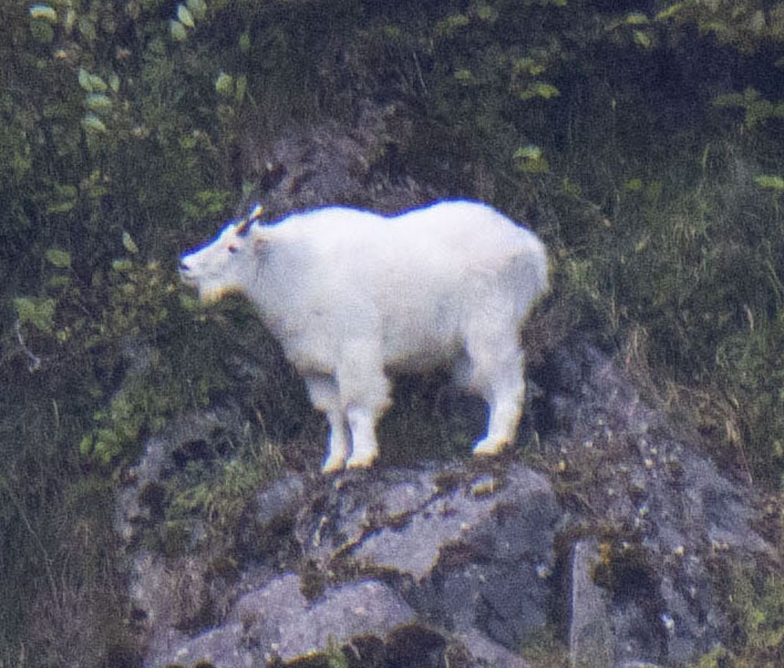
| Mountain Goat |
The Park is home to both land and marine mammals.
The land mammals we DIDN'T see include: Brown Bears, Black Bears, Moose, Wolves, Porcupines, Canadian Lynx, Coyotes, Beavers and River Otters. The ones we DID see were: Mountain Goats, Sea Otters, Harbor Seals and Steller Sea Lions.
Cetaceans found in the Park include: Humpback Whales, Fin Whales, Gray Whales, Minke Whales, Dall's Porpoise, Pacific White-Sided Dolphins and Orcas. We saw just Orcas. As if that's a "just."
 |
| Orca |
Birds that nest in this park include Bald Eagles, Peregrine Falcons, Black-Billed Magpies and Steller's Jays. Marine birds include Tufted and Horned Puffins, Common and Thick-Billed Murres and Marbled Murrelets.
 |
| Left: Horned Puffin; right: Tufted Puffin |
The weather for our trip was fabulous, so the views were incredible. Sometimes, the area is completely fogged except for around the glaciers, which can be clear even when the rest of the area is cloudy. But not today. It was sunny and bright with just some clouds for effect.
 |
| A perfect day |
The Aialik Glacier was amazing. When we first arrived, we passed through relatively few ice bergies and brash, although there was a fair amount near the glacier.
 |
| Ice bergies |
We noticed some Harbor Seals hauled out on some of the ice.
 |
| Harbor Seals |
And, when we looked harder, we saw a whole lot more.
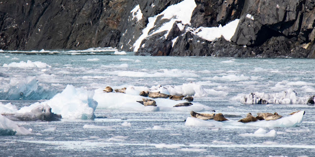 |
| Lots of Harbor Seals |
So, what is a glacier?
 |
| The face of the Aialik Glacier |
A glacier is a persistent body of dense ice that is constantly moving under its own weight. Glaciers form where the accumulation of snow exceeds ablation (melting and sublimation) over many years, often centuries.
 |
| Glaciers crush and push rocks down the mountains |
Glaciers slowly deform and flow due to stresses induced by their weight, creating crevasses, seracs and other distinguishing features.
They also abrade rock and debris from their substrate and push them along to create landforms such as cirques and moraines.
Glaciers form only on land and are distinct from the much thinner sea ice and lake ice that form on the surface of bodies of water.
 |
| The Kenai Mountains |
On Earth, 99 percent of glacial ice is contained within vast ice sheets (also known as "continental glaciers") in the polar regions, but glaciers may be found in mountain ranges on every continent.
Glaciers cover about 10 percent of Earth's land surface, with the largest expanses in Antarctica, Greenland and Patagonia.
Glacial ice is the largest reservoir of fresh water on Earth. Glaciers store water as ice during the colder seasons and release it as meltwater when the weather is warm. Within high-altitude and Antarctic environments, the seasonal temperature difference is often not sufficient to release meltwater. However, this is changing with global warming.
 |
| A tour boat approaches the Aialik Glacier (notice how little lice there is in the water) |
In fact, because glacial mass is affected by precipitation, mean temperature and cloud cover, glacial mass changes are considered among the most sensitive indicators of climate change and are a major source of variations in sea level.
Glaciers often appear blue because water molecules absorb other colors more efficiently than blue and because the ice in glaciers lacks bubbles. Air bubbles, which give a white color to ice, are squeezed out by pressure increasing the density of the ice. Glacial ice acts like a filter on light, and the more time light can spend traveling through ice, the bluer it becomes.
 |
| Glaciers appear white and blue with obvious infusions of gray and brown rock |
The word "glacier" is French derived from the Latin "glaciēs," meaning "ice." There are several type of glaciers.
 |
| A cirque in the cloud |
Cirque glaciers form on the crests and slopes of mountains.
A glacier that fills a valley is called a valley glacier, an alpine glacier or mountain glacier.
A large body of glacial ice on a mountain, mountain range or volcano is termed an icecap or icefield, as long as it does not exceed 19,000 square miles.
Glacial bodies larger than that are ice sheets or continental glaciers.
Portions of an ice sheet or cap that extend into water are called ice shelves. Narrow, fast-moving sections of an ice sheet are called ice streams.
Tidewater glaciers (I told you we would get there) terminate in the ocean. Most glaciers in Southeast Alaska are tidewater.
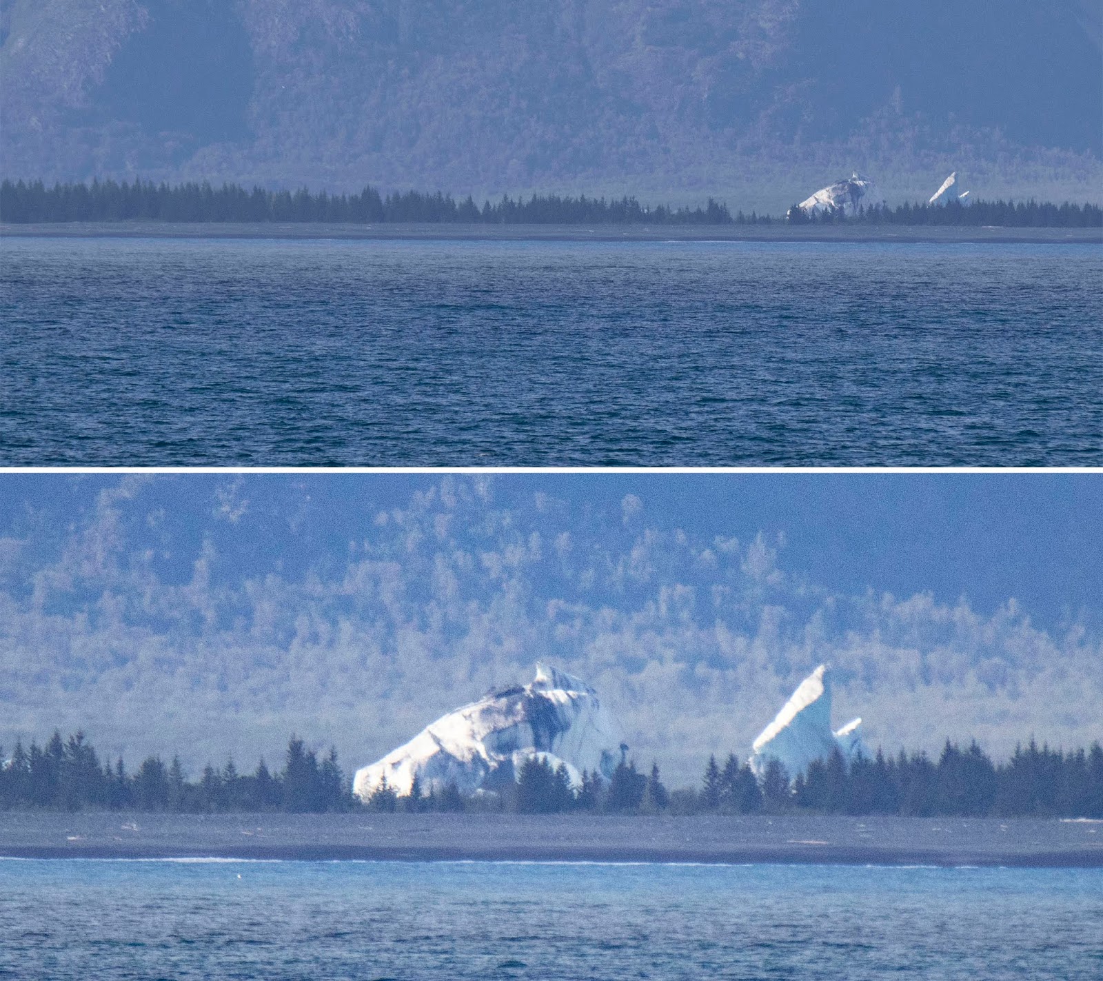
 |
| Distant icebergs |
As the ice reaches the sea, pieces break off, or calve, forming icebergs. Most calving is above sea level, often with tremendous impact as the iceberg strikes the water. When the ice breaks into small pieces, it forms bergies and brash. Tidewater glaciers advance and retreat and are less affected by climate change than other types of glaciers.
Following end of the Little Ice Age around 1850, glaciers around the Earth have retreated substantially. A slight cooling led to the advance of many alpine glaciers between 1950 and 1985, but since then glacier retreat has increased.
Glaciers move, or flow, downhill due to gravity and the internal deformation of ice. Ice behaves like a brittle solid until its thickness exceeds about 160 feet and then the flow becomes "plastic." Often, layers of glaciers move at different speeds and sometimes meltwater underneath the glacier speeds its downhill progress.
If two rigid sections of a glacier move at different speeds and directions, they break apart, opening a crevasse. Crevasses are seldom more than 150 feet deep, but can be 1,000 feet or more. Intersecting crevasses can create isolated peaks in the ice, called seracs.
 |
| Glaciers reshape the land |
A few glaciers have periods of very rapid advancement called surges caused by failure of the underlying bedrock, pooling of meltwater at the base of the glacier or the accumulation of mass beyond a critical "tipping point." After the sudden acceleration of the surge, the glaciers return to their previous speed.
Abrasion occurs when the ice and its load of rock fragments slide over bedrock and function as sandpaper, smoothing and polishing the bedrock below. The pulverized rock this process produces is called rock flour. Abrasion leads to steeper valley walls and mountain slopes in alpine settings, which can cause avalanches and rock slides, adding even more material to the glacier.
Glacial moraines are formed by the deposition of material from a glacier and are exposed after the glacier has retreated. They usually appear as linear mounds.
 |
| Medial Moraines look like highways. |
Terminal or end moraines form at the foot or terminal end, of a glacier.
Lateral moraines form on the sides of the glacier.
Medial moraines form when two glaciers merge and their lateral moraines coalesce to form a moraine in the middle of the combined glacier.
Before glaciation, mountain valleys have a characteristic "V" shape, produced by eroding water. During glaciation, these valleys are often widened, deepened and smoothed to form a "U"-shaped glacial valley or glacial trough. If a glacial valley runs into a large body of water, it forms a fjord.
Enough?
 |
| Yes, enough! |
OK, back to the Aialik ...
In front of the glacier were a couple of stand-up paddleboarders. Seeing them really gives perspective on how big the face of the glacier actually is.
 |
| The glacier face dwarfs the paddleboarder |
Knowing that a large piece could peel off the glacier at any time makes me wonder about getting so close, but to each his own.
When we first arrived, the glacier had a few small icefalls and made a lot of cracking and popping noises.
 |
| A small icefall |
Then, it happened. A long protracted calving that dropped off huge pieces of the glacier is a series of cracks and falls.
 |
| Down it comes |
Ultimately, a piece about the size of a two-to-three story building fell off ...
 |
| A bigger piece |
... leaving a huge concave cavity and creating a fairly large wave ...
 |
| Wowza! |
Fortunately, the paddleboarders got out of the way. Our captain even had to reposition our boat to prevent excessive rocking.
 |
| The wave approaches |
To see Scott's video of the event, click here.
 |
| It was spectacular |
We probably stayed at the glacier longer than normal because the show was so good. And, then it got better. On the way back, we encountered a pod of Orcas, including baby Orcas.
 |
| Orcas |
And, that will be my next post.
Trip date: August 17-September 4, 2018


No comments:
Post a Comment