 |
| Muskox in Nome |
Another destination on our "out of the way" places was Nome. The flight there was magnificent -- clear with a gorgeous view of the rugged mountains between Anchorage and Nome.
 |
| Map: Google Maps; Lower left photo: Scott Stevens |
Once again, the tour options -- this time with Explore Tours (operating the Nome Discovery Tour) -- included a fly-up-and-back trip or an overnight trip. We selected the latter, that included a tour and a rental car (a nice red Jeep). I highly recommend this tour.
 |
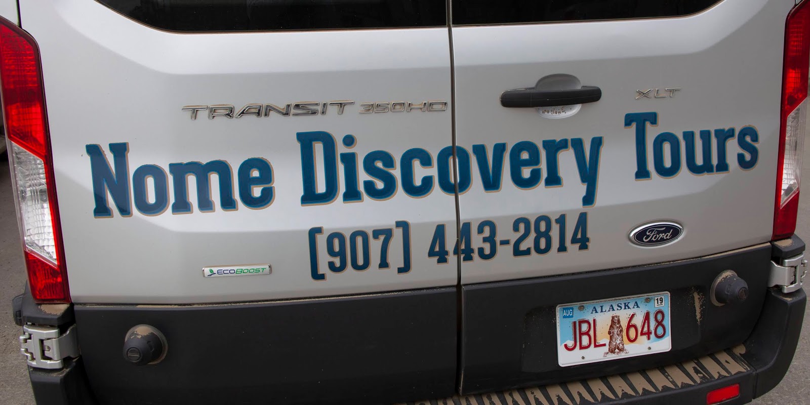
| Richard's company, Nome Discovery Tours, is now owned by Explore Tours |
The tour guide is a truly colorful figure. Richard Beneville, a gay alcoholic Broadway hoofer, moved to Alaska almost 30 years ago to sober up. He started out in Utqiaġvik (then called Barrow) working in a store that sold a wide variety of items from groceries to appliances. Hear him talk about it here ...
Richard ended up in Nome, where he did indeed kick the habit. For years, he developed programs for the schools in Nome. Now he's the mayor. Drawing on his oversized personality and acting skills, he began running tours of his adopted hometown and he eventually sold his successful business to Explore Tours.
 |
| "Hello Central! is on his van; Photo: Scott Stevens |
Richard has three signature phrases. "Hello, Central!" harkens back to Broadway and is Richard's exclamation for just about anything.
He refers to every child he meets as "My hero."
It is obvious he loves the kids in town and they love him. Oh, and he calls the locals "Nomans."
Richard met us -- and our tour mates, a mother and 11-year-old daughter, at the airport.
 |
| Scott arrives in Nome |
He immediately rushed us to a big field near the Nome hospital to see the town's favorite animals, a small herd of Muskoxen.
Muskoxen
 |
| A male Muskox |
The Muskox is an Arctic hoofed mammal known for its thick coat and for the strong odor emitted during the seasonal rut to attract females.
Its Inuktitut name "Umingmak" translates to "bearded one." Muskoxen live primarily in Greenland, the Northwest Territories and Nunavut, with small introduced populations in the Yukon, Scandinavia, Siberia and Alaska.
 |
| A small herd |
The Muskox's ancestors are believed to have migrated from Siberia to North America between 200,000 and 90,000 years ago.
It is believed a form of Muskox previously occupied Alaska when Alaska was connected to Siberia.
It was isolated periodically from the rest of North America between 250,000 and 150,000 years ago.
Along with the Bison and the Pronghorn, the Muskox was one of a few species in North America to survive the Pleistocene/Holocene extinction event and live to the present day.
Muskoxen stand 4-5 feet high at the shoulder, with females measuring 4.4-6.6 feet in length and larger males 6.6-8.2 feet. Both male and female Muskoxen have long, curved horns. Adults range from 400 to 900 lbs. The thick coat and big head suggests a larger animal than the Muskox truly is; the Bison, to which the Muskox is often compared, can weigh up to twice as much.
 |
| Muskoxen have long, soft hair |
The Muskox's coat, a mix of black, gray and brown, includes long guard hairs that reach almost to the ground. The wool, qiviut, is highly prized for its softness, length and warmth, with yarn prices ranging from $40 to $80 per ounce.
 |
| An older and younger bull |
Males and females both have horns that grow throughout their lives, although the males' are larger. Richard told us that the mature males have curling horns with black tips; the younger males' horns don't curl and are not tipped, making them look a lot more like domestic cattle.
Although all the ones we saw were placid and slow-moving, a Muskox can reach speeds of almost 40 mph. Their life expectancy is 12-20 years.
The original Alaskan population was wiped out in the late 19th or early 20th century by excessive hunting, augmented by climate change.
 |
| These Muskoxen were in town |
The U.S. Fish and Wildlife Service introduced Muskoxen onto Nunivak Island in 1935 for subsistence hunting. Other reintroduced populations are in Arctic National Wildlife Refuge, Bering Land Bridge National Preserve, Yukon's Ivvavik National Park, a wildlife conservation center in Anchorage, Aulavik National Park in Northwest Territories, Kanuti National Wildlife Refuge, Gates of the Arctic National Park and Whitehorse, Yukon's wildlife preserve.
 |
| Such beautiful animals |
There have been at least two domestication attempts. In the 1950s, an American researcher and adventurer captured Muskox calves in Northern Canada for relocation to Vermont, where they grew up but were plagued by parasites and diseases.
 |
| Captive Muskox calves in Palmer, 2013 |
The surviving herd was eventually relocated to a farm in Palmer, Alaska, which has been successful since the mid-1950s.
The farm is attempting to domesticate the feisty animal to make qiviut production possible.
Currently, shed qiviut is collected from bushes and twigs.
During the summer, Muskoxen live in wet areas, moving to higher elevation in the winter to avoid deep snow. Muskoxen eat grasses, Arctic willows, woody plants, lichens and mosses. They live in herds of 12-24 in the winter and 8-20 in the summer.
 |
| This herd had nine-12 members and moved about town while we were there |
Their primary predators are Arctic Wolves, which account for up to half of all mortality for the species. Other occasional predators, likely mainly predators of calves or infirm adults, can include Grizzly and Polar Bears.
We spent a fair amount of time photographing these magnificent animals, pausing just a moment to take a picture of a Northern Harrier soaring above us.
 |
| Juvenile Northern Harrier |
Then, we headed out on our tour. The next day, we retraced some of the same areas (after all, Nome is very small). So, let me tell you a little about the town.
Nome
 |
| Nome from the air |
With a population of just under 4,000, it’s hard to believe that Nome
was once the most-populous city in Alaska. Exceptionally
remote, it is accessible only by air or sea.
Inupiat hunted for game on the west coast of Alaska from prehistoric times and there was an Inupiat settlement at Nome called Sitnasuak before the the arrival of white men.
Nome first appeared on the 1900 U.S. Census as an unincorporated
village of 12,488 residents. At the time, it was bigger than Skagway and Juneau. It was formally incorporated as a city in
1901. By 1910, it had fallen to 2,600 residents. And, by 1920, it dropped to just
852 residents.
Why the dramatic change in population?
Gold!
 |
| "Three Lucky Swedes" |
In the summer of 1898, the "Three Lucky Swedes," Norwegian-American
Jafet Lindeberg and two naturalized American citizens of Swedish birth, Erik
Lindblom and John Brynteson, discovered gold on Anvil Creek.
By 1899, the area was organized as a mining district. Then,
gold was found in the coastal sand, spurring an even bigger gold rush. About 1,000 prospectors a day came by steamship from Seattle and
San Francisco and built a tent city.
Population may have surged as high as 20,000. It was the last
great gold stampede in the history of the American West.
Wyatt Earp even stayed in Nome for a
while, building the Dexter Saloon with partner Charles E. Hoxie. It was the city's first two-story wooden building and it is still there.
During the gold rush, the U.S. Army policed the area, and every
fall expelled anyone who did not have shelter or the resources to pay for
shelter for the harsh winter.
 |
| Nome during the gold rush; Photo: RareGoldNuggets.com |
By 1910, most of the mines were depleted and the rush was over.
Fires in 1905 and 1934 and violent storms in 1900, 1913, 1945 and
1974 destroyed much of Nome's gold-rush-era architecture. But, you can still
find abandoned mining dredges and you can still pan for gold along the beach.
 |
| Gold dredge |
In addition to gold, Nome is famous for the “serum run.” In the
winter of 1925, a diphtheria epidemic raged among Alaska Natives and a territory-wide blizzard prevented the
delivery of a life-saving serum by airplane from Anchorage. Instead, a relay of
dog sled teams delivered the serum. In 1973, Nome became the ending point of
the 1,049-mile Iditarod Trail Sled Dog Race; using the same route for the end as
the serum run.
 |
| Nome serum run, 1925 |
Set at the tip of the Seward Peninsula on the Bering
Sea, Nome has 350 miles of roads but is not connected by land to any of Alaska’s
major cities. With very few trees, Nome is set on a wide expanse of rolling
tundra, clear rivers, expansive marshes and wide sandy beaches.
 |
| Left: Safety Bridge view; right: Teller Road |
Nome's climate is subarctic, with long, very cold winters and short, cool
summers. However, like Utqiaġvik, conditions in both winter and summer are
moderated by the city's coastal location: winters are less severe than in the
Interior, and conversely, summers are lukewarm.
 |
| St. Joseph's Church |
Average highs are below freezing from late October until late
April, and the average first and last dates of freezing lows are August 30 and
June 9, respectively, meaning that there are only 81 days without freezing temperatures.
Snow averages 76 inches per
season, with the average first and last dates of measurable snowfall being
October 4 and May 16.
Bering Sea water temperatures around Nome vary during
summer from 34°F to 48°F and from −2°F to
10°F in winter.
The population of Nome is a mixture of Inupiat Eskimos and
non-Natives. Although some employment opportunities are available, subsistence
activities are prevalent in the community.
The station was named for United States Senator and Secretary of the Interior Henry Moore Teller in 1892. Richard said that there are still Reindeer in the area.
The town of Teller was established in 1900 after the Bluestone Placer Mine discovery 16 miles to the south. During the boom years in the early 20th century, Teller had a population of about 5,000 and was a major regional trading center.
Today, Teller is an Inupiat village that depends on subsistence hunting and fishing.
 |
| Exploring the tundra |
We only drove the first part of the road, listening to Richard's stories and learning about tundra, a type of biome where the tree growth is hindered by low temperatures and short growing seasons.
"Tundra" comes through Russian from the Kildin Sami word тӯндар, meaning "uplands" or "treeless mountain tract."
Tundra vegetation is composed of dwarf shrubs, sedges and grasses, mosses and lichens. The word "tundra" usually refers only to the areas where the subsoil is permafrost, frozen 10 to 35 inches down, making it impossible for trees to grow. During the summer, the permafrost thaws just enough to let plants grow and reproduce, but because the ground below this is frozen, the water cannot sink any lower and lakes, bogs and marshes form.
 |
| Fall tundra |
The biodiversity of tundra is low: 1,700 species of plants, 48 species of mammals and only a few fish species. However, millions of birds migrate through the tundra every year, attracted the marshes. Unfortunately, we were not there for migration.
A severe threat to tundra is global warming, which causes permafrost to melt. About one third of the world's soil-bound carbon is in taiga and tundra areas. When the permafrost melts, it releases carbon in the form of carbon dioxide and methane, both of which are greenhouse gases.
Our tour included spending quite a bit of time walking around in the tundra, looking at the wide variety of berries -- predominantly blueberries, crow berries, cranberries and soap berries -- that grow wild.
 |
| Tundra plants |
The landscape was mountains covered with beautiful gold, orange and red tundra punctuated by interesting rock formations and some marshy lakes.
 |
| Cabin Rock along Teller Road |
We also saw a number of birds.
I saw some Red-Throated Loons (see the red throat?), one of the birds I the really wanted to see ...
 |
| An adult and a juvenile |
Unfortunately they were always far away and the light wasn't great ...
 |
| Flap |
I also saw an adult and juvenile Northern Shrike balanced on a wire ...
 |
| A tale of two Shrikes |
It was a beautiful drive.
 |
| Left: a sled dog's grave; right: a rock outcrop |
Nome-Council Road
 |
| Me at the Train to Nowhere |
Next we traveled down the road toward Council, which travels east flanked by the ocean on one side ...
 |
| Nome beach; photo: Scott Stevens |
... and Safety Sound on the other ...
 |
| Safety Sound |
Then, it curves to the northeast toward the abandoned town of Council on the Niukluk River.
 |
| Map: Google Maps |
Built in 1897-98 when gold was discovered near Ophir Creek, Council may have had as many as 15,000 inhabitants during the early years. But, residents soon left to work larger gold discoveries near Nome around 1900.
During the summer, Council is now used as a fish camp and a recreational location for residents of Nome and White Mountain.
 |
| Abandoned house along the road |
Nome-Council Road is closed during winter. Regardless, because Council is the nearest site to Nome that has trees, some Nome residents travel to Council in winter to cut spruce Christmas trees.
Council first appeared on the 1910 U.S. Census as Council City, although it was an unincorporated village. In 1920, the name was shortened to Council.
It did not appear on the 1930 census, but returned again in 1940 and 1950.
It did not appear again until 1990 when it was classified an Alaska Native Village Statistical Area. It has reported a population of zero in 2000 and 2010.
 |
| Nome-Council Road |
We went as far as the "Train to Nowhere," which is situated in the middle of a blazing orange marsh.
 |
| Train to Nowhere |
The three steam locomotives from the 1880s are abandoned where they were toppled by a storm over 100 years ago.
Investors from Chicago had a plan to connect Nome to the hard rock mines in Council via a railroad that would eventually go all the way south to Vancouver, B.C. In 1903, a steamer from Seattle delivered two locomotives -- circa 1881 and 1886 -- that had been retired by the New York Elevated Rail System. A third locomotive, of similar age, arrived the following year. The steamer also delivered box cars, flat cars, 51 miles of track, railroad ties and lumber for trestles, offices, housing and a machine shop.
 |
| Abandoned equipment |
Workers completed about 10 miles of main line and laid out a town site that soon boasted five saloons, six restaurants and other businesses. Then the rush was over. Construction stopped in 1906, with only 35 miles of track in place. A storm then toppled some of the cars and washed out the track. Now there are only the rusting locomotives and scattered equipment.
Along the road, we also encountered another field with just the barest outline of mound dwellings that used to be there. Unlike those in Utqiaġvik, these structures were supported by driftwood rather than whale bones. Because of its location directly on the Bering Sea, whaling was never a big part of life in Nome.
 |
| Mound field |
There are, however, whales, as evidenced by the dead Minke Whale lying on the beach.
 |
| Dead Minke Whale |
I mentioned earlier that the marsh was a blazing orange. All the photos look like they have been doctored, but they have not. Nome may have no trees, but it certainly has a brilliant fall -- with the gorgeous marsh grasses ...
 |
| Nome marshes |
... and the profusion of tundra plants and berries ...
 |
| Tundra plants |
We traveled up and down the Council Road a number of times where we saw ...
Ocean views ...
 |
| Angry-looking sea |
Harbor Seals near the Safety Bridge ...
 |
| Looking at us |
Tundra Swans ...
 |
| Lots and lots of Tundra Swans |
A very cooperative Red-Necked Phalarope ...
 |
| It was spinning around |
Such a pretty bird ...
 |
| Pretty back colors |
It even gave me a good look at its wings ...
 |
| Pretty wing feathers |
Common Loons ...
 |
| Preening |
A Dunlin ...
 |
| A graceful shorebird |
A hunting Peregrine Falcon ...
 |
| Expert hunter (but we didn't see it catch anything) |
Green-Winged Teals ...
 |
| They have to fly for you to really see the green |
Pelagic Cormorants ...
 |
| In the water |
Canada Geese ...
 |
| As usual, flying in a line |
Glaucous Gulls ...
 |
| A young one |
Red-Breasted Mergansers ...
 |
| Females |
A Brant ...
 |
| Just one |
Common Eiders ...
 |
| Females and ducklings |
And, of course, Muskoxen ...
 |
| Thrilled to see us |
We stopped twice at the Safety Roadhouse, a rustic tavern that is open in the summer and then again for several weeks in March, when it serves as the final checkpoint for the Iditarod Trail Sled Dog Race.
 |
| Safety Roadhouse |
It's one of those funky places adorned with dollar bills and garage-sale furniture.
 |
| Left: Safety Roadhouse; right: Iditarod marker |
Very Alaskan.
Dredges
 |
| Left: old dredge bucket; right: abandoned dredge |
We also saw several abandoned gold dredges. These are large, multi-story machines that use water to extract gold from sand, gravel and dirt. Most of the ones in Nome were built in the 1900s, but there are some newer ones that are still working.
The dredge uses steel scoops on a circular, continuous "bucketline" at the front end that digs up dirt. The scooped material is then dumped on a rotating steel cylinder that carries away rocks and dumps these tailings behind the dredge. Holes in the cylinder allow smaller material including gold to fall into a sluice box to be sorted.
 |
| Gold dredge from the air |
The basic concept is that the gold in sand or soil will settle to the bottom of the sluice box because gold is heavy and dense. The dirt, sand and rock washes away, leaving the gold behind. The original methods to perform placer mining involved gold panning, sluice boxes and rockers to wash sand, gravel and dirt away. Gold settles to the bottom of the pan, or into the bottom of the riffles of the sluice box. The gold dredge is the same concept but on a much larger scale.


No comments:
Post a Comment