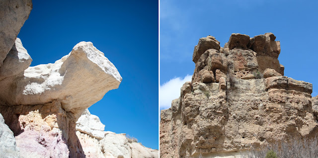
Back in 2016, I blogged about a places I had just discovered and have now been to multiple times. So, I thought it might be time to provide some more information on Paint Mines Interpretive Park. Plus, I have been to Castlewood Canyon State Park many times and have mentioned it only in passing in my blogs.
Paint Mines Interpretive Park
My first blog about Paint Mines is here. This past May, I visited with my sister and did a brief hike through the Park.
Named for colorful clays that Native Americans collected to make paint, the Park is one of the most unique open spaces in El Paso County, Colorado. The area is in the middle of some nondescript prairie with a few rolling hills. First, all you see is grass and, then, in a hard-to-see depression are exposed rock formations composed of brightly colored bands of clay and oxidized iron compounds. If you don't get close, you won't even see it.
 |
| Surprise! |
Paint Mines is located near the small town of Calhan and, in addition to being a Park, it's an archeological district.
The Park's 750 acres contain grassland, wetlands and badlands dotted with geological formations of hoodoos, colored clay and sandstone-capped spires.
 |
| Hoodoos |
The diverse ecological system attracts Coyote, Mule Deer, birds, lizards, Jack Rabbits and desert rodents.
 |
| Mule Deer at the top |
Paint Mines has four miles of trails that rise over 500 feet in elevation.
 |
| A wide, well-maintained trail |
There is good parking, restrooms, interpretive signage and overlooks. Rangers often give guided walks.
 |
| The overlooks give a good view |
 |
| Cody Complex arrowheads: arrowheads.com |
 |
| Stunning colors |
Selenite was used for arrowheads. The channels between formations were used to herd bison into a gulch where they could be easily hunted with bows and arrows.
 |
| A narrow passageway |
In the 1800s, Euro-American people settled in the Park property to ranch.
 |
| Calhan, 1910 |
It's a cool spot that is good for a quick look or leisurely hike. It's hot in the summer and can be quite windy. I have gone mainly mid-day because of schedule, but sunrise and sunset will pop up the colors.
 |
| Sunblock and water are necessary |
Castlewood Canyon State Park
Located just south of Franktown, Colorado, Castlewood Canyon is also another place that just seems to suddenly appear in the middle of rolling prairie.
 |
| Castlewood Canyon State Park |
 |
| Cherry Creek |
The up-to-400-foot-deep Canyon, created by Cherry Creek, can be viewed from multiple overlooks.
 |
| You don't have to get in the Canyon for good views |
The Park has 15 trails, ranging from 1/4 mile to 4 miles, totaling 12.9 miles. Some are on the rim and some go down to the Creek.
 |
| Waterfalls on Cherry Creek |
Castlewood Canyon State Park comprises 2,136 acres with elevations ranging from 6,200 to 6,600 feet.
The diverse Park emcompasses grasslands, shrublands, riparian, foothills-conifer and exposed caprock.
 |
| Pikes Peak from the Park |
 |
| Turkey Vultures |
Oh, and about those Leopard Frogs: Yes, you will hear them (lots of them!) at Castlewood Canyon. Will you see any? No matter how hard you try? I don't think so. But, there is a good variety of birds.
A day-use Park open from sunrise to sunset, Castlewood Canyon has two miles of paved roads, restrooms (handy when making the drive from Fort Collins to Colorado Springs) and some nice picnic areas.
 |
| A beautiful Park |
The natural amphitheater and the Bridge Canyon Overlook gazebo perched on the edge of the canyon are also used for weddings or other outdoor ceremonies.
 |
| Bridge Canyon |
The Park has some interesting history, too. In 1933, the Castlewood Canyon Dam built in 1890 collapsed following heavy rains, resulting in a 15-foot wall of water rushing down Cherry Creek to Denver 15 miles away.
 |
| The broken dam |
Remnants of the homestead, the dam and the flood damage can be seen in the Park.
 |
| Part of the old dam |
These two Parks really underscore the diversity of landscape close to my house.
 |
| Paint Mines and Castlewood Canyon: pretty! |


No comments:
Post a Comment