We booked a campsite at Madeline Island, which is the only Apostle that is not part of the park. Madeline has both a state park and a town park on it. Madeline Island was lovely --perhaps Scott's favorite place on the whole trip because of the magical green woods.
 |
| Green, green, green |
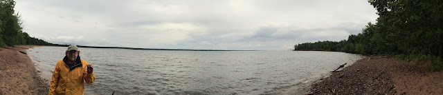
The gateway to the Apostle Islands National Lakeshore is Bayfield, Wisconsin, which sits right on Lake Superior. It houses a Visitors Center and a city wharf where tours and the ferry to Madeline Island dock. It's a pretty little town with many lovely Victorian houses and a number of large sandstone buildings, since the islands were the source of much of the sandstone used in the Midwest during the early 1900s.
 |
| Bayfield, Wisconsin |
 |
| The ferry; Photos: Scott Stevens |
The ferry isn't cheap, so the cost should be taken into consideration if you plan to stay on Madeline Island. It was $76 roundtrip for the car and trailer; $51 for just the car.
We were in such a hurry to get to Madeline, we didn't stop at the first Visitors Center we passed -- at Little Sand Bay northwest of Bayfield. We never made it back there, but I understand most of what is to see there is best seen by kayak or, in the winter, on foot from the frozen lake. This is the site of Apostle Island's famous ice caves, which form when wind repeatedly blows lake mist again sandstone cliffs, forming a dramatic overhang of ice.
 |
| In winter; Photo: Department of the Interior |
I wish we had been able to kayak in the sea caves, but the water was fairly rough while we were there, so that wasn't going to happen.
 |
| Sea Caves; Photo: National Park Foundation |
 |
| Apostle Islands |
Primitive boat-in camping is offered on 18 of the 21 islands. Of course, we opted for the more civilized camping at Big Bay Town Park, which has flush toilets and showers.
Apostle Islands National Lakeshore has more lighthouses than any other National Park Service area (eight historic towers on six islands). We saw only two of them ...
 |
| Raspberry Island |
 |
| Long Island |
The island is not very developed. It has a small town (LaPointe) with a few stores and restaurants (not a lot of culinary choices), the dock, an elementary school and a post office.
 |
| LaPointe |
 |
| Scott on a cloudy day |
 |
| A trail |
The Anishinabe, Ojibwe and Chippewa were the first inhabitants of the Apostles. French explorer Étienne Brûlé visited Madeline about the same time as the Pilgrims landed at Plymouth Rock.
Five years later, Jesuit Father Claude Allouez and Father Jacques Marquette arrived and established a mission at LaPointe.
For the next 150 years. Madeline was an outpost for fur traders.
 |
| Mushrooms |
Madeline Island is named after Madeleine Cadotte, the daughter of Anishinabe Chief White Crane. She took her French name when she married fur trader Michael Cadotte.
It was rainy when we walked around through the woods the first day, which, I think, added to its appeal.
It was also buggy (mosquitoes!), which didn't add any appeal!
The walk had beautiful trees and ferns. But, one of the highlights of the parts of the trail that went through the forest was the myriad types of mushrooms, lichen and fungus growing on the ground and the logs. There were multiple shapes, sizes and colors, some truly unusual.
The Bayview portion of the trail was one of the most impressive parts of the Lake Superior lakeshore we saw.
It had lots of sandstone outcroppings and even a few small sea stacks. The outcroppings weren't as tall and impressive as the ones we had seen a few years ago at Pictured Rocks National Lakeshore, which is on the other side of Lake Superior in the Upper Peninsula of Michigan. But, they were pretty.
While we did see one sea stack ...
The walk had beautiful trees and ferns. But, one of the highlights of the parts of the trail that went through the forest was the myriad types of mushrooms, lichen and fungus growing on the ground and the logs. There were multiple shapes, sizes and colors, some truly unusual.
The Bayview portion of the trail was one of the most impressive parts of the Lake Superior lakeshore we saw.
It had lots of sandstone outcroppings and even a few small sea stacks. The outcroppings weren't as tall and impressive as the ones we had seen a few years ago at Pictured Rocks National Lakeshore, which is on the other side of Lake Superior in the Upper Peninsula of Michigan. But, they were pretty.
 |
| Interesting outcrops |
Although we heard lots of squirrels and birds chirping, we didn't see many animals.
 |
| Red-eyed Vireo |
Of course, water is a big, big part of Madeline Island. Water constantly crashes against (and under) the outcroppings -- often creating large waves and little temporary waterfalls. The first day we walked, we saw some teenagers jumping from some of the cliffs and swimming. Plus, we saw a couple of kayakers. Although the pictures don't really show it, it was a little rough on the lake, so kayaking might have been challenging. Still, it looks like a great way to explore the shore.
 |
| Great shoreline |
As I said, we spent much of our first afternoon at Big Bay State Park. We also went back the next afternoon to see more.
 |
| Birch log |
Because it was a little rainy, we ate dinner in LaPointe rather than cooking at our campsite. We ate at the Beach Club, a small seafood restaurant by the docks. It was a casual place where you ordered at a window and then they brought the food to you. I had some peel-and-eat shrimp -- not very Wisconsiny, but pretty darn good.
The highlight of the evening, however, was the sunset -- definitely the best one of our trip.
 |
| Incredible sunset |
The next morning, we headed back over to Bayfield on the ferry for a boat tour of the Apostle Islands. Since it's another water-based park, touring by boat seemed a necessity. This tour was conducted by a Apostle Island Cruises, a concessionair (unlike the NPS-conducted tour at Voyageurs). We took the "grand Tour." I must say, it wasn't that grand.
 |
| The boat tour |
There were so many people taking the tour, they used two boats instead of one. We were allowed to select which boat we wanted to take and we opted for one that they usually use on the shipwreck tour. It was out plan to stand on the front deck, so we were disappointed to find that there was no access to that deck. So, we had to stand on the back.
The three-and-a-quarter-hour tour simply tried to cover too much. It has a 55-mile roundtrip route, which means that the boat roars along most of the time. Too fast for great photography. Too fast for actual comfort.
Plus, most of the islands look pretty much like the other islands. It makes you wonder why we had to try to see so many.
 |
| Manitou Island |
One of the "highlights" was Manitou Island, the site of an old fish camp that is manned by a volunteer (who appears to just sit there) and can be visited by water taxi or private boat. We just zoomed past.
 |
| Native demonstration |
Another was Raspberry Island, which does have a very pretty (but not spectacular) lighthouse. The Great Lakes lights just don't tend to be the tall, dramatic structures your brain conjures when thinking "lighthouse."
 |
| Lighthouse |
The promised wildlife included an (unoccupied) Eagle aerie, some Gulls and a solitary Loon ...
 |
| Not much wildlife |
 |
| Sea stack |
 |
| Photo: emaze.com |
 |
| Green water |
 |
| Murky |
If you were considering a glass-bottom boat tour to see shipwrecks, I would check water clarity in advance.
The Grand Tour on Apostle Islands Cruises was $40 per person. For $360 or more you can book a private tour and the company also offers water taxi service to many of the islands. In retrospect, I think we would have enjoyed taking the water taxi to one or two islands instead of trying to see it all on the tour.
After the tour, we ate lunch at Greunke's First Street Inn in town. I had walleye -- again delicious. Scott had lake trout, which had been highly touted as a specialty of the area. Scott said that it was a fairly strong-flavored fish. Since he had not had it before, he wasn't sure it it was just that fish or if it's just a fishy fish. Anyway, it was not good.
So, a disappointing tour and lunch. We had to redeem the day.
The day before, Scott decided he wanted to go sailing. He had looked into it and gotten a "maybe" for an advertised sunset sail with the Animaashi (Anishinabe for "to sail away) Sailing Company. The captain had some family issues and wasn't sure if he could do it.
When we got back, we were able to reach Animaashi and the captain asked if we could do an afternoon trip rather than evening. That was perfect. He could take care of his family stuff and we didn't have to chill in Bayfield for a couple of hours waiting for sunset. We spent a couple of hours sailing on Sarah's Joy, a 34-foot yacht, with Captain Paul J. Bratti, who told us about his life in Bayfield.
He had met his wife while stationed in Bayfield in the Coast Guard and, then settled down there after retiring. In addition to sailing, he also works at the local school.
His wife is Anishinabe, which is one of the reasons he selected an Anishinabe word to name his company. The area has been home to the Anishinabe/Ojibwe/Chippewa for centuries. There is (as one would predict) a casino nearby. It appears that much effort has been made recently to reintroduce the Anishinabe culture to the area. In 2015, the Town of La Pointe and the Apostle Islands Area Community Fund worked together to bring bilingual English & Ojibwe Signs to Madeline Island. Capt. Paul told us about a friend who teaches the Anishinabe language at the public school in nearby Red Cliff.
Our sail didn't get us any closer to any of the islands because the prevailing winds kept us mainly in the bay. But, it was a very pleasant way to spend the afternoon.
The Grand Tour on Apostle Islands Cruises was $40 per person. For $360 or more you can book a private tour and the company also offers water taxi service to many of the islands. In retrospect, I think we would have enjoyed taking the water taxi to one or two islands instead of trying to see it all on the tour.
After the tour, we ate lunch at Greunke's First Street Inn in town. I had walleye -- again delicious. Scott had lake trout, which had been highly touted as a specialty of the area. Scott said that it was a fairly strong-flavored fish. Since he had not had it before, he wasn't sure it it was just that fish or if it's just a fishy fish. Anyway, it was not good.
So, a disappointing tour and lunch. We had to redeem the day.
The day before, Scott decided he wanted to go sailing. He had looked into it and gotten a "maybe" for an advertised sunset sail with the Animaashi (Anishinabe for "to sail away) Sailing Company. The captain had some family issues and wasn't sure if he could do it.
 |
| Sailing |
He had met his wife while stationed in Bayfield in the Coast Guard and, then settled down there after retiring. In addition to sailing, he also works at the local school.
His wife is Anishinabe, which is one of the reasons he selected an Anishinabe word to name his company. The area has been home to the Anishinabe/Ojibwe/Chippewa for centuries. There is (as one would predict) a casino nearby. It appears that much effort has been made recently to reintroduce the Anishinabe culture to the area. In 2015, the Town of La Pointe and the Apostle Islands Area Community Fund worked together to bring bilingual English & Ojibwe Signs to Madeline Island. Capt. Paul told us about a friend who teaches the Anishinabe language at the public school in nearby Red Cliff.
Our sail didn't get us any closer to any of the islands because the prevailing winds kept us mainly in the bay. But, it was a very pleasant way to spend the afternoon.
 |
| Another boat |
 |
| Photo: NPS |
The 21 islands and their facilities are:
- Basswood Island - dock, camping, farm
- Bear Island
- Cat Island - camping
- Devil's Island - dock, lighthouse, camping
- Eagle Island
- Gull Island
- Hermit Island - sandstone quarry
- Ironwood Island - camping
- Long Island - lighthouse
- Manitou Island - dock, ranger station, fish camp, camping
- Michigan Island - dock, lighthouse, camping
- North Twin Island
- Oak Island - dock, ranger station, camping
- Otter Island - dock, camping
- Outer Island - dock, lighthouse, camping
- Raspberry Island - dock, ranger station, lighthouse
- 17. Rocky Island - dock, ranger station, camping
- Sand Island - dock, ranger station, camping, lighthouse
- South Twin Island - dock, camping
- Stockton Island - two docks, ranger station, camping, logging camp, sandstone quarry
- York Island - camping
 |
| Lots of variety |
Long Island, although still listed as an island, is actually a very narrow peninsula. Over the years, the current has deposited enough sand and silt to close off the shore side of the island. over time, it may seal off Chequamegon Bay.
So, while some of the visit was disappointing, we loved Madeline Island, making it one of the highlights of our trip. But, it was time to head off to our next National Park
Trip date: August 12-September 5, 2016
No comments:
Post a Comment