 |
| Room with a view: Caernarfon Castle |
The Longest Name
Llanfairpwllgwyngyllgogerychwyrndrobwllllantysiliogogogoch is a funky "attraction" in Wales. With 58 characters split into 18 syllables, the town's name is purported to be the longest place name in Europe and the second longest (!) one-word place name in the world. We wanted a photo of a sign, so we used our GPS to look for it.
 |
| This is what we wanted; Photo: Conde Nast Traveler |
_-_geograph.org.uk_-_1058331.jpg) |
| Town; Photo: Wikipedia |
The town also goes by Llanfairpwllgwyngyll or Llanfair Pwllgwyngyll and is sometimes shortened to Llanfair PG.
The population is about 3,000 of whom 71 percent speak Welsh.
The original name of the medieval township was Pwllgwyngyll, meaning the pool of the white hazels. The parish name was recorded as Llanfair y Pwllgwyngyll (Llanfair meaning St. Mary's church). The suffixing of the township name to that of the church would have served to distinguish the parish from the many other sites dedicated to Mary in Wales.
 |
| It is hard to fit in the narrative |
The long name was supposedly contrived in 1869 as an early publicity stunt to give the train station the longest name of any railway station in Britain. This form of the name adds a reference to the whirlpool in the Menai Strait known as the Swellies and to the small chapel of St. Tysilio, located on a nearby island. The final -gogogoch (red cave) is supposed to have been an addition inspired by the Cardiganshire parish of Llandysiliogogo, rather than by any local features. Hear a local weatherman pronounce it here.
 |
| St. Mary's Church, Llanfairpwllgwyngyll; Photo: Wikipedia |
Caernarfon Castle
After failing to find Llanfairpwllgwyngyllgogerychwyrndrobwllllantysilio-gogogoch, we headed on to another castle: Caernarfon. It stands near where the Romans built a fort, named Segontium, near the bank of the River Seiont.
 |
| Caernarfon Castle |
 |
| The river below |
The Welsh recaptured Gwynedd in 1115 and took possession of Caernarfon Castle. After the English annexed Wales, King Edward I established an administrative center for north Wales on the site and began to replace the old structure with the current stone Castle.
 |
| Caernarfon has interesting displays about its history |
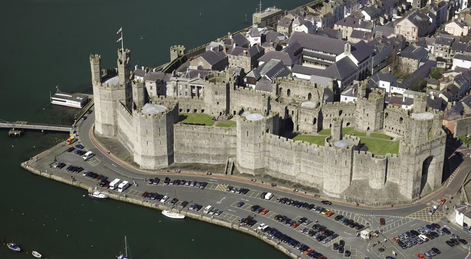 |
| Aerial view; Photo: Visit Wales |
Edward I and his queen, Eleanor of Castile, stayed at Caernarfon in July-August 1283 and for Easter 1284 in timber-framed apartments built expressively for them.
Edward II was born at Caernarfon during the second visit and was named Prince of Wales in 1301, with control over Wales and its incomes. Since then, the title has traditionally been held by the eldest son of the monarch.
 |
| The Castle's chessboard shows the complicated relationships of the monarchs |
In the summer of 1295, the English recaptured Caernarfon and began refortifying the town. Construction continued until 1330. Still, much of what was planned for the Castle was never carried out. The backs of the King's Gate (the entrance from the town) and the Queen's Gate (the entrance from the southeast) were left unfinished.
 |
| A view from inside |
The walls of the town and Castle remained in good condition while features that required maintenance, such as roofs, were in a state of decay. Of the Castle's seven towers and two gatehouses, only the Eagle Tower and the King's Gate had roofs by 1620.
The domestic buildings inside the Castle were stripped of anything valuable, such as glass and iron.
Despite the disrepair of the domestic buildings, the Castle's defenses were in a good enough state that, during the English Civil War in the mid-17th century, it was garrisoned by Royalists. Caernarfon Castle was besieged three times by Parliamentarian forces. This was the last time the Castle was used in war.
 |
| Cannons no longer thunder there |
Although it was ordered in 1660 that the Castle and town walls be dismantled, the work may never have started.
The Castle was neglected until the 19th century when the state funded repairs. Steps, battlements and roofs were repaired, and the moat to the north was cleared of post-medieval buildings that were considered to spoil the view, despite the protest of locals.
 |
| Doorways |
In 1911, Caernarfon was used for the investiture of Edward, Prince of Wales (later Edward VIII), eldest son of the newly crowned King George V. In 1969, the precedent was repeated with the investiture of Charles, now King Charles III, although he had actually held the title since 1958.
 |
| Charles' investiture at Caernarfon |
William now holds the title, but does not plan to have an investiture because of sensitivity in Wales over the whole concept of having an English Prince be the Prince of Wales. Many belief the last true Welsh Prince died in the Middle Ages.
Although Caernarfon Castle has been the property of the Crown since it was built, it is cared for by Cadw, the Welsh Government's historic environment division. In 1986, Caernarfon was added to the UNESCO list of World Heritage Sites as part of the Castles and Town Walls of King Edward in Gwynedd in recognition of its global importance and to help conserve and protect the site. Caernarfon Castle is now a major tourist attraction.
 |
| The banding is easier to see in person |
 |
| Angles rather than curves |
While the curtain wall and its towers survive largely intact, all that remains of the buildings that were contained within the Castle are the foundations.
 |
| Ornate door |
Had Caernarfon Castle been completed as intended, it could have contained a royal household of several hundred people.
Our visit to the two castles, Beaumaris and Caernarfon, was marred a bit by drizzle and wind, but somehow that works for ruined castles.
If the terms above are confusing, read my post on Welsh castles.
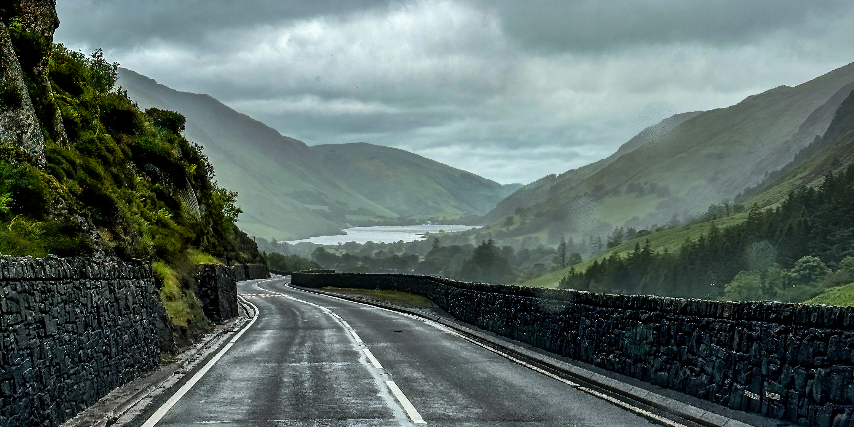
Eryri National Park/Snowdonia
I had planned to visit Eryri National Park, formerly called Snowdonia, to see Wales’ tallest mountains and most rugged landscape. But, the weather deteriorated significantly into cold rain.
 |
| A pretty landscape; Photo: Caty Stevens |
 |
| Beddgelert |
 |
| Aber Falls |
Formed in 1951, Eryri covers a total of 823 square miles in northwest Wales.
The largest National Park in Wales, it includes Mount Snowdon (Yr Wyddfa), which at 3,560 feet, is the highest mountain in all of Ireland, England and Wales. Eryri also holds Wales’ largest natural lake, Llyn Tegid.

Snowdonia is simply taken from the name of the mountain. The Park authority used the English Snowdonia and Snowdon when referring to the National Park and mountain until 2023, when it began primarily using the Welsh names, Eryri and Yr Wyddfa.
We drove through the western edge of Eryri on our way to Cardigan, where we would spend two nights. We chose to do two nights there because it is centrally located on the coast, which would make it easy to explore in any direction depending on how we were doing compared to our plans.
Dyfi Ffwrnais/Furnace
As we drove south, we came across Dyfi Ffwrnais in the town of Furnace.
 |
| Dyfi Ffwrnais |
Dyfi is a restored mid-18th century charcoal-fired blast furnace that was used for smelting iron ore.
 |
| Furnace |
The Dyfi Furnace was situated to take advantage a waterfall on the River Einion for power and the trees in nearby woods to burn for charcoal.
 |
| The river and the falls |
The Furnace was built around 1755 and used to smelt iron ore. By 1810, it had been abandoned and the waterwheel removed.
Later, a new waterwheel was installed and the furnace became a sawmill. The Furnace site was renovated around 1988.
 |
| The waterwheel |
Trip date: June 6 - 20, 2024
No comments:
Post a Comment