 |
Great Sand Dunes |
This is the second installment of my post on a trip we took last August to southern Colorado, Oklahoma and New Mexico. To see the first post, click here.
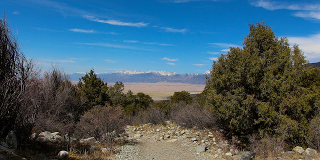
After visiting Black Mesa State Park, we headed west again toward Great Sand Dunes National Park and Preserve (GSD). We camped there, but didn't really spend much time in the Park, primarily because we have been there many times before and have a stockpile of great photos of the dunes. They are magnificent when the light is right; when it's not, the photos aren't as good. And, we didn't have as good light this time.
 |
| A favorite shot from 2009 |
Great Sand Dunes
But, let me give some background on GSD, using predominantly photos from past visits. Conserving an area of sand dunes up to 750 feet tall on the eastern edge of the San Luis Valley plus areas in the Sangre de Cristo Range, the Park was originally designated as a National Monument in 1932. At the time, it protected 55.5 square miles; today it is a National Park and Preserve and comprises 232.9 square miles. It became a National Park and Preserve in 2004.
About 30 square miles is sand dunes, which seem pretty incongruent in the middle of the mountains far, far from a large body of water. And, these dunes, which are made up of 1.2 cubic miles of sand, are the tallest in North America.
 |
| Great Sand Dunes, 2015 |
How did they get there? Sediments washed down from the mountains from the surrounding mountains over multiple geologic time periods, settling in lakes and riverbeds. When the lakes dried up rather suddenly after volcanic dams broke, giant sand deposits were exposed. Then, the wind took over.
For ages, predominant southwest winds have blown from the valley floor toward the mountains. But during storms, the winds shift and blow back toward the valley. These opposing wind directions cause the dunes to grow vertically. Two mountain streams -- Medano and Sand Creeks -- also capture sand from the mountain side of the dunefield and carry it around the dunes and back to the valley floor.
 |
| Medano Creek, 2015 |
The creeks then disappear into the sand sheet, and the sand blows back into the dunefield. This combination of opposing winds, a huge supply of sand from the valley floor and the sand recycling action of the creeks, are all part of the reason that these are the tallest dunes in North America. The dunes system is fairly stable because the opposing wind directions balance each other out over time.
 |
| Sunset at GSD, 2015 |
Also, the main dunefield is moist beneath a thin layer of dry surface sand. While the top few inches of sand are blown around during windstorms, the moist sand remains largely in place. Because the surface sand shifts so much, it is difficult for vegetation to grow, although it does occasionally take root.
 |
| Plants tend to grow on the creek bed rather than the dunes |
Hiking the dunes is popular, as is sandboarding and sandsledding. In summer, temperatures can reach 150 °F. I have yet to climb to the top, but really want to. Maybe soon!
 |
| Me at the Dunes, 2015 |
Most of the year, the tall dunes are accessed via a wide flat sandfield, but in the late spring, snowmelt covers the area with flowing water, forming Medano Creek. Small underwater sand ridges that act like dams form and break down, creating surges of water which resemble waves in the creek. In a high-water year, the surges can be as high as 20 inches. When the creek is flowing, you see families gathering on beach blankets, the children making sand castles just like a day at the beach.
 |
| Good flow at the creek, 2015 |
Elevations within the Park Elevations range from 7,515 feet in the valley west of the dunes to 13,604 feet at the summit of Tijeras Peak in the northern part of the preserve. Blanca Peak, the tallest mountain in the Sangre de Christos at 14,351 feet, is not in the Park, but dominates the horizon.
 |
| Cleveland Peak towering over the Dunes |
GSD comprises the same multiple ecosystems I as Rocky Mountain National Park: alpine, subalpine, montane and riparian. Plus, the sandsheet comprises wet meadows, cool-grass prairie and desert shrubland, depending on proximity to groundwater and soil type. An area called the "sabkha" is a wetland region where groundwater rises and falls seasonally, leaving white alkali deposits on the surface.
 |
| The Park has dramatic differences among its ecosystems |
There are hundreds of plant species and resident mammals include Pika, Yellow-bellied Marmot, Bighorn Sheep, Black Bear, Snowshoe Hare, Abert's Squirrel, Golden-mantled Ground Squirrel, Gray and Red Foxes, Cougar, Coyote, Mule Deer, Water Shrew, Beaver, Porcupine, Kangaroo Rat, Badger, Pronghorn and Elk.
 |
| A Golden-mantled Ground Squirrel |
More than 2000 Bison are ranched within park boundaries on private land, owned by the Nature Conservancy, that is closed to the public. While more than 250 species of birds have been documented, I haven't had great birding results within the Park. GSD reptiles include the Short-Horned Lizard, Fence Lizard, Many-Lined Skink, Bullsnake and Garter Snake. Amphibians include the Tiger Salamander, Chorus Frog, Northern Leopard Frog, Spadefoot Toad, Great Plains Toad and Woodhouse's Toad.
More than a thousand different kinds of arthropods have been found in GSD, including several endemic insects such as the Great Sand Dunes Tiger Beetle.
 |
| Most of the critters hide, especially during the heat of the day; but, the scenery makes up for it |
The oldest evidence of humans in the area dates back about 11,000 years to nomadic hunter-gatherers following herds of mammoths and prehistoric bison. The first historic peoples to inhabit the area were the Southern Ute Tribe. The Apache and Navajo Nations also have cultural connections in the area. In 1694, Diego de Vargas, a Spanish governor of Santa Fe de Nuevo México, became the first European on record to enter the San Luis Valley, although herders and hunters from the Spanish colonies in present-day northern New Mexico probably entered the valley as early as 1598. Juan Bautista de Anza, Zebulon Pike, John C. Frémont and John Gunnison all traveled through and explored parts of the region in the 18th and 19th centuries.
 |
| It is hard to believe this land can be used for ranches |
The explorers were soon followed by settlers who ranched, farmed and mined in the valley starting in the late 19th century. The Park was originally established to protect it from gold mining and the potential of a concrete manufacturing business.
The Park has a very nice campground, with beautiful views of the dunes. It's a bit nostalgic for us because the very first place we camped with the Little Guy was at GSD.
 |
| Nice view from our campsite |
After being on the road for a few days, it was nice to just hang at the campsite. And, we made a great Mexican dinner.
 |
| We eat well when we camp (well, we eat well at home, too) |
In May 2019, GSD was designated an International Dark Sky Park by the International Dark-Sky Association. And, that's why we went, with hopes of getting good night shots with the dunes. The evening started with a gorgeous sunset.
 |
| Pretty sunsets are common at GSD |
But, pretty sunsets come from clouds. And, clouds make star photography difficult to impossible. That evening, it was a bit cloudy and a bit misty, so, while a pleasant visit, it did not accomplish our goals.
 |
| A shot before the clouds filled the sky (you can see how the mist blurred the planets) |
But, we did discover a new destination: Blanca Wetlands.
Blanca Wetlands |
| Water in the high desert |
Just south of GSD and accessed from Mosca to the west or off Highway 160 to the south, Blanca Wildlife Habitat Area is a refuge for birds, fish and other wildlife administered by the Bureau of Land Management (BLM). It sits in an area historically called the Blanca Wetlands.
 |
| A Peregrine Falcon at Blanca Wetlands -- a bird I don't frequently see |
These wetlands had been completely destroyed by pumping and water diversion for irrigation, so, starting in 1965, BLM began to restore what had become dry-as-bones "playas."
 |
| Some of the water is alkali, surrounded by salt deposits |
Now, they are an increasingly important ecological habitat for shorebirds, waterbirds and other wildlife and native plants.
 |
| The birds had not yet arrived to nest |
Covering almost 10,000 acres, the area contains about two hundred shallow basins floored by layers of sand and clay, holding wet meadows, salt flats, marshes and freshwater ponds. It is closed to the public from mid-February to mid-July to avoid disturbing nesting birds. At other times of the year, the wetlands are open for activities such as fishing, waterfowl hunting and bird watching.
 |
| The amount of water was surprising in such an arid environment |
I had no idea it was there. And, judging from the few other people we saw while there, neither do many other people. Since that first visit, I have been back two more times. This write-up includes photos from all three visits (because do you really care when I saw what?).
 |
| The Wetlands are open dawn to dusk from mid-July to mid-February |
Blanca Wetlands is an important area for birds in Colorado because it provides habitat for migrating waterbirds or shorebirds, including 13 threatened, endangered and sensitive species. On my visits, I saw a number of raptors both in or near the Wetlands, including a Bald Eagle ...
 |
| Bald Eagle on the road to the Wetlands |
Golden Eagles ...
 |
| We were surprised to see TWO Golden Eagles right off the highway near Mosca |
Swainson's Hawks ...
 |
| Swainson's Hawks are common in the summer |
Peregrine Falcons ...
 |
| A pair of Peregrine Falcons on an artificial perch that towers about the native vegetation |
A Prairie Falcon ...
 |
| A nice juxtaposition of civilization and nature |
And, Red-tailed Hawks ...
 |
| The most common hawk in Colorado |
The Snowy Plover, White-faced Ibis, American Bittern, American Avocet, Common Yellowthroat, Eared Grebe, Forster's Tern, Greater Sandhill Crane, Northern Harrier, Savannah Sparrow, Snowy Egret, Sora Rail, Western Grebe, Yellow-headed Blackbird, Mallard, Northern Pintail, Green-winged Teal and a variety of gulls and sandpipers have been documented as nesting or visiting there. There are many in that group I would love to see, but the Wetlands are closed during nesting season.
 |
| A welcome oasis for birds |
We have seen a few American Coots ...
 |
| Two Coots hug the reeds |
Herons ...
 |
| Black-crowned Night Heron |
And some shorebirds ...
 |
| A flock of Wilson's Phalaropes |
There are also Great Plains Toads, Plains Spadefoot Toads, Western Chorus Frogs, Leopard Frogs, Tiger Salamanders, several species of bat, Least Chipmunks ...
 |
| Least Chipmunk |
... Ord's Kangaroo Rats, Muskrats, Coyotes, Mule Deer, Elk and, even though not mentioned in the literature, North American Porcupines.
 |
| I was scanning trees for nest and this nest turned out to be a Porcupine |
Oh, and let's not forget a variety of bugs ...
 |
| Plains Forktail Damselfly and Hayden's Grasshopper |
This was a cool discovery and now a go-to place on my visits to the GSD area, along with Monte Vista National Wildlife Area, where Sandhill Cranes gather in the late winter/early spring.
 |
| Sandhill Cranes at nearby Monte Vista National Wildlife Refuge |
Oh, and the drive to Blanca Wetlands in the late summer delivered some stunning fields of rapeseed ...
 |
| Wow! |
... with its gorgeous yellow flowers ...
 |
| Close-up of rapeseed |
... that clearly demonstrate the possibilities that irrigation promises ...
 |
| Irrigation brings land to life, but can drain wetlands if not managed correctly |
These fields were filled with butterflies ...  |
| Cabbage White Butterflies were everywhere |
... and magic ...
 |
| Nature can be astonishing |
And, the horses that live along the route to Blanca Wetlands are lovely and entertaining.
 |
| Some of the locals |
A Good TripWe set out for night skies, but got so much more. What a fun trip! And a nice break from the pandemic.
 |
| Nothing like an accomplished goal |
Trip date: August 15-19, 2020


No comments:
Post a Comment