Thursday, November 10, 2022

Looking for Fall: Going West and a New National Park

Indiana Dunes National Park
After our visit in Pennsylvania, we started on our true quest for fall foliage.

On to Ohio
We left very early the next morning to head to Magee Marsh, which is near Port Clinton, Ohio, on the shore of Lake Erie. It was rainy and dark for the first part of our drive, which was unfortunate because it is quite possible that Pennsylvania’s Pocono Mountains were our best chance for glorious fall. But, we saw nothing but big trucks and dark highway and, then, after dawn, a few glimpses of yellow, red and orange. I guess getting an early start is not always a great idea. 

As the day brightened up, we did see some nice foliage, however.

Things were looking up (and this was at a rest stop!)
Before we finally made it to Port Clinton, we made two stops to see Lake Erie lighthouses. First was the Lorain West Breakwater Light, also called the Lorain Harbor Light.

Looks more like a house than a lighthouse
Built in 1917 on Lake Erie by the United States Army Corps of Engineers, it was taken out of service in 1965 when it was replaced by an automated light tower on a nearby breakwater.
 
The new light is quite small
The light was added to the National Register of Historic Places in 1978.

Ring-billed Gulls in the parking lot by the Lorain Light
Next, we stopped at the Marblehead Lighthouse.

The Marblehead Light
The oldest lighthouse in continuous operation on the American side of the Great Lakes, it has guided sailors safely along the rocky shores of Marblehead Peninsula since 1822 and is still an active aid to navigation.

Marblehead, far more traditional-looking than the Lorain Light, is a 50-foot tower of native limestone on the tip of the (you guessed it) Marblehead Peninsula. 

Built to withstand fierce storms, the base is 25 feet in diameter, with walls five feet thick! It narrows to 12 feet at the top, with two-foot-thick walls.

That's me to the left (I am looking at Eagles)
Before it was automated, 15 lighthouse keepers (two of whom were women) in succession tended the beacon.

A pair of Bald Eagles in almost perfect unison fly by
Early keepers commuted until a keeper's house was built in 1821. Early on, the light was powered by 13 whale oil lamps with multiple metal reflectors, each sixteen inches in diameter. In 1858, the whale oil lamps were replaced by the light from a single kerosene lantern magnified by a Fresnel lens which created a highly visible fixed white light. In 1880, the original 1821 stone keeper's-house was replaced with the present large wood-frame Keeper's House. A lifesaving station was built west of the lighthouse in 1876.

Lake Erie isn't always this calm
The turn of the century ushered in new technology as well as structural changes including the addition of another 15 feet to the tower's height. A clock-like mechanism was installed to rotate the lantern, creating the appearance of a brilliant flash of light every 10 seconds. This system required that the lighthouse keeper crank the weights every three hours through the night to keep the lantern turning. An improved Fresnel lens with prism surfaces created an even more brilliant beacon.

Three views of the lighthouse
An electric light replaced the kerosene lantern in 1923, dramatically increasing the intensity of the signal. During World War II, when the lighthouse became strategically important for national defense, the Coast Guard assumed responsibility. The beacon was automated in 1958 and the exterior of the lighthouse tower was given a fresh coat of new stucco. 

A nice Park
The Ohio Department of Natural Resources has maintained the property surrounding the lighthouse since 1972 and accepted ownership of the Marblehead Lighthouse tower in May 1998. The U.S. Coast Guard continues to operate and maintain the beacon.

In 2012, an LED light was installed. Its green signal flashes every six seconds and is visible for 11 nautical miles. The green distinguishes the lighthouse signal from white lights coming from air beacons.

The lighthouse is now part of the nine-acre Marblehead Lighthouse State Park.

Magee Marsh

A visit to a major birding site
While in Port Clinton, we visited Magee Marsh twice – once in the afternoon right after we arrived ...

A pretty reflection on the road in
... and once in the early morning the next day before heading to Indiana ...

Sunrise and Trumpeter Swans (Mom and her two "teens")
From a birding perspective, it was disappointing. Not unexpected because I knew fall migration had already pretty much finished, but still I had hoped for more.

Male and female Northern Cardinals
Situated on the southern shore of Lake Erie, the Marsh is famous as a prime stopover for North American Warblers during spring migration. 

Is the Yellow-rumped Warbler angry that he hasn't migrated yet?
During early May, it is the site of one of the United States’ most popular Birding Festival, aptly called The Biggest Week in American Birding. Thousands of birds, mainly Warblers, stop here to forage before making the long flight over the Great Lakes as they migrate to Canada for the summer. I was scheduled to attend in 2020 (we know how that went) and am hoping to go within the next two years.

Black-capped Chickadee (a bird I see all the time at home)
Magee Marsh has a raised boardwalk that makes it easier (but not easy) to see and photograph tiny Warblers as they hop around in the bushes which, because the boardwalk is raised, are at eye-level. 

Eye-level, but deep in shade; this is a White-throated Sparrow
Both when we arrived and the next morning there were birds; actually more birds than I had seen anywhere else on this trip so far (at 983 birds on my Life List, I was hoping for a bonanza to push me to 1,000). But, alas, none were lifers …

By far, Yellow-rumped Warblers were the most common bird at Magee Marsh
… and, with the exception of some cooperative Rusty Blackbirds, none offered better photo ops than I had had elsewhere ... 

Male non-breeding Rusty Blackbird (look at those eyes!)
Still, it was a pleasant visit. It was nice to walk peacefully along the quiet boardwalk. It was nice to get a feeling for what it might be like in May.

Of course, there were lots of Red-winged Blackbirds
We got some nice fall foliage ... 

Foliage with Canada Geese
I saw some critters ... 

A Groundhog (AKA Woodchuck) and an Eastern Cottontail
.. and, we had some Great Lakes whitefish in Port Clinton ...

Ya gotta have it; Photo: Scott Stevens
After Magee, we pressed on, wiggle-waggling north through Michigan and then down the lakeshore to Indiana. We stopped to see some pretty fall colors ...

A pretty field in southern Michigan
... and actually happened upon a Fox Hunt! 

This was unexpected! Left photo: Scott Stevens
No, we didn’t see any Foxes, which was probably a good thing. 

Of course lots of Foxes could be hiding in there
We also stopped briefly in Benton Harbor, Michigan, where we witnessed Lake Michigan in its full fury, with large waves thrashing the pier under blue skies. 

A windy, but pretty, day
We walked about for awhile, admiring the lakeside art …

Richard Hunt's stainless steel And You, Seas is nearly 50 feet tall
Indiana Dunes National Park
Indiana Dunes National Park is my 62nd of the nation’s 63 National Parks. You may wonder why I had not been to this Park before because I have certainly been in the area. Well, it wasn’t named a National Park until 2019. 

Transition to a National Park, 2019; Photo: Dunes Learning Center
Before that, it had been Indiana Dunes National Lakeshore since 1966. We had been by, but never stopped in. So, now I was getting another check on my list. The National Park runs for about 20 miles along the southern shore of Lake Michigan and covers 15,349 acres in several unconnected units.

The Park has lots of nice facilities and boardwalks
The Park includes dunes, most of which are covered with vegetation rather than being just exposed sand (the kind of dunes we are used to in Colorado). Of course, the vegetation protects them from wind. And, being a Park protects them from people.

A typical dune
The Park protects the environment
Becoming a National Park took over 120 years. 

It started when an article on the unique flora of the dunes in the 1899 Botanical Gazette by University of Chicago botanist Henry Chandler Cowles sparked a movement to preserve the dunes habitat. 

In 1916, National Parks Director Stephen Mather, who thought it wasn't Park material, reluctantly held hearings in Chicago on a "Sand Dunes National Park." 

The desire to preserve the area was fueled by the removal of the “Hoosier Slide,” a large dune that was decimated when its sand was transported to the Ball Brothers and Hemingray Glass Co. plants in Muncie, Indiana. The Hoosier Slide was gone by 1920 and a power plant sits on the site today.

Lake Michigan
In 1926, Indiana Dunes State Park opened. In the 1950s, a desire to maximize economic development through a "Port of Indiana" spurred more interest in preservation. In late 1966, Indiana Dunes National Lakeshore became a reality, followed by four subsequent expansions in 1976, 1980, 1986 and 1992.

A lovely day
Four major glacial lake periods created the Indiana Dunes: Lake Chicago, 14,000 years ago; Lake Algonquin, 9,000 years ago; Lake Chippewa, 7,000 years ago; and the Nipissing Great Lakes stage, 4,000 years ago. Once the glaciers had fully retreated from the Lake Michigan basin, strong currents created shallow inland bays with a wide sand spit between each bay and the open lake. Over time, the sand spits merged with the far shoreline, forming interdunal ponds. 

Dune and pond
Each sand spit became a dune ridge. As the ponds filled in and wind built the outer sand ridges higher, the ponds dried up and only streams remained. As the shoreline moved northward, new ridges formed along with additional streams, now slower and less powerful, and the process duplicated itself.

The Park is lovely, with miles of unadulterated shore, undulating dunes, some drifting sand and pockets of civilization, including some pretty amazing mid-century architecture.

Left, homes in the Park; right, Pavilion: Right and upper left photos: Scott Stevens
The Indiana Dunes Pavilion, which is in the adjacent Indiana Dunes State Park, was recently renovated to its late 1920s glory.

We couldn't see inside; this is how it looked in 1930
We walked around the area early on a Sunday morning. The Pavilion wasn’t open, but we did witness what appeared to be a Gospel singing group making a video on the lakeshore.

A pretty setting for a video
The whole time we were at the Dunes, we were virtually alone. After all, it was cool and windy. But, it was easy to see how the area is probably very busy and crowded during the summer. It’s a beautiful beach near some very highly populated areas.

In addition to space for swimming and sunning, there is lots of hiking, including the "Diana of the Dunes Dare."

Quite a climb
"Diana of the Dunes" was actually Chicagoan Alice Mabel Gray, who had worked for the U.S. Naval Observatory in Washington, D.C., after graduating from the University of Chicago. Then, in 1915, she moved to the dunes, where she lived alone in the wilds. The "dare" is (apparently) a one-mile hike that climbs up and down "Diana's Dune" and features educational signs about vegetation, dune formation and Diana. Unfortunately, every write-up I found was creative, but not informative. I guess we should have done the hike!

Change in Plans
Two things started working in concert to change our plans. First, we realized that weather would make traveling to northern Michigan difficult, if not impossible. 

Nope! Photo: Michigan Live
So, we decided to cancel that part of our trip and make other plans, but we had not decided yet what we would do after visiting my sister in Illinois.

What??? Sign me up!
Then, while I was making a restroom stop at the Indiana Dunes Visitor Center on Saturday, Scott happened to notice a brochure about Saw-whet Owl banding at Indiana Dunes! 

I have been trying to find a Saw-whet for years. I looked into it and it was in five days! And, we were heading west the next morning. If I were by myself, I would plan to go back. But, I couldn’t ask Scott to do that! He already indulges my birding more than he needs to. But, then, he suggested it.

So, I make us reservations to attend the banding on the following Thursday, booked us another night at the very nice Best Western in Chesterton, Indiana, where we were staying and crossed my fingers that the banding would be successful.

Scott took this from our hotel room
We shall see.


Trip date: October 10-22, 2022

Wednesday, November 9, 2022

Looking for Fall: Pennsylvania

Ah! Pennsylvania
Back in 2018, we took a trip to the Midwest, with a goal of seeing some fall colors. We started in Cincinnati and then traveled around Lake Michigan. The results were mixed – some hot weather, some cold rain, some beautiful trees and a little bit of wildlife. We came away from it with a full understanding that fall colors are tricky – temperature, rain and snow can change the landscape overnight and it is impossible to predict where to go and when to go. 

So, of course, we decided to do it again.

We had a few additional reasons this time – primarily we wanted to visit Colorado Springs friends Jenny and Don, who are now spending half their time living next to Don’s daughter’s family in Bethlehem, Pennsylvania.

Scott, me, Don and Jenny
Neither of us had spent much time in Pennsylvania, so it was a chance to see a new place. 

Our destination
And, we could spend some fun time with friends. We ended up crafting an itinerary that included other friends and family.

And, later, we ended up rearranging parts of the itinerary to accommodate weather and a cool opportunity to nab a lifer bird I have been pursuing for years. 

The Plan
As we were mulling over things to do (and the fact that my planned trip to the Albuquerque International Balloon Fiesta could delay departure), we discovered that the King Biscuit Blues Festival was being held in Arkansas in early October. 

So, we decided that Scott would drive to Memphis, pick up friend Will Jones at the airport and the two of them would attend the festival before driving to Will’s home in Cincy. 

King Biscuit; Photos: Scott Stevens
I would then fly to Cincinnati and we would spend time with Will and his wife, Cassandra, before we took off for Bethlehem. Then, after spending a few days with Jenny and Don, we would drive to northern Ohio to check out Magee Marsh, which is a birding mecca. We knew it was probably too late in the fall migration for lots of birds, but I still wanted to see what we could see.

Next, we’d go to Indiana Dunes National Park, one of the two National Parks I had not yet visited, and then spend a day and a half with my sister, Linda, and her husband, Robert, in Peoria, Illinois, before heading to Pictured Rocks in the Upper Peninsula of Michigan.

We left the plans for the trip home from Michigan loose, planning to plot our route based on glorious fall colors. 

Fundamentally, our plan was a migrating Goose!
Well. The first part went as planned – except Scott was underwhelmed by the Blues Festival and the colors weren’t changing much in Ohio yet. We had to cancel Michigan because of an early season snowstorm that dumped two feet of heavy wet stuff on our planned route. I’ll cover what we did for the rest of the trip later, but even though it wasn’t what we planned, we did get some nice color and we had a good time.
 
It looked more like this with lots more squiggles
Uncharacteristically, we got home earlier than planned (rather than extending and extending). But, with everything on our plates right now, that was actually a relief. 

First Stop: Cincinnati
My time in Cincinnati was very brief and – oddly – I took no photos (even more oddly, neither did Scott).

After Scott and Will picked me up at the airport, we wandered around downtown, visiting some art galleries, including visiting the IAN STRANGE: DISTURBED HOME AND ANNEX exhibit at the Art Academy of Cincinnati. It was small and, initially, not too impressive. But, as I read and looked closely, I was intrigued. Strange’s work revolved around homes that are destroyed or displaced by natural and economic disaster and, what looked to be doctored photos of houses, turned out to be photos of doctored houses.

That house was actually painted and then photographed; Photo: Ian Strange
Quite intriguing. 

The next day we had an uneventful drive to Bethlehem. It wasn’t fall yet along that route, so we just plugged along. 

Covered Bridges
After a day of driving ...

A pretty stop on our route
 ... we spent two days in Bethlehem with Jenny and Don. First, we saw their gorgeous home, a gracious house built in the 1920s. It is on a lovely tree-covered lot, has a sunroom and a carriage house that now serves as a garage. But, coolest of all, the basement was actually a speakeasy during Prohibition! 

Our first day there was gloriously warm and sunny and we took advantage of the weather by touring the covered bridges of Lehigh County. 

Don at Guth's covered bridge
Forty miles long and 20 miles wide, Pennsylvania’s Lehigh Valley is bound to the north by Blue Mountain, to the south by South Mountain, to the west by Lebanon Valley and to the east by the Delaware River on Pennsylvania's eastern border with Warren County, New Jersey. 

Lots of history; Photo: Scott Stevens
The Valley's largest city is Allentown, where we stayed. It is a mix of urban, suburban and rural areas. And, it is full of history, dating back to before the Revolutionary War.

Throughout the 19th and most of the 20th centuries, Lehigh Valley thrived as a leader in coal and iron mining and, eventually, steel and heavy manufacturing. It was the cradle of the American Industrial Revolution. 

But, this day was not spent looking at now-defunct steel stacks (that came later). 

Rather, we spent time appreciating most of the quaint covered bridges that remain from the 19th century.

Map: Travel with Lolly
A covered bridge is a wooden bridge that has been covered to protect the wood from weather that could hasten rot and decay. The covered bridges in the Lehigh Valley were built using the Burr Truss design that uses large, central arches along the sides that are tied into the bridges' abutments. 

Still functional, if a bit raggedy
This design, which helped strengthen bridges, is named after Theodore Burr who patented it in 1804. Typically, covered bridges were named after their builders, local citizens or nearby businesses. 

All the covered bridges we visited were red, which is not a coincidence. In fact, they were built – and painted – to resemble barns, which helped to calm horses and other animals that needed to pull wagons over streams and creeks.
 
A barn near Guth's bridge matches the color scheme
The bridges are owned and maintained by the municipality in which they reside: whether it be township (Kreidersville), city (Bogert's), county (Geiger's, Manasses Guth's, Rex's, Wehr's) or state (Schlicher's). Two, Geiger's and Schlicher's, are in the Trexler Nature Preserve, a sprawling 1,108-acre park. Even though they are old, narrow and wooden, the bridges all still carry traffic (foot and/or vehicle). The bridges range in length from 100 to 145 feet long. 

We visited: 
Bogert's Bridge in Allentown, which was, built in 1841, making it one of the oldest in the state. It spans the Little Lehigh Creek, a popular fishing stream.

Bogert's
Manasses Guth Bridge in South Whitehall, a 108-foot span that dates back to 1858. It's one of five covered bridges that span Jordan Creek. 

Guth's (that's Scott on the left)
Wehr's Covered Bridge in South Whitehall, a 128-foot, two-lane bridge that was also built in 1841.

Wehr's is in a pretty setting
Rex's Covered Bridge in North Whitehall, a 116-foot span built in 1858.

Two views of Rex's
Geiger's Covered Bridge in North Whitehall, which was built in 1860 and crosses the Jordan Creek on Old Packhouse Road. It's on the eastern side of the Trexler-Lehigh County Game Preserve. The bridge has a unique "stepped portal" design, which sets it apart from the Valley's other covered bridges. 

Geiger's was being renovated; we couldn't get close enough for a pic: Photo: Travel with Lolly
Schlicher's Covered Bridge in North Whitehall, which is not the original structure. It was sagging so badly that it was closed in 2010. It was too costly to repair, so it was replaced with an accurate recreation of which 10 percent is recycled materials from the original. 

Original materials allowed Schlicher's to stay on the National Register of Historic Places
Kreidersville Covered Bridge in Allen Township is a pedestrian-only 116-foot single-span bridge built in 1839, making it the oldest in the Lehigh Valley and one of the oldest in the state.

Kreidersville had the prettiest sign
While they do start to resemble each other as you move from one to another, they landscape is pretty, the weather was gorgeous and none were crowded. We just admired them, took pictures and picnicked. I had hoped to see birds and wildlife, but had to be satisfied with just a few birds and bees …

Gray Catbird, female House Sparrow and Eastern Bumblebee near Guth's bridge
… plus an invasive Spotted Lantern Fly …

You're supposed to kill them on sight; I couldn't
... and a fluffy Sycamore Tussock Moth Caterpillar … 

I found him on a bridge crossing a streamlet that fed into Jordan Creek
The impression from this day was of rural bliss, with rolling hills, nature trails, trees moving toward their fall glory and reminders of Pennsylvania’s rich immigrant farming history.

An old hunter's cabin in Bogert
After seeing the bridges, we made a brief stop a Burnside Plantation, a 6.5-acre park on the grounds of what was once a 500-acre working farm.

Burnside Plantation
The plantation’s namesake, James Burnside sold 200 acres to a group of Moravians (immigrants from what is now the Czech Republic) in 1751. His widow sold the remaining land to the Moravian Church in 1758 and the church leased the plantation to individual farmers from 1765 to 1845. It was sold and divided multiple times until Lehigh County bought it in 1986 and leased it to Historic Bethlehem Museums & Sites to restore, develop and manage as a living and natural history resource. It was listed on the National Register of Historic Places in 1990. The museum, which was not open when we visited, is part of the Smithsonian Affiliations program.

The grounds are lovely and back up to a stream near remnants of Pennsylvania’s historic canal system.

Old tracks, canals and creeks
We finished the day with an outdoor dinner (a bit chilly) at the Tavern at the Sun Inn in Bethlehem. 

When we were there it was cooler, windier and darker; Photo: Tavern at the Sun Inn
The venue, built in 1758, was lovely, with displays of original furniture inside.

Photo: Tavern at the Sun Inn
And, the burrata cheese was yummy.

Martin and Industry
Our gorgeous weather deserted us the next day, which started drizzly and gray and got progressively worse, ending in a downpour. Since outdoor activities were out of the question, we needed a new plan. A friend of Scott’s, reacting to something Scott posted on Facebook, suggested that we tour the C. F. Martin & Co. guitar factory in nearby Nazareth. Scott checked and found out that all the tours were full. But, he and Don decided to be optimistic and visit anyway.

Scott and Don optimistically out front
Even if we couldn’t tour, we could visit the small museum.

And the store!
When we arrived, the woman at the front desk confirmed that all the tours were full. But upon learning we were from out-of-state, she rounded up another tour guide and set up a new tour for us (and a few other lucky folks who walked in).

The tour
That was unexpected and delightful. I was impressed. And, after the tour, I was even more impressed.

I had no idea how intensively guitars are hand-crafted. Yes, they are more machined that in the past and the less-expensive models that are made in Mexico have a far more automated process. 

The cutting room
But, much of the work is done by hand by employees who seem to truly enjoy their work.

Custom design work being done by hand
The factory was clean (a bit messy, but very clean) and the people seemed to take great pride in their work. From what I gathered, the company is very employee-friendly and jobs there are much-coveted (and seldom turned over). Even when new automated systems come onboard, employees are retrained and redeployed.

This employee shows us how the body is formed
I was also struck but the combination of sophisticated mechanical equipment and some, shall we say, less industrial tools …

Lots of hand work, Elmer's Glue and clothespins
I cannot recall so thoroughly enjoying a tour of a manufacturing facility – and I used to lead tours of a manufacturing facility!
 
Martin has been based in Nazareth since 1833
It was great fun. And, the boys even got to sample the wares.

Scott out front and in the playing room
After the tour and a quick pizza lunch, we drove through some heavy rain to the now-closed Bethlehem Steel industrial area called SteelStacks, which is now being converted to a cultural and arts center.

SteelStacks; Photo: Fun Times Guide
The plant operated as Bethlehem Steel from 1904 until 1995, but its roots date to the Bethlehem Iron Co., which opened 60 years earlier. The area is still a bit rough, but the concept seems solid. We visited the National Museum of Industrial History, a small installation that features a number of static displays of industrial machines and equipment.

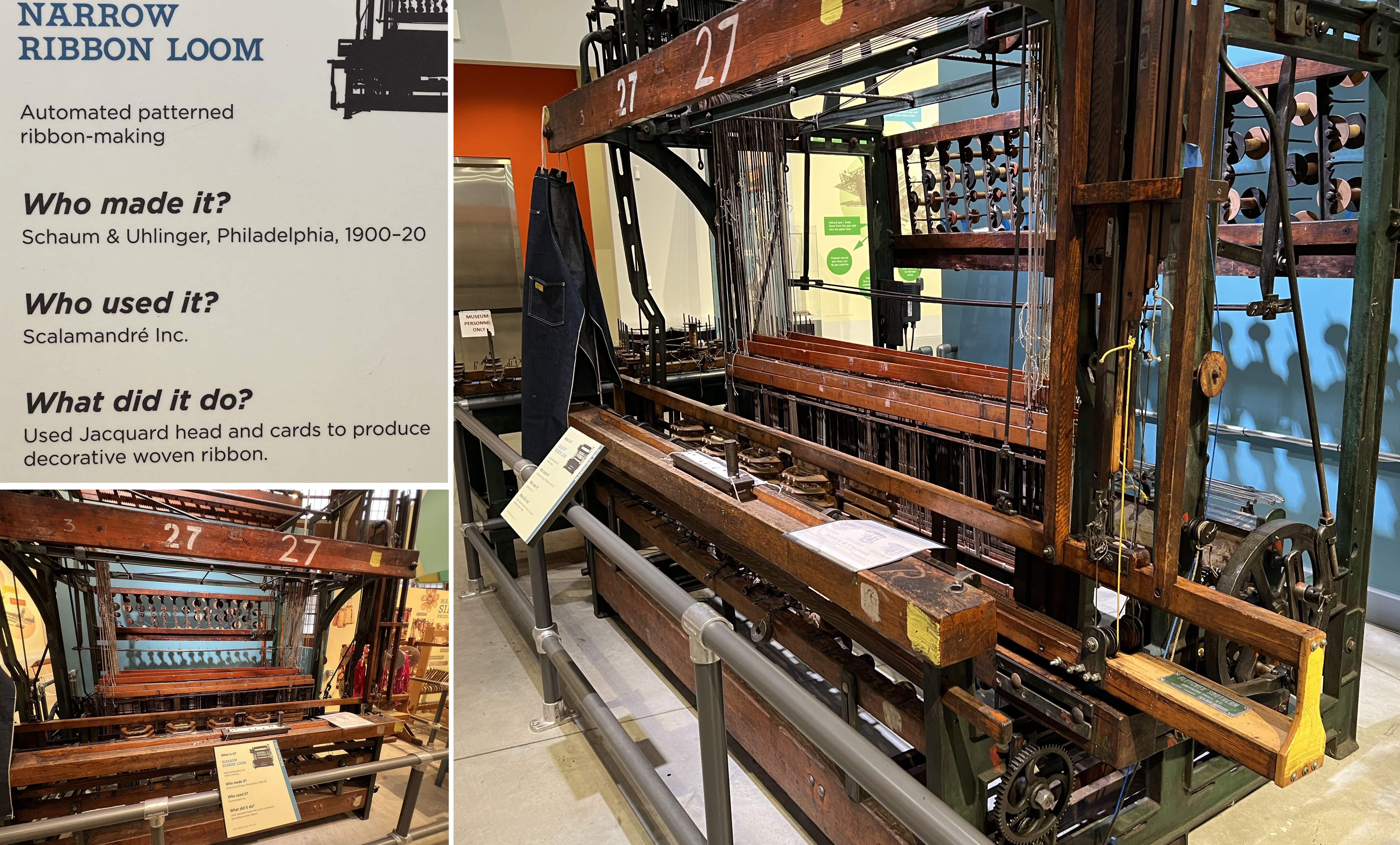
Bethlehem was also a center for decorative trim manufacturing 
Then, we had dinner at the Bookstore Speakeasy, a very, very dark restaurant/bar fashioned after a speakeasy (it even has a nondescript door that can be tricky to find, although we spotted it right away).

Top middle and bottom left photos: The Bookstore
Photo: Tripadvisor
It features live jazz (good but a bit too loud for the tiny room), truly delicious small plates and precious “hand-crafted” drinks.

I had something with pomegranate; the boys insisted upon regular martinis. 

It was fun, but I need a bit more quiet and more light so that I can enjoy spending time with my dinner companions. 

Our trip will continue in my next post.


Trip date: October 10-22, 2022