Monday, April 17, 2017

New Mexico and Texas with Caty

Caty (my daughter and partner in travel/wildlife photography crime, in case you didn’t know) had a long weekend in April, so she asked me to go on a “check off some additional National Parks/Monuments” trip. We decided we didn’t really have time to go all the way to Big Bend (going all the way to Big Bend is ALWAYS an issue because it is just so far from everything). So, we decide to hit White Sands National Monument and Guadalupe Mountains and Carlsbad Caverns National Parks. 

Diverse travel objectives
None were new to me – after all, I have been to every National Park in the Continental United States – but I am always up for a National Park jaunt. Plus, as you will see, we did go to some exciting new places as well.

Petroglyphs
First, a word about planning. Every time you think you have it down pat, you get a little too confident and mess things up. But, it usually works out anyway.

White Sands National Monument
We booked this trip a long time ago. 

Our plan was to drive on Thursday to Alamogordo, New Mexico, taking our time looking at scenery and wildlife, but possibly arriving in time for sunset at White Sands National Monument.

It technically takes a little over seven hours to drive from Colorado Springs to Alamogordo, but we knew we would take longer. In fact, we budgeted about 12 hours, which would allow us to leisurely make stops on the way. And, it ended up taking us just about 12 hours.

Our plan was to then spend the next day in White Sands before heading out to Whites City, where we would stay two nights so we could hit both Carlsbad Caverns and Guadalupe Mountains. 

Carlsbad and Guadalupe Peak
Then, we would head home, possibly staying one more night on the road, but not making definitive plans. We just needed to get back to Colorado Springs in time for Caty to get home at a reasonably decent time because she had to work at 7:00 a.m. on Tuesday.

White Sands
So, what went wrong?

Well, first, as we were driving, we somehow convinced ourselves we were staying TWO nights in Alamogordo. 

Did we recheck? 

Nope. 

So, we decided we didn't need to hurry to see sunset at White Sands on day one. It wasn't until after sunset that we realized that we wouldn't be there the next night. 

Oh well!

Second, we had discussed that we needed to stay at the Rodeway Inn in Whites City to visit both Carlsbad and Guadalupe. It's not a fancy hotel, but it's right at the entrance to Carlsbad and only 36 miles from Guadalupe, making it the CLOSEST non-camping lodging to Guadalupe.

Far, but not too far
Somehow, that got messed up and we ended up with reservations at the Rodeway Inn in Carlsbad, N.M. 

Now, you would THINK that Carlsbad is closest to Carlsbad Caverns, but it's not. Whites City is. I suspect MOST people make this mistake. 

It's only 15 miles, but still ... 

If you are staying in Carlsbad, Rodeway wouldn't be my first choice. It wasn't a big issue and it was certainly inexpensive, but a silly mistake.

But, despite those two little glitches, it all worked out.

Capulin Volcano National Monument
We started the trip with a fairly long detour -- about 30 miles one-way from Raton to Capulin Volcano National Monument. 

Close to home
I had already been there a few times, including once in 1975 on our first trip west right after Scott and I got married, and then as recently as last year. 

But, apparently, I haven't blogged about it before. Here's a little background.

Located in northeastern New Mexico, Capulin Volcano National Monument is an extinct cinder cone volcano that is part of the Raton-Clayton Volcanic Field. 

Aerial photo: National Parks (and More) 
A nice paved road spirals around the volcano up to the rim of the extinct caldera, where there is a small parking lot and trailhead. 

It is a well-preserved, relatively young (58,000 to 62,000 years old), symmetrical cinder cone that rises from the surrounding plains to 8,182 feet. 

The irregular rim of the crater is about a mile in circumference and the crater is about 400 feet deep.

Compared to many other volcanoes, Capulin is quite small -- you can "easily" hike the rim in a short amount of time. I put quotes around "easily" because this time the trail was completely buried in snow and ice. I think it would have been tough to make it up and back (as you can see from the aerial photo, the rim has some gain and loss as it skirts the edge). 

I did do this hike last year and I can tell you that, because of the elevation, it can also get you huffing and puffing.

Photo: Caty Stevens
The Monument was designated in 1916, shortly before the National Park Service was formed. Darn, we missed the Centennial Celebration!

Snow in the caldera
Right now, the Visitor Center is being renovated, so everything is relocated to a small shed. I have to admit, we probably spent more time talking with the delightful ranger that actually visiting the park. 

I had to buy a new National Park Senior Pass because I have misplaced mine. 

My National Park Map
At $10 for a lifetime pass, it’s the deal of the century!!! 

It's going up to $80 next October and is STILL the best deal you can get. That's as long as our current Administration doesn't completely destroy our National Parks before we can elect some competent leaders again.

The ranger shared lots of interesting information. He told us that the National Park of American Samoa presents a certificate (and possibly a trophy) to people visiting as their final of the 59 National Parks. 

I anticipate that will be the case for me, so I need to plan ahead so I can get the certificate.

Anyway, back to Capulin Volcano ...  

The rim provides panoramic views of the volcanic field that contains at least 100 extinct volcanoes, distant snow-capped mountains and portions of five states (New Mexico, Oklahoma, Kansas, Texas and Colorado).

The view
We drove the road up and snapped some pictures, deciding we should come back when the hike around would be less treacherous and then we headed south.
Also close to home
Maxwell National Wildlife Refuge
We stopped next at Maxwell National Wildlife Refuge, which I blogged about when I visited in February 2016 on my way down to Bosque del Apache National Wildlife Refuge to see Sandhill Cranes.

Back in 2016, the place was filled with Bald Eagles, but very little else because the lake was frozen. This time, there were no Eagles. We assume that the ones I saw were migrating north, so by April, they had already moved on.

There were, however,  quite a few American White Pelicans and ducks on and around the lake. We got some great shots of the pelican flying slowly right over our heads. 

The bump on the bill indicates a breeding adult
We also saw a Common Raven sitting in a nest – interesting only because we had just been discussing that we had never seen a Raven nest.

On the lake were Gadwalls ...

Female Gadwall
... Ruddy Ducks ...

Also a female
... Lesser Scaups ...

Pretty golden eyes (but not a Goldeneye!)
... and swimming American Pelicans ...

Breeding White Pelican
Maxwell has a Visitor Center, but it seems to be the victim of the insidious government funding cuts that are stripping so much away from our public lands. It never seems to be open. So, no stamp. Just a quick drive-through. We saw a Red-Tailed Hawk ...

Keeping watch
A Black-Tailed Jack Rabbit ...

Much rangier than a cuddly Cottontail
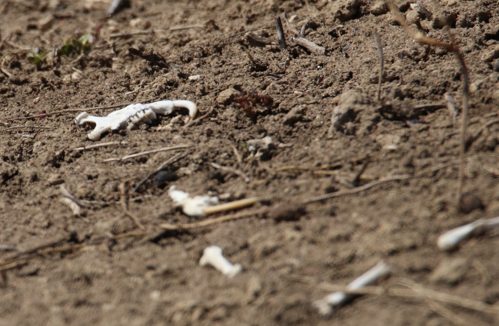
A Burrowing Owl too far away to photograph and some very odd bones on a Prairie Dog mound (could that be a Prairie Dog?) ...

Hmmmm????
We did picnic at a rest stop in Wagon Mound, where I saw my first Say’s Phoebe. Needless to say, I took a few pictures!

Say's Phoebe
Fort Union National Monument
Our next stop was Fort Union National Monument, just north of Watrous, N.M. I have driven by the exit many, many times, but never stopped because 1) it was too early in the morning; 2) I was in a hurry to get somewhere and didn’t have time to stop; 3) it was too late; or 4) I was in a hurry to get home and didn’t have time to stop. Sometimes things are just too close to home to be a priority.


A pretty spot on a pretty day
So, this time, we stopped. And, I am glad we did. The small park is more impressive than I expected – which means that it has more ruins that I thought from the descriptions I have read and pictures I have seen online.

Fort Union National Monument was dedicated in 1954 to preserve the ruins of three forts constructed on the site beginning in 1851. The forts are interesting because they were built of wood (which is mainly gone), stone and brick (of which some remains), but mostly of bright red adobe. 

An interesting spot
It operated for 40 years (1851-1891) as a frontier post but had an interesting legal history because it was built on private property. Over the years, the government took more and more of the private land and, despite lots of time in court, never compensated the legitimate owners.

Distant shot
It is a really striking grid of red walls against a pretty backdrop dotted with old wagons and canons.

Worth the stop
One puzzling thing is that, on the road to the park there is an “overlook” where you have to park and then walk about a quarter mile. We drove past and couldn’t figure out what it was looking over -- the view looked identical to what we could see from the road. 

There are wagon ruts from the Mountain and Cimarron Branches of the old Santa Fe Trail, which passed through the Fort, along the way, too.

Old equipment
The day was gorgeous, so the stroll around the ruins was very pleasant, but we had to get back on the road! 

Roadside stops can be fun
To Alamogordo
Now we headed on to Alamogordo without too many more stops. 

We reached Alamogordo around 7:00 p.m. and decided we needed to get dinner as quickly as possible because – for reasons I have never learned – restaurants in New Mexico tend to close at 8:00 p.m. We inquired at the hotel (a nice Holiday Inn Express that I paid for with points!) about good New Mexican food and were directed to Rizo’s. It was good – certainly a huge amount of food for little cost – but not as NEW Mexican as I wanted (no blue corn tortillas …).

It was during dinner that we discovered that we had miscalculated our trip and we were sad to see a beautiful sunset that we were missing at White Sands! 

Turns out that it was probably the prettiest sunset of out entire trip because there were actually some low clouds. That’s the funny thing about sunsets – you really need clouds for drama. So, those bright blue cloudless New Mexican skies don’t always deliver at sunset.

So, off to bed so we could hit White Sands when it opened the next morning.

Tomorrow


Trip date: April 6-10, 2017

Saturday, March 18, 2017

Iceland -- Doing the Right Thing the (Slightly) Wrong Way #3

The next morning, we headed out on our ice cave tour. 

Patterns in the cave wall
As we were getting ready to load up, there was brief moment of rosy red sunrise which would have been really pretty over the lagoon, but it was nice enough from the hotel. Once again, the penalty you pay for not having your own car. We probably would have been at Jökulsárlón for sunrise.

Sunrise
We reached the cave in a Jeep with huge tires, necessary for the rough terrain of the very rutted and slushy road that leads up to and then across the tongue of the Vatnajökull glacier. 

Jeeps on the makeshift road
To get an idea of what the trip was like, click here

The view on the glacier was beautiful. The storm had not hit yet and the sun was peeking through the clouds, illuminating the mountains and an outlet lagoon near the cave. 

The blue sheet in the distance is an outlet glacier
Ice caves are formed by water flowing through the glacier during the summer and fall (as you may recall, Vatnajökull is a "water glacier," with streams coursing throughout it). When the weather turns cold, the streams freeze and it is safe to enter the cave. Then, in spring, the water begins to flow again and the caves aren't safe (you could be easily swept away or the cave could collapse). Because of the flowing and freezing, the caves change every year. Here on the edge of the glacier, they are generally open for tours from November to late March.

Cave entrance
Caty and I had been on a tour in January 2015 at what I believe was the same cave (maybe). But, this time, the cave was so much different. It was much, much smaller -- maybe half the size. Back in 2015, the ceilings were 20 or more feet high and this time, maybe 12 feet tops.

The guide told us that the edge of the glacier had receded about 15 feet in just a year, moving the cave entrance with it. This could explain the size difference.

This is 2015: you can see how big and empty the cave was then
Plus, in 2015, the floor was snowy and icy. This time it was rough gravel. The guide showed us some video of a flood that occurred a few weeks earlier when unseasonably warm temperatures and rain (rather than snow) created spring-like conditions. That flooding brought lots of debris through and shrunk the cave. It was near the end of the season anyway, so I shouldn't have been surprised that the cave was different.

When Caty and I went, it was just our tour and maybe one other -- a maximum of 20 people. 

This time, there were multiple tours -- each with the big-wheel Jeeps. 

Several tours at once
Another big difference in the tour was the number of people in the cave. The cave was packed with perhaps 100 people. It made it much more difficult to take pictures and to get around to see everything.

Our group was bigger than in 2015
Despite the crowd, people seemed to be having fun and lots and lots and lots of people were taking selfies.

Our fellow visitors
I am still not certain it was the same cave -- it could have been different. When Caty and I went, we went with Ice Guides (not Extreme Iceland like this time). It is possible Ice Guides have another cave with some exclusivity. Or, it could be just a different season. I should have researched a bit more. I just assumed that all the tours are alike. Once again -- I know better!

Anyway, I did get a good walk-around. 

I particularly enjoyed looking at the debris and bubbles trapped in the ice walls, the many different colors (black, white, turquoise, blue) of the ice and the wide variety of surfaces scraped and sculpted in the walls. Some walls drip as they melt, forming frozen stalactite-type ice formations.

Amazing
After I toured the inside, I went on top (although not directly over the cave -- they don't like that!) and got a spectacular view of the glacier and the mountains.

What a view!
To see video of the cave, click here.

Following the ice cave tour, we went over to Jökulsárlón, the glacier lagoon. The gloomy weather made it tricky to photograph ...

Gloomy
... so I concentrated on the cute little Snow Buntings -- a new bird for me.

Snow Bunting
More impressive on the overcast day was Diamond Beach, which forms the mouth of the lagoon. A narrow channel dumps the icebergs from the lagoon into the ocean.

Diamond Beach
Some make a clean getaway ...

Iceberg at sea
...  but most get stranded on the black lava beach. The icebergs range in size from very, very large (car-sized) to tiny (pebble-sized). 

Some of the icebergs are blue
Some are white
Some look just like diamonds
As the tides come in and out, the arrangement of icebergs changes. So, the beach is always different. While exploring, I came across a flock of Common Eiders at the mouth of the lagoon. 

Swimming in the cold, cold water
These cold-loving ducks live exclusively in coastal arctic and subarctic areas all around the northern hemisphere.

Male, top; female, bottom
They line their nests with their very soft and very fine feathers and down. For centuries, Icelanders have harvested the feathers and down for pillows, mattresses and duvets. That's where eiderdown comes from!


After exploring Diamond Beach, we loaded up the van (a very nice Mercedes Benz van complete with WiFi, by the way) and started our trip back to Reykjavik. The weather was getting progressively worse and Vignir was concerned about the wind. Hurricane force was predicted.

But, he still stopped at a few places along the way.

The most impressive was Svínafellsjökull -- Swine Mountain Glacier. I cannot find why such a beautiful place has such an unattractive name -- but it does sound better in Icelandic. Svínafellsjökull is an otherworldly sub-glacier of Vatnajökull that is easily (well, kind of) accessed by a narrow gravel road. 

Panoramic view
This beautiful craggy blue glacial has been used in many movies -- most notably as the place where Matt Damon attacked Matthew McConaughey in Interstellar.

Great as an alien planet
On the gray, gloomy day, the background just faded into the sky. It looks very cold, but, in reality, it wasn't bad at all. 

A nice portrait
We had a very short stop, but we were able to climb up a gravel hill to get a view of a small lagoon by the glacier. Only four of the people in our group (including Scott and me) did the little hike. So, we got a very exclusive view.

Otherworldly
Most everyone else stayed down by the frozen pond near the parking area.

The pond
After Svínafellsjökull, it started to really blow, making driving a little rocky and, occasionally, including making waterfalls disappear. 

Where did it go?
Luckily, the bad weather was the only rain we had during the week that was originally forecast to be miserable the whole time.

We also stopped to look at a bridge across a glacial stream. If you look at the bridge supports, you can see how much damage has been done by previous floods -- the rocks have washed away the the supports are bent.

Yikes!
We stopped for lunch at the Systrakaffi (Sister's Cafe) in Kirkjubaejarklaustur (the locals just say "Klaustur"). 

Yum!
We had burgers, which are served in many restaurants in Iceland and, while expensive, are usually good. These were tasty.


But, warning: if you don't like rare burgers, speak up! Every burger we saw was pink in the center.

By the time we got to Kirkjubaejarklaustur, the wind was so strong it was hard to stand up. When we crossed over the mountain to Reykjavik, it was snowing pretty hard. It wasn't as dramatic as the whiteout Caty and I drove through in 2015, but it was quite a bit different than the sunny weather we had had the day before. And, it was a time when I was glad we weren't driving ourselves.

Back in Reykjavik, we stepped out to dinner in the howling wind. We didn't want to walk far, so we ended up near the hotel at Sjávargrillið, a seafood grill. It was pricy and most of the items didn't really appeal to me since I was only slightly hungry. We ended up with a salad (yummy, but about $19 for essentially a tossed salad), shrimp pasta for Scott (good but not hot) and fried plaice (good) with a side of boiled tiny tiny shrimp with capers and almonds (interesting and tasty).

On our final day in Reykjavik, the sun came out again! We took a Hop-on-Hop-off bus tour. We did an hour-long loop and saw the sights I had seen on my walk -- Harpa, Sun Voyager, Hallgrímskirkja.

Hallgrímskirkja
On the hill
We were able to see the Perlan, a restaurant and event complex situated in old tanks that used to hold hot water for the city. 
The tanks were converted in 1991 and now the Perlan is a tourist destination. With its location high above the city, it has a commanding view and can be seen from far away. 

We didn't have time to get out and explore because the bus circuit was a full 60 minutes. 

We also passed a number of active hot water pumping stations along some of the major streets.

Iceland's biggest natural resource
More than 80 percent of Reykjavik gets its heat and hot water directly from the earth. That geothermal water also generates most of the electricity.

This is one area of life in Iceland that is inexpensive. At least there is one.

With its snowy mountains and colorful houses, Reykjavik is quite pretty.

The snow makes it lovely
Following the bus tour, I walked down to Tjörnin, Reykjavik's city pond, for my bird fix. I was rewarded.

Whooper Swan
Greylag Goose
Male Mallard
Male Tufted Duck
Female Tufted Duck
That was rewarding because of what I saw only Mallards can be found at home. And, the birds were not shy, so photographing them was easy.

Whooper Swans
Then, it was off to the airport for out flight. Unlike our nighttime flight to Iceland, this was a daytime flight. Although much of the flight was cloudy, we did get some great views of Baffin island and Labrador. 

Great views
Are there any polar bears down there?
So, what did we learn?

Iceland is a special place.

Aurora borealis
Planning and research are essential.

Sun Voyager
Trips should be planned according to you own travel preferences ...

Skogafoss
... but, for a great deal, it might just be okay to sacrifice a few things.

Jökulsárlón
Even imperfect travel beats no travel.

Reynisdrangar


Trip date: March 5-11, 2017